72 results
Higher education geography classroom decor microsofts
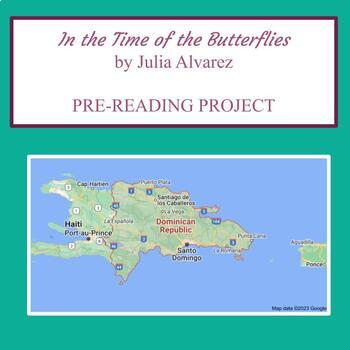
"In the Time of the Butterflies" Pre-Reading Map Project
In the Time of the Butterflies by Julia Alvarez // Pre-Reading Map Project This is the perfect project to get students motivated to learn more about the dictatorship of Rafael Trujillo in the Dominican Republic and how the Mirabal sisters developed an underground revolution to fight against him and his murderous regime.It helps students develop the necessary geographical background knowledge for a country they may not be familiar with, as well as familiarizing themselves with some of the Spanish
Subjects:
Grades:
10th - 12th, Higher Education
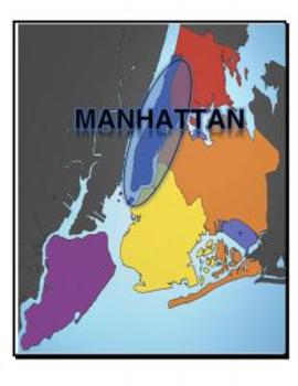
Map, New York, 5 Boroughs
Each page of this document includes a map of NY with a variety of places highlights:
- 5 Boroughs
- Hudson River
- East River
- Atlantic Ocean
Great for labeling student tables for a unit and/or handing out to study maps.
Grades:
K - 12th, Higher Education
Types:
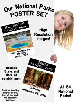
National Parks Posters Set (High resolution)
This beautiful and Instructional Poster Set can be used as a Bulletin Board, Presentation or Flash Cards can be used all around the year. These National Parks Poster Set are great for a geography, earth science, ecology or United States Region lesson. It includes 63 Established National Parks and 1 extra Park in process of establishment. These high quality posters include State or States area and also the date of establishment. These Posters can be used as part of a lesson, a lesson theme
Subjects:
Grades:
PreK - 12th, Higher Education, Adult Education, Staff
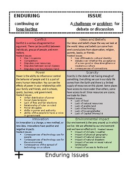
6th Grade Enduring issues poster
This is an enduring issues poster that I created. I feel that these enduring issues (with nested issues included) are perfect for the 6th grade NYS curriculum. This will help your students when they enter high school and need to write an enduring issues essay.
Subjects:
Grades:
6th, Higher Education
Also included in: Enduring issues poster and bookmarks
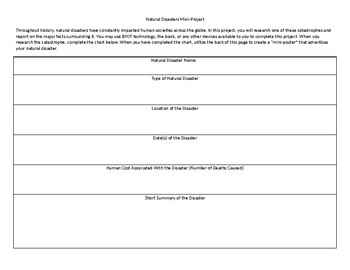
Natural Disasters Mini Project
This short project can typically be completed in one or two days. In it, students research a major natural disaster and complete an informational chart. Once they have completed the chart, they create a "mini-poster" on the back that describes their natural disaster.
Grades:
4th - 12th, Higher Education, Adult Education
Types:

My Hometown TAIWAN (An introduction of Taiwan for International Fair)
Slides version: https://docs.google.com/presentation/d/1EnT1L5cfX8kaeQ8e6QTmRdyjloS-a9s8t85_JM8y9HU/copy
Subjects:
Grades:
PreK - 12th, Higher Education, Adult Education
First & Second Agricultural Revolution, Columbian Exchange, Green Rev One Pager
This is a great activity to ensure students know the essential information regarding the First (Neolithic) Revolution, Second Agricultural Revolution, Columbian Exchange, and Green Revolution for AP Human Geography units 5.3-5.5. My students had a fun time making these and continuously refer back to them as a resource when we discuss these topics. Additionally, it helps students to visualize the differences and similarities between each revolution as well as causes and effects in a fun, colorfu
Grades:
6th - 12th, Higher Education, Adult Education, Staff
Types:
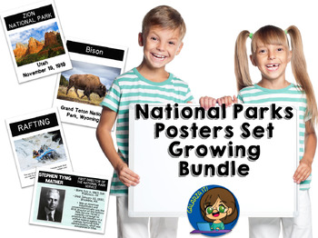
National Parks Photo Poster Growing Bundle
This Bundle include various sets of beautiful and Instructional Poster can be used as a Bulletin Board, Presentation or Flash Cards all around the year. These National Parks Poster Bundle are great for a Biology, Geography, Earth Science, Ecology or United States Region lesson. You can create a Bulletin Board, National Park of the Month, Leader of the Month and much more. These high quality posters are so versatile, that can be used as part of a lesson, a lesson theme or as a bulletin/door
Subjects:
Grades:
PreK - 12th, Higher Education, Adult Education, Staff

Economic Sectors / Business Classification Lesson
Students will learn about the 3 Economic Sectors used in Business or Economics. These are Primary Sector, Secondary Sector and Tertiary Sector. Students will learn how each sector contributes to the economic development of a country. By the end of the lesson students will perform individual classwork, and will identify and classify industries given in the attached exercise.
Subjects:
Grades:
9th - 12th, Higher Education, Adult Education, Staff
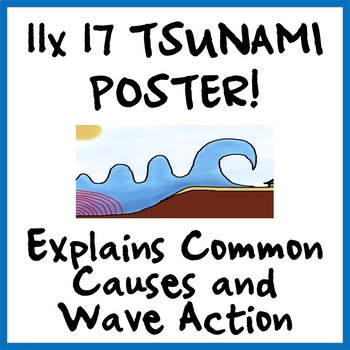
Super-Cool TSUNAMI WAVE AND WAVE CAUSES MINI-POSTER
This fun tsunami wave poster shows two common causes of tsunamis (earthquakes and landslides) as well as a scientifically accurate image of a tsunami wave that captures how height increases as the tsunami wave approaches land.This poster can be printed on 11 x 17 paper and then laminated or used as is. Teachers report using these posters to explain concepts around tsunamis and then seeing students get up and go at look at the posters to clarify concepts for themselves.Clip art used in these pos
Subjects:
Grades:
4th - 12th, Higher Education, Not Grade Specific
Also included in: WORLD GEOGRAPHY & SOCIAL STUDIES MINI-POSTERS - Big Savings on Bundle
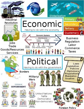
Economic, Political, Social, & Environmental Anchor Charts/Posters for Geography
Use these anchor charts/posters to teach the Economic, Political, Social and Environmental aspects of World Geography!
Grades:
6th - 10th, Higher Education
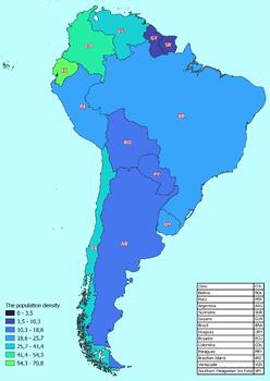
South America map with countries classified by population density
South America map with countries classified by population densityThis download contains files that may be printed and copied or used digitally.World City MapsBooksPinterestInstagramFacebookTikToK
Subjects:
Grades:
5th - 12th, Higher Education

The North America map classified by the number of inhabitants of the countries
The North America map classified by the number of inhabitants of the countriesThis download contains files that may be printed and copied or used digitally.World City MapsBooksPinterestInstagramFacebookTikToK
Subjects:
Grades:
5th - 12th, Higher Education
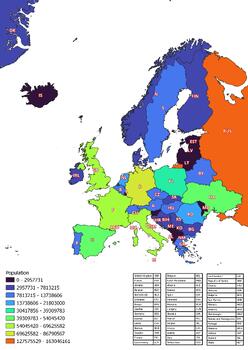
The Europe map classified by the number of inhabitants of the countries
The Europe map classified by the number of inhabitants of the countriesThis download contains files that may be printed and copied or used digitally.World City MapsBooksPinterestInstagramFacebookTikToK
Subjects:
Grades:
5th - 12th, Higher Education
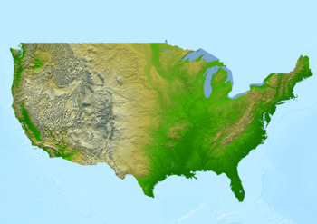
Physical map of the United States of America Poster
Physical map of the United States of America PosterThis poster features a physical map of the United States of America. The map highlights major physical features such as mountains, rivers, lakes, and deserts.The topography is shown in shaded relief, with darker shades indicating higher elevations, and lighter shades indicating lower elevations.This download contains files that may be printed and copied or used digitally.___________________________________________________________________World Ci
Subjects:
Grades:
PreK - 12th, Higher Education, Adult Education, Staff
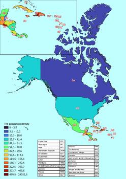
North America map with countries classified by population density
North America map with countries classified by population densityThis download contains files that may be printed and copied or used digitally.World City MapsBooksPinterestInstagramFacebookTikToK
Grades:
5th - 12th, Higher Education
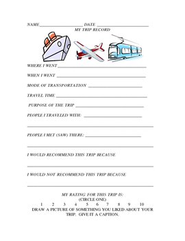
My Trip Record
Are you looking for an alternative to "How I Spent My Summer Vacation"? If so, use this handy classroom form. Keep this classroom form on hand all school year so that students can share their travel and vacation experiences with the class. It includes pertinent information about a trip as well as what the students liked and disliked about it and people they saw. There is also a rating scale as well as a place for an illustration about something they liked. This lends itself to a geography l
Subjects:
Grades:
2nd - 12th, Higher Education, Adult Education
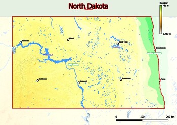
Physical map of North Dakota with mountains, plains, bridges, rivers, lakes,
Physical map of North Dakota with mountains, plains, bridges, rivers, lakes, mountains, citiesThis download contains files that may be printed and copied or used digitally.World City MapsBooksPinterestInstagramFacebookTikToK
Grades:
4th - 12th, Higher Education, Adult Education
National Park's Activities Poster and Bulletin Board Set
This beautiful and Instructional Poster set can be used as a Bulletin Board, Presentation or Flash Cards all around the year. These are outdoor activities that can be realized in our National Parks but also as a recreational activity review. It includes 30 high quality posters with terms and definitions. These Posters can be used as part of a lesson, a lesson theme or as a bulletin/door decor.Need to adapt the definitions to your level. Just add a blank box in the PowerPoint and use your des
Subjects:
Grades:
PreK - 12th, Higher Education, Adult Education, Staff

World map of average annual temperatures
World map of average annual temperaturesThis download contains files that may be printed and copied or used digitally.World City MapsBooksPinterestInstagramFacebookTikToK
Subjects:
Grades:
5th - 12th, Higher Education
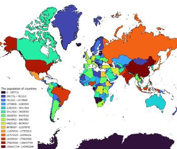
The world map classified by the number of inhabitants of the countries
The world map classified by the number of inhabitants of the countriesThis download contains files that may be printed and copied or used digitally.World City MapsBooksPinterestInstagramFacebookTikToK
Subjects:
Grades:
4th - 12th, Higher Education
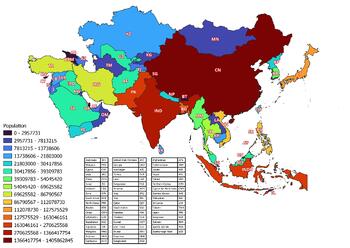
The Asia map classified by the number of inhabitants of the countries
The Asia map classified by the number of inhabitants of the countriesThis download contains files that may be printed and copied or used digitally.World City MapsBooksPinterestInstagramFacebookTikToK
Subjects:
Grades:
5th - 12th, Higher Education
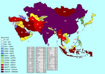
Asia map with countries classified by area
Asia map with countries classified by areaThis download contains files that may be printed and copied or used digitally.World City MapsBooksPinterestInstagramFacebookTikToK
Subjects:
Grades:
6th - 12th, Higher Education
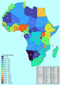
Africa map with countries classified by population density
Africa map with countries classified by population densityThis download contains files that may be printed and copied or used digitally.World City MapsBooksPinterestInstagramFacebookTikToK
Subjects:
Grades:
5th - 12th, Higher Education
Showing 1-24 of 72 results


