25 results
Adult education geography classroom decor microsofts
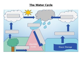
The Water Cycle Worksheet and Answers
This activity works well when projected onto a whiteboard and writing in the answers together with the class while discussing the purpose of each part of the Water Cycle. Answer sheet is included.
Activity can also be used for assessment of knowledge of the Water Cycle.
Answers sheet can be printed out and used as a poster for the classroom.
Subjects:
Grades:
4th - 12th, Adult Education
Types:
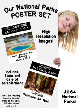
National Parks Posters Set (High resolution)
This beautiful and Instructional Poster Set can be used as a Bulletin Board, Presentation or Flash Cards can be used all around the year. These National Parks Poster Set are great for a geography, earth science, ecology or United States Region lesson. It includes 63 Established National Parks and 1 extra Park in process of establishment. These high quality posters include State or States area and also the date of establishment. These Posters can be used as part of a lesson, a lesson theme
Subjects:
Grades:
PreK - 12th, Higher Education, Adult Education, Staff
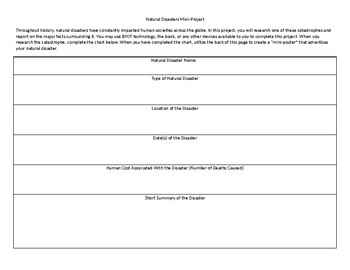
Natural Disasters Mini Project
This short project can typically be completed in one or two days. In it, students research a major natural disaster and complete an informational chart. Once they have completed the chart, they create a "mini-poster" on the back that describes their natural disaster.
Grades:
4th - 12th, Higher Education, Adult Education
Types:
My Hometown TAIWAN (An introduction of Taiwan for International Fair)
Slides version: https://docs.google.com/presentation/d/1EnT1L5cfX8kaeQ8e6QTmRdyjloS-a9s8t85_JM8y9HU/copy
Subjects:
Grades:
PreK - 12th, Higher Education, Adult Education
First & Second Agricultural Revolution, Columbian Exchange, Green Rev One Pager
This is a great activity to ensure students know the essential information regarding the First (Neolithic) Revolution, Second Agricultural Revolution, Columbian Exchange, and Green Revolution for AP Human Geography units 5.3-5.5. My students had a fun time making these and continuously refer back to them as a resource when we discuss these topics. Additionally, it helps students to visualize the differences and similarities between each revolution as well as causes and effects in a fun, colorfu
Grades:
6th - 12th, Higher Education, Adult Education, Staff
Types:
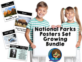
National Parks Photo Poster Growing Bundle
This Bundle include various sets of beautiful and Instructional Poster can be used as a Bulletin Board, Presentation or Flash Cards all around the year. These National Parks Poster Bundle are great for a Biology, Geography, Earth Science, Ecology or United States Region lesson. You can create a Bulletin Board, National Park of the Month, Leader of the Month and much more. These high quality posters are so versatile, that can be used as part of a lesson, a lesson theme or as a bulletin/door
Subjects:
Grades:
PreK - 12th, Higher Education, Adult Education, Staff

Economic Sectors / Business Classification Lesson
Students will learn about the 3 Economic Sectors used in Business or Economics. These are Primary Sector, Secondary Sector and Tertiary Sector. Students will learn how each sector contributes to the economic development of a country. By the end of the lesson students will perform individual classwork, and will identify and classify industries given in the attached exercise.
Subjects:
Grades:
9th - 12th, Higher Education, Adult Education, Staff
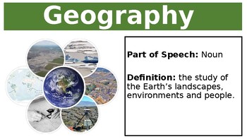
Biomes Geography Vocabulary World Wall Bulletin Board
Geography biomes vocabulary posters. Excellent addition to a Geography bulletin board or creating a word wall. Can purchases the explicit vocabulary PowerPoint to as a bundle. Extend your students vocabulary and knowledge of Geography and Biomes. Australian curriculum aligned.Australian Curriculum Present findings, arguments and explanations in a range of appropriate communication forms, selected for their effectiveness and to suit audience and purpose, using relevant geographical terminology, a
Subjects:
Grades:
7th - 12th, Adult Education
Also included in: Geography Biomes Vocabulary Bundle
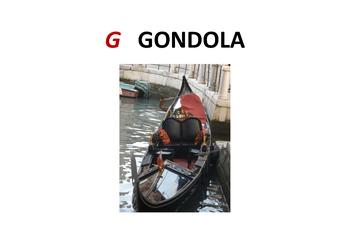
Italian warm up
This Power Point can be used as a lesson warm up, introduced gradually. It is suitable for all grades, depending on the level of Italian already achieved by the individual classes. It comprises of 157 slides, ranging from the Italian alphabet to special sounds, days of the week, months, seasons, some grammatical points, lots of conversation, weather and numbers. This is followed by a wide range of current cultural slides, which focus on the geography of Italy, with particular emphasis on certain
Subjects:
Grades:
K - 12th, Adult Education
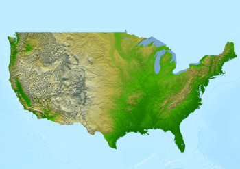
Physical map of the United States of America Poster
Physical map of the United States of America PosterThis poster features a physical map of the United States of America. The map highlights major physical features such as mountains, rivers, lakes, and deserts.The topography is shown in shaded relief, with darker shades indicating higher elevations, and lighter shades indicating lower elevations.This download contains files that may be printed and copied or used digitally.___________________________________________________________________World Ci
Subjects:
Grades:
PreK - 12th, Higher Education, Adult Education, Staff
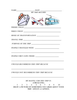
My Trip Record
Are you looking for an alternative to "How I Spent My Summer Vacation"? If so, use this handy classroom form. Keep this classroom form on hand all school year so that students can share their travel and vacation experiences with the class. It includes pertinent information about a trip as well as what the students liked and disliked about it and people they saw. There is also a rating scale as well as a place for an illustration about something they liked. This lends itself to a geography l
Subjects:
Grades:
2nd - 12th, Higher Education, Adult Education
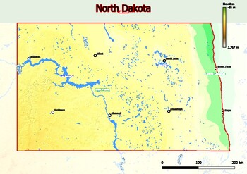
Physical map of North Dakota with mountains, plains, bridges, rivers, lakes,
Physical map of North Dakota with mountains, plains, bridges, rivers, lakes, mountains, citiesThis download contains files that may be printed and copied or used digitally.World City MapsBooksPinterestInstagramFacebookTikToK
Grades:
4th - 12th, Higher Education, Adult Education
National Park's Activities Poster and Bulletin Board Set
This beautiful and Instructional Poster set can be used as a Bulletin Board, Presentation or Flash Cards all around the year. These are outdoor activities that can be realized in our National Parks but also as a recreational activity review. It includes 30 high quality posters with terms and definitions. These Posters can be used as part of a lesson, a lesson theme or as a bulletin/door decor.Need to adapt the definitions to your level. Just add a blank box in the PowerPoint and use your des
Subjects:
Grades:
PreK - 12th, Higher Education, Adult Education, Staff
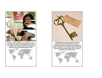
Birthdays Around the World
Eight cards describe the birthday practices of eight nations: China, South Africa, Israel, Hungary, India, Germany, Ecuador and the Phillipines. A Q&A card is included. The cards can be expanded to their original 11" x 8" size. All photos are either used with permission, purchased, or public domain. Cards written and formatted by Britt Elizabeth Verstegen. Birthdays Around the World by Britt Elizabeth Verstegen is licensed under a Creative Commons Attribution-No Derivative Works 3.0 United S
Subjects:
Grades:
3rd - 6th, Adult Education
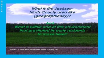
MISSISSIPPI STUDIES: JACKSON, MISSISSIPPI: HISTORICAL MOTIVES TO IMMIGRATE THERE
GREETINGS FANS OF LOCAL CULTURE AND GEOGRAPHY:THIS PRESENTATION PROVIDES DETAILS REGARDING THE SOCIAL, ECONOMIC, AND POLITICAL MOTIVES THAT DROVE THE FOUNDING OF MISSISSIPPI'S CAPITAL AND ITS COUNTY (HINDS).I HOPE THAT THIS PRESENTATION INSPIRES YOU TO CREATE A LOCAL CULTURE CURRICULUM FOR YOUR SCHOOL OR DISTRICT! OUR STUDENTS NEED TO KNOW WHO THEY ARE AT THEIR GEOGRAPHICAL CORE MORE THAN ANY OTHER PLACE AND SPACE IN OUR COLLECTIVE WORLD!THANKS YOU FOR YOUR TIME!SINCERELY AND EARNESTLY, MICHA
Subjects:
Grades:
6th - 12th, Higher Education, Adult Education
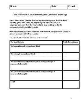
WORLD HISTORY- THE CULTURAL (A.K.A. COLUMBIAN) EXCHANGE PROJECT
GREETINGS, CHANGEMAKERS!!!The present-day elements of cultural diversity that exists in the former colonies of Portugal, Netherlands, Spain, Germany, Japan, France, and England are a result of the historic, cultural exchanges of those colonies and the "motherlands" aforementioned. These former industrial and economic powers are just as much a part of our history as the motherlands from which our ancestors came, because THEY ARE A PART OF THE WAYS IN WHICH WE LIVE TODAY; from some of the challeng
Subjects:
Grades:
6th - 12th, Higher Education, Adult Education
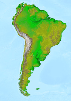
Physical map of the continent of South America Poster
Physical map of the continent of South America PosterThis poster features a detailed physical map of South America, including its varied terrain and natural features. It includes all of the major geographical features such as mountains, rivers, deserts, and plains.This download contains files that may be printed and copied or used digitally.___________________________________________________________________World City MapsBooksPinterestInstagramFacebookTikToK
Subjects:
Grades:
PreK - 12th, Higher Education, Adult Education, Staff
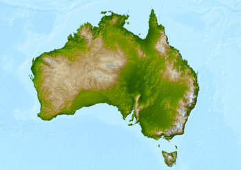
Physical map of the continent of Australia Poster
Physical map of the continent of Australia Poster descriptionThis poster features a physical map of the continent of Australia. It dThe color scheme used on the map is blue, green, and white, with a white background. It is a great resource for anyone looking to learn more about the physical geography of Australia.This download contains files that may be printed and copied or used digitally.___________________________________________________________________World City MapsBooksPinterestInstagramF
Subjects:
Grades:
PreK - 12th, Higher Education, Adult Education, Staff
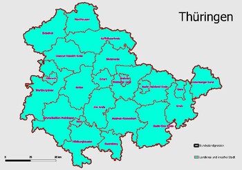
Map Administrative Structure Federal State Thüringen
Map Administrative Structure Federal State ThüringenThe administrative structure of the federal state of Thüringen is composed of three layers: the federal government, the state government, and the local government. The executive branch of the federal government is headed by the Federal President and is composed of the Federal Ministries and Federal Agencies. The state government is headed by the Minister-President and is composed of the State Ministries and State Agencies. The local government
Subjects:
Grades:
4th - 12th, Higher Education, Adult Education, Staff
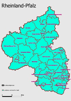
Map Administrative Structure Federal State Rheinland - Pfalz
Map Administrative Structure Federal State Rheinland-PfalzRheinland-Pfalz is a federal state in Germany. It is located in the western part of the country, and it is bordered by the states of North Rhine-Westphalia, Hesse, Baden-Württemberg, and Saarland. The state is divided into 16 districts (Kreise) and five independent cities. The capital and largest city is Mainz. The government of Rheinland-Pfalz is a parliamentary representative democracy, headed by a Minister-President, who is elected by
Subjects:
Grades:
4th - 12th, Higher Education, Adult Education
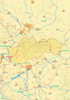
Slovakia map with cities township counties rivers roads labeled
Slovakia map with cities township counties rivers roads labeledSlovakia Europe map is a type of map that includes geographical features such as towns, communes, counties, rivers and roads. These features are labelled with their respective names, allowing the user to easily identify them.This type of map is useful for anyone wishing to explore the country or better understand its geography.This download contains files that may be printed and copied or used digitally.______________________________
Grades:
4th - 12th, Higher Education, Adult Education
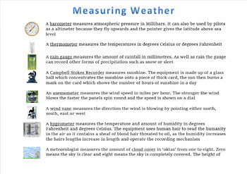
Measuring Weather
This poster or handout gives brief explanation of how different elements of the weather is measured
Subjects:
Grades:
4th - 12th, Higher Education, Adult Education

*FREE* AP Human Geography Chapter 3 Word Wall
This word wall is based on Rubenstein's book The Cultural Landscape.Most important it is all the Key Terms for Chapter 3 (ALL 29!)The doc will have a link on it to the Google Slide Presentation with all 29 Key Terms of Chapter 3! All you have to do is click the link to make a copy of it to your Google Drive and then add to your Google Classroom!Word Walls are a great way of getting the vocabulary in one place!Also can be used with Distance Learning.
Grades:
9th - 12th, Higher Education, Adult Education
Types:
FOR PRE-GCSE STUDENTS - Why to choose GCSE geography?
This is a type of persuasive piece, to persuade Year 9 students to choose geography as one of their GCSE options.
Subjects:
Grades:
4th - 12th, Higher Education, Adult Education
Types:
Showing 1-24 of 25 results


