🎉 Teacher Appreciation: Save up to 25% using promo code THANKYOU24. Sale ends in 18 hrs 4 min. Learn more
79,648 results
World history worksheets
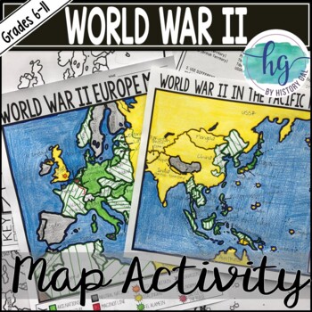
World War II (World War 2) Map & Geography Activity for Europe & the Pacific
These World War II in Europe and World War 2 in the Pacific maps will help students become more familiar with the nations of Europe and those in the Pacific during World War II by identifying which countries belonged to the Allies, which ones joined the Axis, which ones were controlled by the Axis Powers, and which ones remained neutral. On the World War II in Europe map, students will also label the Maginot Line, the Battle of Dunkirk, the Battle of Britain, the Battle of Stalingrad, the Battl
Subjects:
Grades:
6th - 11th
Types:
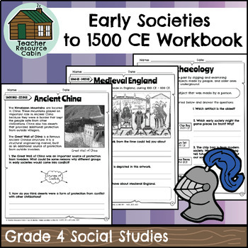
Early Societies to 1500 CE Workbook (Grade 4 Ontario Social Studies)
This workbook covers the Grade 4 Early Societies to 1500 CE unit in the Ontario Social Studies 2018 curriculum (Heritage and Identity). In this workbook, students will learn about various topics related to early societies and their cultures. Students will delve into the fascinating world of ancient civilizations such as Ancient Egypt, the Indus Valley, Ancient China, Ancient Rome, Medieval England, Six Nations, Inuit, and the Inca Empire. They will explore aspects of these societies, including t
Grades:
4th
Also included in: Grade 4 Ontario Social Studies Workbook Bundle
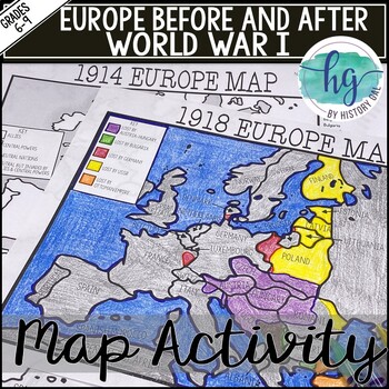
World War I Map Activity Lesson (1914 & 1918 Europe Maps)Print &Digital Resource
These 1914 and 1918 Europe Map worksheets will help students understand the effects of World War I on the European map. They will also help students become more familiar with the nations of Europe during World War 1 by identifying which European countries belonged to the Allies, which ones joined the Central Powers, and which ones remained neutral. Additionally, students will be able to identify the new nations that were created after World War I and which nations lost territory after the war.Wh
Subjects:
Grades:
6th - 10th
Types:
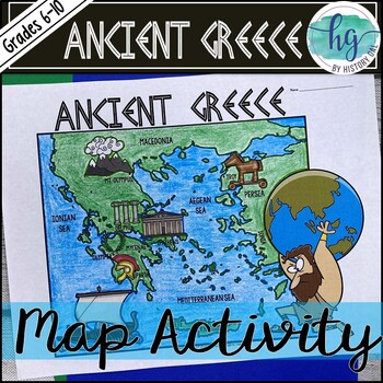
Ancient Greece Geography Map Activity (Print and Digital Resource)
This activity will help students better understand the geography of Greece and its impact on Ancient Greek civilizations. They will label and color the blank map version and then answer a few questions. Alternatively, students can just color on the coloring page version. It's a great way to incorporate geography in your lesson.What's included with the Printed Versions:*Ancient Greece map for students to label, color, and answer 10 questions (1 page map, 1 page directions/questions, uneditable pd
Grades:
6th - 10th
Types:
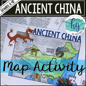
Ancient China Map Activity Lesson (Print and Digital Resource)
This activity will help students better understand the geography of Ancient China. They will label and color the blank map version and answer a few questions. Alternatively, students can just color on the coloring page version. It's a great way to incorporate geography in your lesson.What's included with the printed versions:*Blank Ancient China map for students to label, color, and answer questions (1 page map, 1 page directions, uneditable pdf)*Blank Ancient China map for students to label, co
Grades:
6th - 10th
Types:
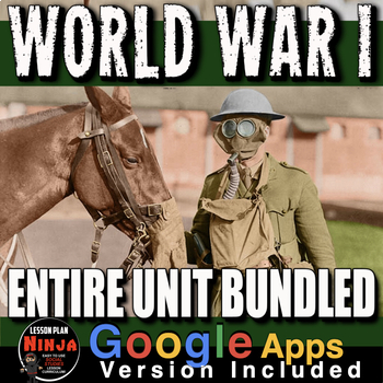
World War 1 Unit: WW1 PPTs, Guided Notes, Worksheets, Plans, Test + Google Apps
World War I Unit Bundled covers the the atmosphere in Europe leading up the assassination of Archduke Franz Ferdinand, World War 1, and finishes with the Treaty of Versailles and its contribution to World War II. This unit includes World War 1 PowerPoints with video clips and presenter notes. Unit also includes, warm up PowerPoints, informational text documents, including timeline with questions, primary source documents, exit tickets, crossword review, Kahoot review game, and editable assessmen
Grades:
7th - 12th, Adult Education
Types:
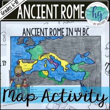
Ancient Rome to 44 BCE Map Activity (Print and Digital)
Students will label and color a map of Ancient Rome in 44 BC/BCE to better understand the expansion of Roman power. Students will also answer 6 questions about the map. What's Included with the print versions:*Blank map with 6 questions for students to answer (2 pages, BC and BCE versions included, uneditable pdf)*Blank map without questions (1 1/2 pages, BC and BCE versions included, uneditable pdf)*Map for students to just color (1 page, BC and BCE versions included, uneditable pdf)*Answer key
Subjects:
Grades:
6th - 9th
Types:
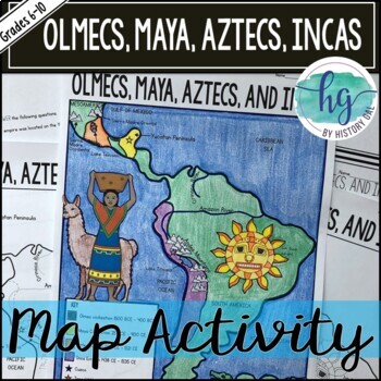
Mesoamerica (Olmecs, Maya, Aztecs) and Incas Map Activity - print & digital
Students will label and color a map to help them visualize and retain the location of the Olmecs, Maya, Aztecs, and Incas in Mesoamerica and South America. They will also label bodies of water and mountain ranges as well as use the map to answer 5 questions. What's Included with the Printed Map:*Blank map with 5 questions for students to answer (2 pages, uneditable pdf)*Blank map without questions (1 1/2 pages, uneditable pdf)*Map for students to just color (1 page, uneditable pdf)*Answer key fo
Subjects:
Grades:
6th - 9th
Types:
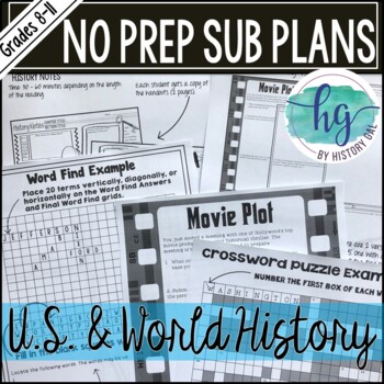
No Prep Emergency Sub Plans for any U.S. or World History Class Print & Digital
These No Prep Emergency Sub Plans are print and digital to make missing a class or a day/s easier for you. Just print and go or assign digitally! The substitute plans I've created for you will work at any time during the year for any U.S. or World History class. Print out a copy of the activities to put in your sub folder or save the digital versions in your Google Drive or One Drive. You'll never have to stress about leaving sub plans for substitutes again!Each activity includes an uneditable P
Subjects:
Grades:
8th - 12th
Types:
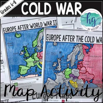
Cold War Map Activity for Europe Before & After the Cold War (Print and Digital)
These two maps will help students become more familiar with Europe during and after the Cold War. Students will identify nations that belonged to NATO, the Warsaw Pact, and which ones remained neutral. In addition students will learn how the map of Europe changed after the Cold War ended. What's Included with the Print Versions:*Blank Europe After World War II map with questions for students to answer (2 pages)*Blank Europe After World War II map without questions (1 1/2 pages) *Coloring Page fo
Subjects:
Grades:
7th - 10th
Types:
Also included in: American History Map Activities Bundle for U.S. History Units & Lessons
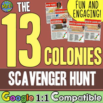
13 Colonies Map and Scavenger Hunt Activity
In this 13 Colonies activity and map scavenger hunt, students complete a gallery walk on the colonization of the 13 American Colonies. Students navigate around the room examining each colony's station to understand the reason behind its founding. Students can work individually or they can create groups and, before they are turned loose, divide up the responsibilities to research the founding of the 13 Colonies and detail the 13 Colonies map. This lesson is a great introduction to the 13 colo
Subjects:
Grades:
5th - 8th
Types:
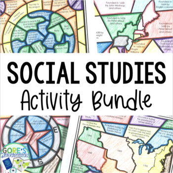
Social Studies Activities Bundle
Looking to give your Social Studies class an engaging way to dig into the text and learn about important historical topics? These Social Studies activities can do just that. 13 different activities are included, and they are great to have on hand all year long when students need a break from the textbook and a chance to color. Once students learn about historical topics, repeated exposure to the material is essential for both comprehension and retention. Add in practicing the skill of locating t
Grades:
4th - 7th
Types:
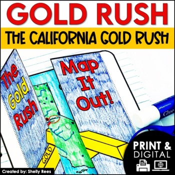
The Gold Rush Activities | California History | DIGITAL and PRINTABLE
Your students will enjoy learning about the California Gold Rush with this interactive packet. The fun, hands-on activities in this resource will surely help your students learn and understand the history of the Gold Rush!Click here and SAVE 20% by buying ALL 15 Social Studies Interactive Notebooks and Mini Units in one Year-Long Bundle.This resource includes both a printable version AND a digital version. The digital version is on Google Slides and is perfect for distance learning, independent
Grades:
3rd - 6th
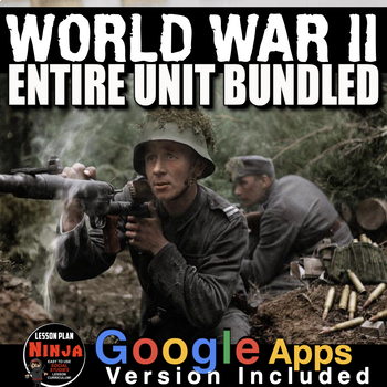
World War 2 Unit PPTs, Guided Notes, Worksheets, Kahoot, Test(WW2) + Google Apps
World War II Unit Includes World War 2 PowerPoint with Video Clips, primary source activities, timeline, video and video guided, crossword review, Kahoot review, and assessment all bound together with detailed daily lesson plans. Each lesson begins with a warm-up, and continues with PowerPoint notes, primary source document reading, informational text or timeline analysis, and an exit ticket. Unit also includes editable assessment-test/quiz, a writing exercise and crossword puzzle review. Everyt
Subjects:
Grades:
9th - 12th, Adult Education
Types:
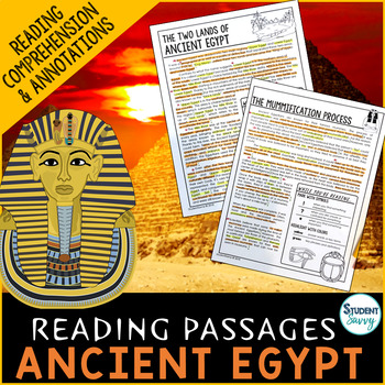
Ancient Egypt Reading Comprehension Passages Questions Pyramids Pharaohs Gods
Ancient Egypt Worksheets - Reading Comprehension Passages, Questions, and Annotations. This resource contains 5 Engaging, Non-Fiction Reading Comprehension Passages with Directions for Student Annotations! Reading Comprehension Questions also included! Questions & Answer Keys for Each of the 5 Reading Passages! COMMON CORE ALIGNED! Quick overview of topics covered in this resource include: 1.) The Two Lands of Ancient Egypt-covers the layout of Ancient Egypt (Upper and Lower Egypt)-flow of t
Grades:
5th - 7th
Types:
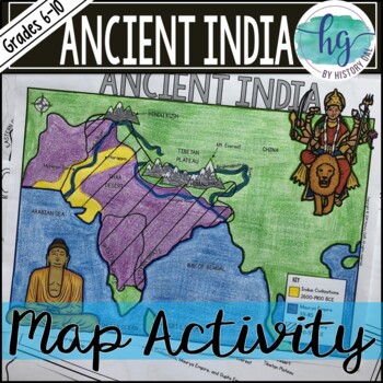
Ancient India Map Activity (Indus Civilizations, Maurya & Gupta Empire)
Students will label and color a map to help them visualize and retain the location of the Indus Civilizations, Maurya Empire, and Gupta Empire as well as key geographical features such as the Brahmaputra, Ganges, and Indus Rivers; Eastern and Western Ghats; Himalayas; Hindu Kush, and more. Students will also use the map to answer 5 questions. What's Included with the printed versions:*Blank map with 5 questions for students to answer (2 pages, uneditable pdf)*Blank map without questions (1 1/2 p
Subjects:
Grades:
6th - 9th
Types:
Also included in: Ancient India Bundle
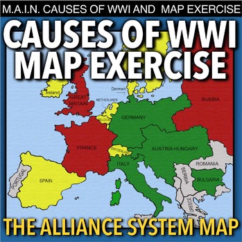
World War I Map Activity & MAIN Causes (WW1)
World War I Map Activity and MAIN Causes of WWI takes students to Europe 1914 to discuss the M.A.I.N. causes of World War 1(Militarism, Alliances, Imperialism and Nationalism). Then students learn about the alliance system through a map activity. No other maps from the book are needed, just thee colored pencils or crayons. This can be used in class or as homework as it’s a completely stand alone assignment. This is also perfect for substitute teacher plans. A key is included.*** A modified Goog
Subjects:
Grades:
7th - 12th
Types:
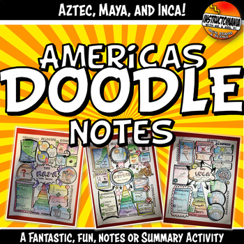
Doodle Style Notes, The Americas, Aztec, Maya & Inca Summary Activity Set
What a fun way to review the geography, religion, achievements, government/leadership, economy and social classes of the Americas! Students complete the Aztec, Maya, and Inca doodle note templates after class notes, reading textbook chapters or informational texts, at the end of the unit, or even after finishing a chapter test (while waiting for students to finish). This activity is a class favorite that is easy to implement. It's great to share and hang in the classroom. This also makes for a
Grades:
5th - 12th
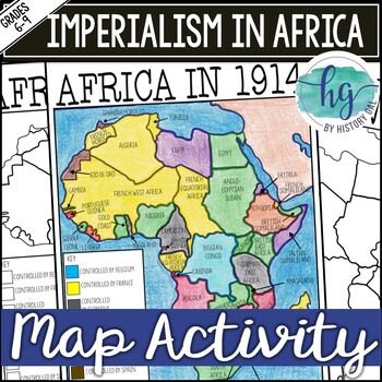
Imperialism in Africa Map Activity Lesson for World History (Print and Digital)
Students will learn about the scramble for Africa by labeling colonies and coloring the map to show which European nations controlled which colonies and which countries remained independent. Students will also answer 3 questions about the map.What's Included with the printed version:*Blank Africa in 1914 map with questions for students to answer (2 pages)*Blank Africa in 1914 map without questions (1 1/2 pages)*Coloring Page for Africa in 1914 map (1 page)*Answer key for map and questions (2 pa
Subjects:
Grades:
6th - 10th
Types:
Vietnam War Unit: PPTs, Worksheets, Guided Notes, Kahoot, Test + Google Apps
The Vietnam War Unit Bundled takes students back to its birth in French Indochina in 1955 to its bitter end in 1975. This unit includes scenes from the front and the politics at home. Vietnam War unit includes Vietnam War PowerPoints, primary source activities, warmups, exit tickets, timeline, video/video guides, review crossword, review Kahoot! game, and editable assessment all bound together by daily lesson plans. This bundle has everything you need to teach all about the volatile period. Deta
Grades:
7th - 12th, Adult Education
Cold War Unit: PPTs, Worksheets, Lesson Plans, Kahoot, Test + GoogleApps
The Cold War Unit Bundled is comprehensive look at the Cold War, conflicts covering from the end of World War II and spanning over 40 years to the fall of the Soviet Union. Unit includes Cold War PowerPoints w/Video Clips + Guided Notes, warm up PowerPoints, informational text documents with questions, primary source lessons, exit tickets, crossword review, Kahoot! review game, video/video guide, and assessment. Everything is put together with detailed daily lesson plans. Just copy and paste to
Grades:
7th - 11th, Adult Education
Types:

Industrial Revolution Unit: PPTs, Guided Notes, Worksheets, Test + GoogleApps
The Industrial Revolution Unit includes Industrial Revolution PowerPoints with video and presenter notes. Unit also includes, warm up PowerPoints, a timeline analysis activity, primary source lessons, exit tickets, crossword review, Kahoot! review game, video/video guide, and assessment, no book necessary. Everything is put together with detailed daily lesson plans. Just copy and paste into your lesson plans. There is much material in this bundle. It is an amazing deal! This Industrial Revoluti
Grades:
8th - 12th, Adult Education
Types:
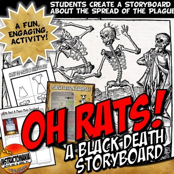
Oh Rats! Black Death Bubonic Plague Story Board Europe Middle Ages Activity Set
Created to align with students' supporting claims with evidence! In this activity, students create a 9-scene storyboard for an animated film. The film should be about a flea-ridden rat who helped to spread the Bubonic Plague into Europe during the 1300s. An example page and an easy step-by-step how to draw a basic cartoon rat printable are both included.This lesson can be used after the Plague/Black Death Powerpoint Slides also posted or in conjunction with our Plague that Rocked the World Lesso
Grades:
6th - 10th
Types:
CCSS:
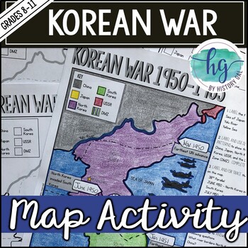
Korean War 1950-1953 Map Activity for No Prep Cold War Lesson
This Korean War map activity will help students become more familiar with key geographical features and important events during the war. Students will label and color the map and then answer a few questions.What's included with the Print Version:*Blank Korean War Map for students to label, color, and answer questions (1 page, uneditable pdf)*Korean War Map Coloring Page (already labeled, no questions, 1 page, uneditable pdf)*Blank Korean War Map without questions (1 page, uneditable pdf)*Key (1
Subjects:
Grades:
8th - 11th
Types:
CCSS:
Also included in: American History Map Activities Bundle for U.S. History Units & Lessons
Showing 1-24 of 79,648 results

