39 results
Adult education geography workbooks under $5
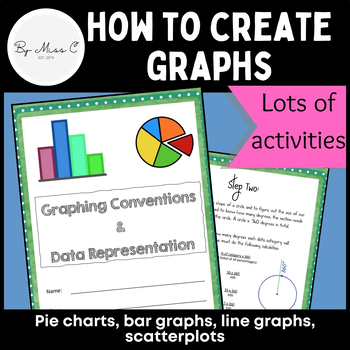
Guide to graphs: Pie charts, bar graphs, line graphs, scatterplots + activities
This is a fantastic resource for introducing students to graphing and data representation. This booklet will take students through the uses for particular graphs and how to construct them. At the end of each module, there are activities for students to complete, to practice their graphing skills. Answer key is included, making this a no-prep activity. This booklet covers: - why we visually represent data- pie charts and how to create them - bar graphs and how to create them - line graphs and how
Subjects:
Grades:
6th - 12th, Higher Education, Adult Education
Types:
CCSS:
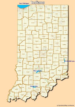
Map of major rivers and map of major lakes in the state of Indiana, USA
Map of major rivers and map of major lakes in the state of Indiana, USAThis material gives you two specific maps, one for rivers and one for lakes, which provide an engaging way to learn about geography.Rivers Map: This map shows the major rivers in Indiana. Using a blank map, students can fill in the names of rivers on the blank map, developing their geography and mapping skills.Lakes Map: Discover the largest lakes in the state of Indiana. Using this white map, students will be able to identif
Subjects:
Grades:
5th - 12th, Higher Education, Adult Education
Types:
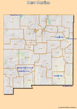
Map of major rivers and map of major lakes in the state of New Mexico, USA
Map of major rivers and map of major lakes in the state of New Mexico, USAThis material gives you two specific maps, one for rivers and one for lakes, which provide an engaging way to learn about geography.Rivers Map: This map shows the major rivers in New Mexico. Using a blank map, students can fill in the names of rivers on the blank map, developing their geography and mapping skills.Lakes Map: Discover the largest lakes in the state of New Mexico. Using this white map, students will be able t
Subjects:
Grades:
4th - 12th, Higher Education, Adult Education, Staff
Types:
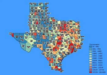
Texas State Map with Population, Density, Area with Worksheet
Click Here>>> click here to subscribe to our storeTexas State Map with Population, Density, Area with WorksheetDiscover the state of Texas in an exciting and interactive way with this set of 4 detailed maps! Each map is categorized by county and provides essential information on population, density, and area, providing a comprehensive overview of the state's diversity and demographics.The population map shows the numerical distribution of residents in each county of the state, providing
Grades:
4th - 12th, Higher Education, Adult Education
Types:
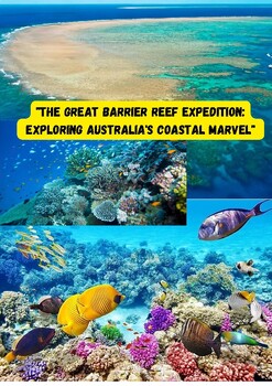
The Great Barrier Reef Expedition Exploring Australia's Coastal Marvel.
The Great Barrier Reef Expedition: Exploring Australia's Coastal Marvel" offers students a captivating educational journey to one of the world's most incredible natural wonders. In this lesson, students will learn about the immense biodiversity of the reef, including its vibrant coral formations and the myriad of marine life that calls it home. They will gain an understanding of the reef's geological and ecological significance and its role in the global carbon cycle. Additionally, students will
Grades:
7th - 9th, Adult Education, Staff
Types:

From Times Square to Central Park: Insights into Human Geography.
From Times Square to Central Park: Insights into Human Geography of New York City" offers students a unique lens through which they can learn about urban diversity and its impact. By exploring Times Square, they understand the dynamics of a bustling commercial and cultural epicenter and how people from different backgrounds coexist and interact.Central Park provides insight into the city's commitment to balancing urbanization with green spaces for recreation and cultural activities. The subway s
Grades:
7th - 9th, Adult Education
Types:
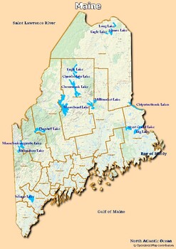
Map of major rivers and map of major lakes in the state of Maine, USA
Map of major rivers and map of major lakes in the state of Maine, USAThis material gives you two specific maps, one for rivers and one for lakes, which provide an engaging way to learn about geography.Rivers Map: This map shows the major rivers in Maine. Using a blank map, students can fill in the names of rivers on the blank map, developing their geography and mapping skills.Lakes Map: Discover the largest lakes in the state of Maine. Using this white map, students will be able to identify and
Grades:
4th - 12th, Higher Education, Adult Education
Types:
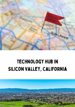
Technology Hub in Silicon Valley, California.
Students can learn about Silicon Valley's global reputation as a technology and innovation hub, understanding the concentration of high-tech companies and research institutions in the region. They can explore the entrepreneurial culture and the history of groundbreaking inventions that have emerged from the area. Additionally, students can grasp the significance of venture capital, networking, and risk-taking in the tech industry. The study of Silicon Valley can also highlight the importance of
Grades:
6th - 8th, Adult Education
Types:

Film Industry in Hollywood, California.
Students can learn about the historic and cultural significance of Hollywood as a global center for the film and entertainment industry. They can explore the impact of Hollywood on popular culture, its role in the development of cinema, and the various aspects of the film production process. Additionally, students can understand the economic importance of the entertainment industry, including job opportunities it offers. This example provides insights into the rich history, diversity, and influe
Grades:
6th - 8th, Adult Education
Types:
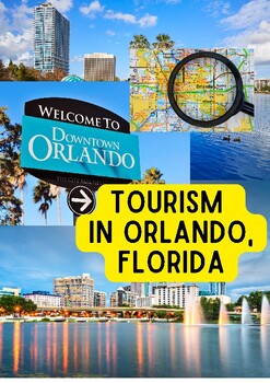
Tourism in Orlando, Florida.
Students can learn about the dynamics of the tourism industry in Orlando, Florida, including the significance of its theme parks and attractions. They can explore how climate, marketing efforts, and transportation networks contribute to its appeal as a tourist destination. Additionally, students can gain insights into the economic impact of tourism on a region, the variety of job opportunities it provides, and the importance of sustainable tourism practices. This example allows students to under
Grades:
6th - 9th, Adult Education
Types:
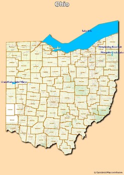
Map of major rivers and map of major lakes in the state of Ohio, USA
Map of major rivers and map of major lakes in the state of Ohio, USAThis material gives you two specific maps, one for rivers and one for lakes, which provide an engaging way to learn about geography.Rivers Map: This map shows the major rivers in Ohio. Using a blank map, students can fill in the names of rivers on the blank map, developing their geography and mapping skills.Lakes Map: Discover the largest lakes in the state of Ohio. Using this white map, students will be able to identify and mar
Grades:
4th - 12th, Higher Education, Adult Education
Types:
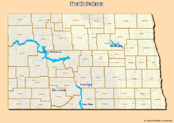
Map of major rivers and map of major lakes in the state of North Dakota, USA
Map of major rivers and map of major lakes in the state of North Dakota, USAThis material gives you two specific maps, one for rivers and one for lakes, which provide an engaging way to learn about geography.Rivers Map: This map shows the major rivers in North Dakota. Using a blank map, students can fill in the names of rivers on the blank map, developing their geography and mapping skills.Lakes Map: Discover the largest lakes in the state of North Dakota. Using this white map, students will be
Grades:
4th - 12th, Higher Education, Adult Education
Types:
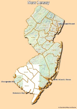
Map of major rivers and map of major lakes in the state of New Jersey, USA
Map of major rivers and map of major lakes in the state of New Jersey, USAThis material gives you two specific maps, one for rivers and one for lakes, which provide an engaging way to learn about geography.Rivers Map: This map shows the major rivers in New Jersey. Using a blank map, students can fill in the names of rivers on the blank map, developing their geography and mapping skills.Lakes Map: Discover the largest lakes in the state of New Jersey. Using this white map, students will be able t
Grades:
4th - 12th, Higher Education, Adult Education
Types:
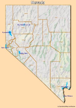
Map of major rivers and map of major lakes in the state of Nevada, USA
Map of major rivers and map of major lakes in the state of Nevada, USAThis material gives you two specific maps, one for rivers and one for lakes, which provide an engaging way to learn about geography.Rivers Map: This map shows the major rivers in Nevada. Using a blank map, students can fill in the names of rivers on the blank map, developing their geography and mapping skills.Lakes Map: Discover the largest lakes in the state of Nevada. Using this white map, students will be able to identify a
Grades:
5th - 12th, Higher Education, Adult Education, Staff
Types:
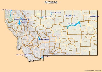
Map of major rivers and map of major lakes in the state of Montana, USA
Map of major rivers and map of major lakes in the state of Montana, USAThis material gives you two specific maps, one for rivers and one for lakes, which provide an engaging way to learn about geography.Rivers Map: This map shows the major rivers in Montana. Using a blank map, students can fill in the names of rivers on the blank map, developing their geography and mapping skills.Lakes Map: Discover the largest lakes in the state of Montana. Using this white map, students will be able to identif
Subjects:
Grades:
5th - 12th, Higher Education, Adult Education
Types:
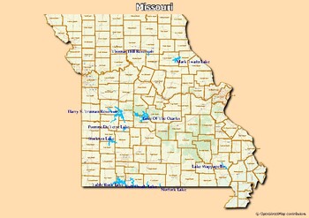
Map of major rivers and map of major lakes in the state of Missouri, USA
Map of major rivers and map of major lakes in the state of Missouri, USAThis material gives you two specific maps, one for rivers and one for lakes, which provide an engaging way to learn about geography.Rivers Map: This map shows the major rivers in Missouri. Using a blank map, students can fill in the names of rivers on the blank map, developing their geography and mapping skills.Lakes Map: Discover the largest lakes in the state of Missouri. Using this white map, students will be able to iden
Grades:
4th - 12th, Higher Education, Adult Education
Types:
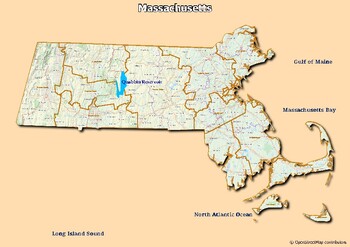
Map of major rivers and map of major lakes in the state of Massachusetts, USA
Map of major rivers and map of major lakes in the state of Massachusetts, USAThis material gives you two specific maps, one for rivers and one for lakes, which provide an engaging way to learn about geography.Rivers Map: This map shows the major rivers in Massachusetts. Using a blank map, students can fill in the names of rivers on the blank map, developing their geography and mapping skills.Lakes Map: Discover the largest lakes in the state of Massachusetts. Using this white map, students will
Grades:
5th - 12th, Higher Education, Adult Education
Types:
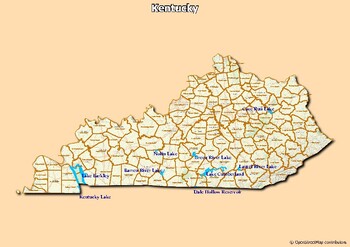
Map of major rivers and map of major lakes in the state of Kentucky, USA
Map of major rivers and map of major lakes in the state of Kentucky, USAThis material gives you two specific maps, one for rivers and one for lakes, which provide an engaging way to learn about geography.Rivers Map: This map shows the major rivers in Kentucky. Using a blank map, students can fill in the names of rivers on the blank map, developing their geography and mapping skills.Lakes Map: Discover the largest lakes in the state of Kentucky. Using this white map, students will be able to iden
Subjects:
Grades:
5th - 12th, Higher Education, Adult Education
Types:

Map of major rivers and map of major lakes in the state of Illinois, USA
Map of major rivers and map of major lakes in the state of Illinois, USAThis material gives you two specific maps, one for rivers and one for lakes, which provide an engaging way to learn about geography.Rivers Map: This map shows the major rivers in Illinois. Using a blank map, students can fill in the names of rivers on the blank map, developing their geography and mapping skills.Lakes Map: Discover the largest lakes in the state of Illinois. Using this white map, students will be able to iden
Grades:
5th - 11th, Higher Education, Adult Education
Types:
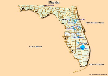
Map of rivers and map of lakes in the state of Florida, USA
Map of rivers and map of lakes in the state of Florida, USAThis material gives you two specific maps, one for rivers and one for lakes, which provide an engaging way of learning about geography.Rivers Map: This map shows the major rivers in Florida. Using a blank map, students can fill in river names on the blank map, developing their geography and mapping skills.Lakes Map: Discover the largest lakes in the state of Florida. Using this blank map, students will be able to identify and mark import
Grades:
4th - 12th, Higher Education, Adult Education
Types:

Map of rivers and map of lakes in the state of Delaware, USA
Map of rivers and map of lakes in the state of Delaware, USAThis material gives you two specific maps, one for rivers and one for lakes, which provide an engaging way of learning about geography.Rivers Map: This map shows the major rivers in Delaware. Using a blank map, students can fill in river names on the blank map, developing their geography and mapping skills.Lakes Map: Discover the largest lakes in the state of Delaware. Using this blank map, students will be able to identify and mark imp
Grades:
5th - 11th, Higher Education, Adult Education
Types:
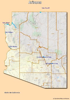
Map of rivers and map of lakes in the state of Arizona, USA
Map of rivers and map of lakes in the state of Arizona, USAThis material gives you two specific maps, one for rivers and one for lakes, which provide an engaging way of learning about geography.Rivers Map: This map shows the major rivers in Arizona. Using a blank map, students can fill in river names on the blank map, developing their geography and mapping skills.Lakes Map: Discover the largest lakes in the state of Arizona. Using this blank map, students will be able to identify and mark import
Grades:
5th - 12th, Higher Education, Adult Education
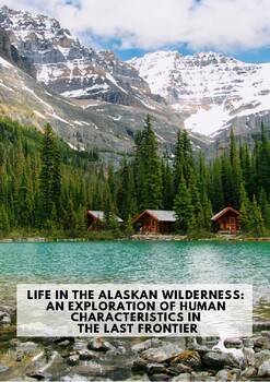
Life in the Alaskan Wilderness: An Exploration of Human Characteristics.
Life in the Alaskan Wilderness: An Exploration of Human Characteristics in the Last Frontier" offers students a fascinating journey into the complex relationship between people and the extreme environment of Alaska. Through this exploration, students can learn about the resilience of indigenous cultures, adaptation to the harsh Arctic climate, and the coexistence of tradition with modernity. They will gain insights into the impact of resource extraction and the importance of environmental conser
Grades:
7th - 9th, Adult Education
Types:
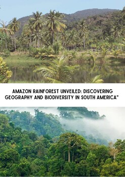
Amazon Rainforest Unveiled: Discovering South America.
"Amazon Rainforest Unveiled: Discovering Geography and Biodiversity in South America" takes students on an educational adventure through the world's largest tropical rainforest. In this lesson, students will explore the Amazon Rainforest's vast geographical expanse, including its unique ecosystems, rivers, and microclimates. They'll gain insights into the extraordinary biodiversity of this region, learning about the incredible variety of plant and animal species that call it home. Students will
Grades:
7th - 9th, Adult Education, Staff
Types:
Showing 1-24 of 39 results


