1,155 results
Free geography assessments
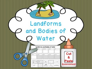
Landform and Body of Water FREE Cut and Paste Match
Students cut and paste pictures of landforms and bodies of water with their name. Color coded by landforms (white pieces) and bodies of water (gray pieces). Answer key is included!
Landforms included:
-mountain
-valley
-plateau
-plain
-hill
-island
Bodies of Water
-ocean
-lake
-pond
-river
Answer Key Included
Clipart by:
Ashley Hughes and Scrappin Doodles
Subjects:
Grades:
K - 3rd
Types:
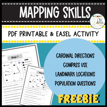
Mapping Skills Worksheets Cardinal Directions Compass Use Easel Activity
Help your students learn more about how to use a map in this free resource. Each page has a specific map that students will need to answer questions about. Students will show understanding of cardinal directions, how to use a compass, locating a landmark, and determining population of specific towns. Teacher keys are provided for easy grading and review with students on a document camera. Each of the maps can be used as a bell ringer, guided practice, or independent class work. This free resourc
Subjects:
Grades:
3rd - 4th
Types:
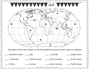
Label the Continents and Oceans Social Studies SOL 3.5
Students will need to correctly label the 7 continents and 5 oceans. This could be used as a quiz or homework.
Social Studies SOL 3.5 Aligned
Subjects:
Grades:
2nd - 4th
Types:
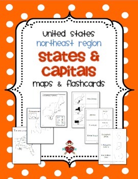
FREE US Northeast Region States & Capitals Maps
UPDATED 2/16/2014! Now includes 3 different maps & 3 different sets of flashcards. Each set of flashcards could also be used as a matching game.
This FREE product contains 3 maps of the Northeast Region of the United States.
• Study guide map labeled with the states and capitals (which can also be used as an answer key)
• Blank map with a word bank of the states and capitals
• Blank map without word bank
Also included are 3 different versions of flashcards to study states and/or capitals
Subjects:
Grades:
3rd - 5th
Daily Geography or Social Studies Map Skills: FREEBIE
Ever felt the need for a spiral geography to help your students learn map skills and become aware of the world and country around them? Me too. That's why I developed Daily Geography.Questions deal with United States specifics and basics of other continents and their locations. Topics include borders, directions, bodies of water, latitude and longitude, and more.The system is set up for students to answer two questions per day. On Friday, they take a short "check-up" half sheet of four quest
Grades:
3rd - 5th
Types:
Map Skills
The student will:Identify a map, globe, and compass roseUse a key to locate places on a mapUse cardinal directionsIdentify land and water featuresIdentify the United States, Washington DC, Virginia, and Richmond. *Leave this page out if you do not need to teach these skills.This is an easy print & go practice or assessment. This product covers Virginia Social Studies Standards K.4, K.5, K.6, K.7 and 1.5.
Subjects:
Grades:
K - 2nd
Types:
Ontario Social Studies Report Card Comments Grades 1, 2, 3 FREEBIE
Hey everyone! Just wanted to share these in case it was helpful to your report card writing/unit planning!*Note: Last updated: Feb 2021* The goal of this item is just to share samples of what your report card comments for Ontario Social Studies may look like and give you something to start with. A new grade means new activities, new projects and new comments! You've got enough on your plate- so I’m here to help! Take a peek into my comments and see what you can use- FREE! Of course, your admin m
Grades:
1st - 3rd
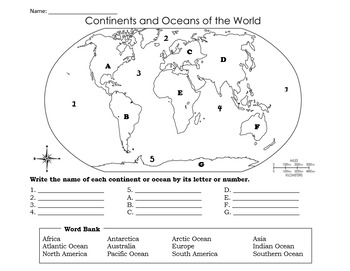
Continents and Oceans Test & Study Guide
A variation of the Continents and Oceans Quiz, this bundle includes an elementary level test and study guide on the world's continents and oceans. It also includes an Answer Key. *Study guide edited to include Arctic Ocean! :)
Grades:
2nd - 5th
Types:
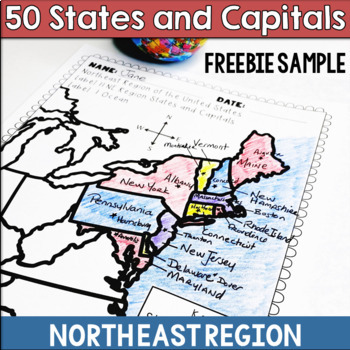
50 States and Capitals Northeast Region Freebie Sample
Make learning the 50 states and capitals more fun with my Northeast Region States and Capitals freebie sample This is one of the 5 regional map activity packets offered in a larger bundle in my store. If you enjoy this freebie, check out the full activity linked below.The United States and Capitals Geography Review Activities and Assessment BundleThe United States and Capitals Geography Review ActivitiesThe United States and Capitals Geography by Regions Printables & AssessmentsIncluded:• No
Grades:
4th - 6th
Types:
Also included in: 50 States and Capitals Bundle Map Print & Digital Resource 50% OFF
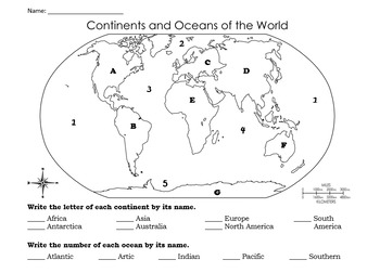
Continents and Oceans Quiz & Study Guide
This bundle includes an elementary level quiz and study guide on the world's continents and oceans. It also includes an Answer Key.*Study guide edited to include Arctic Ocean! :)
Grades:
2nd - 5th
Types:
Maps and Globes
Maps and Globes - This Freebie is designed to teach and review map skills.
Students will identify continents and oceans on a world map; identify their own city, state and country and review vocabulary words.
Included:
Vocabulary Posters
Where I Live Activity Sheet
Continents and Oceans Review
If you enjoy these pages please see my full unit:
Maps and Globes
Feel free to use the “Ask a Question” tab if you have any additional questions.
Thank you
Terrie Campbell
Subjects:
Grades:
1st - 3rd
Types:
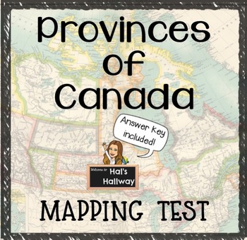
Provinces of Canada Mapping Test with Answer Key
*FREEBIE* Provinces of Canada fill-in-the-blanks worksheet/mapping test for Canadian Geography and Social Studies. With the given names of provinces and territories, students must label each correctly on the blank line.This download includes:Fill-in-the-blanks Provinces of Canada worksheet/testStudent answer keyTeacher answer keyPlease rate and leave feedback!- Hal's Hallway
Grades:
K - 9th
Types:
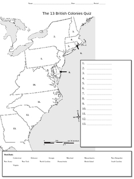
13 Colonies Map Quiz
This mapping activity which addresses the original 13 colonies can be used either an initial introduction worksheet/organizer or as a quiz.
Subjects:
Grades:
4th - 9th
Types:
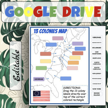
13 Colonies Map Labelling (Print & Digital)
Great for practicing the 13 Colony locations. Simply drag and drop the colony name on the right over top of the correct colored rectangle. If you're interested in more resources pertaining to the 13 Colonies Unit, please check out the links below:13 Colonies Complete BundleSouthern Colonies Resources PackJamestown Colony Resources PackMiddle Colonies Resources PackRoanoke Colony Resources PackNew England Colonies Resources Pack13 Colonies Breakout Slides Group Research ExerciseYou many also be i
Grades:
1st - 8th
Types:
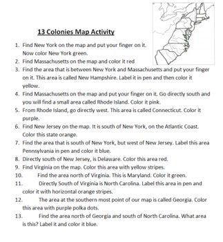
13 Colonies Map Activity
This is a simple mapping activity for Colonial America. I've included instructions for finding the different colonies and how they are to color them. The instructions include using directions like north, south, east, and west. All you need to provide is your favorite map of the 13 colonies to use.
Also included is mnemonic for remembering the 13 colonies and a bonus point for drawing a picture of this mnemonic.
I give each student their own map and instruction sheet. I then have students take
Subjects:
Grades:
4th - 5th
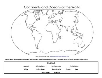
Continents and Oceans Map Labeling PDF Format
This is the same Continents and Oceans Map Labeling handout that I uploaded recently.
This is the PDF version of the same file.
Subjects:
Grades:
2nd - 4th
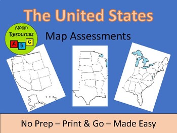
United States Map Assessments
Memorizing the locations of all 50 US states can be hard for some students. Sometimes looking at the entire map can be overwhelming, even if the student has the entire list of states next to them.I designed these assessments (or quizzes) to help prevent students from being overwhelmed. You choose the style. One set of maps comes with a state abbreviation list. One set of maps is entirely blank. These maps are a versatile product. Use as you cover each part of the United States or to check for pr
Subjects:
Grades:
3rd - 12th
Types:
Columbus Day Freebie With Map Skills
Columbus Day Freebie With Map Skills
3 Pages Free
Map Skills Covered:
Compass Rose
Cardinal directions
Intermediate directions
Using a letter/grid system
Symbols
Creativity; students can make their own map (journey) and symbols
Grades:
1st - 4th
Types:
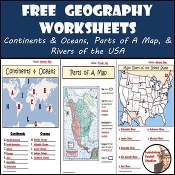
FREE Geography Worksheets: Great Printables for Distance Learning
As a history teacher, I know how important it is for students to have a connection between geography and history. I teach 8th grade and see many students at the start of every year who don't know the continents, parts of a map, or the major rivers in the USA. That's why I wanted to provide a few FREE resources for you to use with your students in the same position.
I don't use these geography worksheets for grades, but more as a way to work with students one-on-one. Especially ones I know a
Subjects:
Grades:
4th - 6th
Types:
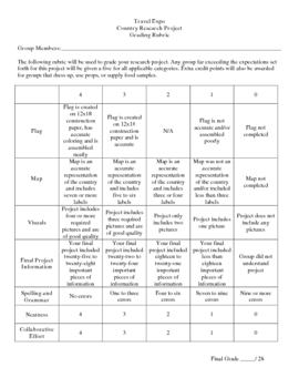
Country Research Project
** Uploaded Word document. Items will need to be copied/pasted into documents to fix some formatting issues.
This Country Research Project was designed as a group project for use with grades 5-8. It includes all of the introduction/explanation papers, worksheets for history, culture, travel, and geography as well as the presentation rubric and worksheet to go along with the Travel Expo (if you so choose to have one). There is a timeline included that covers roughly 8 days and includes time in t
Subjects:
Grades:
5th - 8th
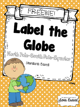
Label the Globe - FREEBIE
Standards based Kindergarten practice page.
K.SS.G.03 Locates North Pole, South Pole, and Equator.
Get your students familiar with global basics--north pole, south pole, and equator. This worksheet could be used as a launching point for a polar bear/penguin research project, or a discussion of global temperature patterns. Where is the earth warmest? Coldest? Why?
Use for morning work, bell work, independent practice, homework, centers, small groups, or assessment!
NO PREP! Simply print and us
Subjects:
Grades:
PreK - 3rd
Types:
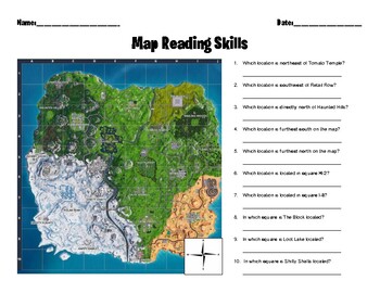
Fortnite Map Skills
Map Skills-Fortnite style! Product includes one worksheet.Map is from Fortnite Season 10.Questions help students practice the following skills:-Applying geographical tools such as grid systems and compass roses to interpret map data-Translating visual data into written information
Subjects:
Grades:
2nd - 6th
Types:
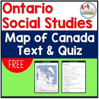
Canada Map with Quiz | FREE
This simple, no-prep map of Canada can be used as an introduction to Canada, or as part of a mapping unit. It is perfect for Canadian students, but also works well with international classrooms who want to learn a little about our country!This resource includes:a map of CanadaA quiz with 9 "fill-in-the-blank" questions and 3 multiple choice questions.An answer key for the quiz.I hope you can take a moment to leave feedback on this free resource after using it!Follow Me:Be the first to learn abo
Subjects:
Grades:
4th - 6th
Types:
Maps and Globes Unit
Maps and Globes – This Unit is designed to teach and review map and globe skills. Students will identify their own city, state and country. They will also identify continents, oceans, the equator, and lines of latitude and lines of longitude. A review and full assessment are also included.This Unit includes:• Vocabulary• Facts about the continents• Activity Sheets• “Where I live…”• “My Town”• “The United States of America”• Vocabulary Flipbook• Continents• Review• Lines of Latitude and Lines o
Subjects:
Grades:
1st - 3rd
Types:
Showing 1-24 of 1,155 results


