18 results
Middle school geography interactive notebook interactive whiteboards
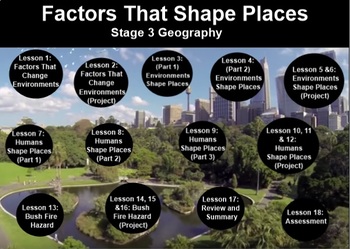
FACTORS THAT SHAPE PLACES- Stage 3 Geography (2 Terms inc. Proj.Bas.Lrn. + test)
My store- The Right Stuff, is primarily stocked with units which are used on the Smart Board. They are SMART NOTEBOOK files, and absolutely REQUIRE you to have this program available to you.This unit covers 2 full terms lesson material strictly adhering to the Australian Curriculum (NSW). You will find all information, worksheets, and web links included, as well as a written assessment. There is no answer sheet as answers are subjective to what students recall from the lessons.The outline is inc
Subjects:
Grades:
5th - 6th
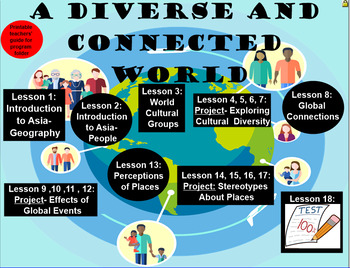
A Diverse and Connected World Two Terms’ Work- Geography, Stage 3
My store- The Right Stuff, is primarily stocked with units which are used on the Smart Board. They are SMART NOTEBOOK files, and absolutely REQUIRE you to have this program available to you.This unit covers 2 full terms lesson material strictly adhering to the Australian Curriculum (NSW). You will find all information, worksheets, and web links included, as well as a written assessment. There is no answer sheet as answers are subjective to what students recall from the lessons. Some links may re
Subjects:
Grades:
5th - 6th
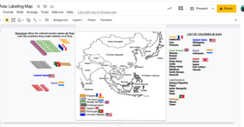
Interactive Imperialism in Asia Mapping Activity
This would work awesome on an interactive whiteboard, or has been made to adapting to this hybrid virtual teaching world. Students can label a map showing the different colonies in Asia during the Age of Imperialism 10.4.
Subjects:
Grades:
7th - 11th
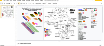
Interactive Imperialism in Africa Mapping
This would work awesome on an interactive whiteboard, or has been made to adapting to this hybrid virtual teaching world. Students can label a map showing the different colonies in Africa during the Age of Imperialism 10.4 and the Berlin Conference.
Subjects:
Grades:
7th - 11th
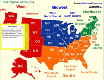
United States Regions - Geography
Regions of the United States - Smart Lab Activities. This Smart Notebook contains 8 interactive pages to help students learn and categorize the states that compose the regions and sub-regions of the United States according the the 2000 US Census Regions and Divisions Map. These pages are:This Smart Notebook contains 8 interactive pages to help students learn and categorize the states that compose the regions and sub-regions of the United States according the the 2000 US Census Regions and Divi
Subjects:
Grades:
5th - 6th
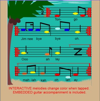
TONGO ~ Polynesian Folk Song~ Timka~ Low so~ Pentatonic~SMARTboard
Brought to you by Kodaly Music with Mrs Perry, this fun 'echo' song is great for teaching low so or timka. Included are 10 pages that allow you to teach one or the other. Read on to see what you get with this purchase:
*BACKGROUND - The name "tongo" is explained, as is what a mangrove is, as well as it's importance.
*MAPS - There are 4 clickable maps that zoom in on the Solomon Islands, Polynesia, where this song is from. You can relocate the star to indicate your school's location.
*PREP
Subjects:
Grades:
3rd - 6th
Types:
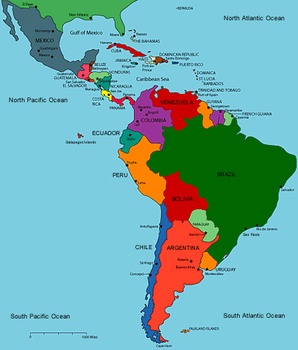
Latin America
Latin America - Social Studies SmartNotebook file to be used to study the three regions of Latin America. Used to explore Central America and Mexico, South America, and the Caribbean!
Slides to label maps, economy, history as well as the Mayans, Aztecs, and Incas!
Subjects:
Grades:
4th - 8th
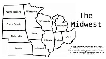
Midwest Geography Review Game
This is a great tool to review the states of the midwest in a fun interactive way.
Subjects:
Grades:
4th - 7th

Political Borders and Regions
Teaching geography/political borders? This SMART Notebook presentation is a great addition to any geography lesson!
Grades:
4th - 8th
Eastern Asia Geography Flashcards!
Students will create flashcards by folding the cards on the black line. One side will have a regional map of Eastern Asia with an arrow pointing to a country and on the other side the name of the country. Great for individual practice or for parent or peer testing. Teachers can also project the flashcards on the smartboard or have the students paste them in their interactive notebooks!
Grades:
4th - 7th
Middle East Geography Flashcards
Students will create flashcards by folding each card along the black line. One side reveals a regional map of the Middle East with an arrow pointing to a country and the other side reveals the country's name. This is a great tool for students to study individually or to practice with a parent or peer. Teachers, you can also display the flashcards on the smartboard for a whole class lesson or have them paste them in their Interactive Notebooks!
Grades:
4th - 7th
Africa Geography Flashcards
Students will create flashcards by folding each card along the black line. Each flashcard will have the continent of Africa with an arrow pointing to a country and then the name of that country on the back for easy individual practice or to study with a parent or peer. Teachers can also display them on the Smartboard for whole class practice or can be placed in an Interactive Notebook!
Grades:
4th - 7th

Beginning of Civilizations Part II Jeopardy
This is another version of the Beginnings of Civilization Jeopardy. In class, I often use both; one version to use in class for review and the other to use during extra help with students. This is a great tool to use to review before a test. Contains information on Otzi, prehistory, domestication, etc..
Grades:
4th - 9th
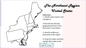
Northeast Region United States
This is an interactive smartboard lesson designed to introduce students to the Northeast Region of the United States. Made on SMARTnotebook 16.2.
Students will learn about the states in the region, their capital and abbreviation. They will also learn the subregions, New England and Middle Atlantic, the physical geography, landmarks, and climate of the region, through interactive maps, videos, and games.
Grades:
3rd - 6th


Guess that Climate!
Perfect SMART Notebook interactive addition to any geography lesson.
Subjects:
Grades:
4th - 8th
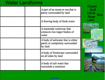
Types of Landforms Smartboard (with Pictures)
A smartboard activity for matching the landform term and picture example to (easy-to-understand) definitions. The slides are divided into "land," "water," and "mixed" landforms and include some well-known landforms such as "lake" and "island," as well as more difficult ones such as "canal" and "delta." The format allows students to use prior knowledge while exploring new terms. I paired it with this worksheet from superteacherworksheets: https://www.superteacherworksheets.com/landforms/landfo
Subjects:
Grades:
2nd - 6th
Types:
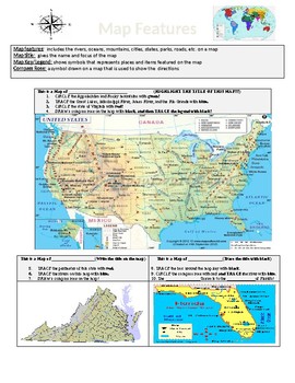
Map Features: USA - Virginia - Florida
Use this file to expose students to the various map features in the USA: Virginia & Florida. Students must use the maps to identify a map legend, a map key, the map's title, rivers, and mountains.
I used this as a team review activity at the end of my Geography unit.
Subjects:
Grades:
2nd - 6th
Showing 1-18 of 18 results


