🎉 Teacher Appreciation: Save up to 25% using promo code THANKYOU24. Sale ends in 11 hrs 11 min. Learn more
29,006 results
12th grade geography resources
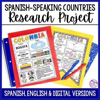
Spanish Speaking Countries Project Research a Country with Google Slides Digital
This Spanish-Speaking country project is an organized and efficient way for students to research Spanish-speaking countries. The templates are in both English and Spanish and can be completed digitally or handwritten. Includes digital templates for PowerPoint and Google Slides.*can easily be adapted for other languages, geography, or social studies classesThis project to create an infographic for a country includes:-Templates in 3 different designs-English templates-Spanish templates-Completed
Subjects:
Grades:
6th - 12th
Types:
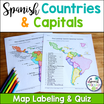
Spanish-Speaking Countries and Capitals Maps and Quiz
This is a map labeling activity and matching quiz over the 21 Spanish-speaking countries and capitals. Students will label and identify the 21 Spanish-speaking countries and capitals in Spanish. This is a great activity when reviewing Spanish-speaking countries and capitals or Spanish geography. Makes a great coloring page. Answer keys are included.
Countries included:
España, México, Costa Rica, El Salvador, Guatemala, Honduras, Nicaragua, Panamá, Cuba, La República Dominicana, Puerto Rico, Ar
Subjects:
Grades:
6th - 12th
Also included in: Spanish Countries and Capitals Geography Bundle
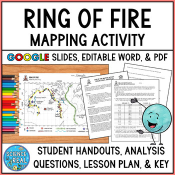
Ring of Fire Mapping Activity and Questions - Earthquakes and Volcanoes
⭐ ⭐ ⭐ ⭐ In this fun and engaging ring of fire mapping activity, students plot the coordinates of past earthquakes and volcanoes along the ring of fire using an easy to read Pacific-centered world map. Students will then draw other geologic features on their maps such as trenches, mountain ranges, hot spots, and mid-ocean ridge. After the map is complete, students will answer 25 analysis questions. Editable MS Word version, PDF version, and Google Slides version are all included!I complete this w
Subjects:
Grades:
8th - 12th
Types:
NGSS:
MS-ESS2-3
, HS-ESS2-1
, MS-ESS2-2
, HS-ESS1-5
Also included in: Plate Tectonics Growing Discount Bundle
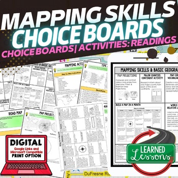
Geography Mapping Skills Activities, Geography Choice Board, Reading Passages
Mapping Skills and Basic Geography Choice Boards, Mapping Skills Readings Google Classroom, Print & Digital Learning provides differentiated activities to use with students to master the content. THIS IS ALSO PART OF SEVERAL BUNDLES World Geography MEGA BUNDLE AND World Geography Choice Board Activity BUNDLE AND Mapping Skills BUNDLE Choice Board Activities and Mapping Skills Readings Including the following: Mapping ActivityCartographerMap ScaleTypes of MapsTime ZonesRoad MapsLand and Wate
Grades:
7th - 12th
Types:
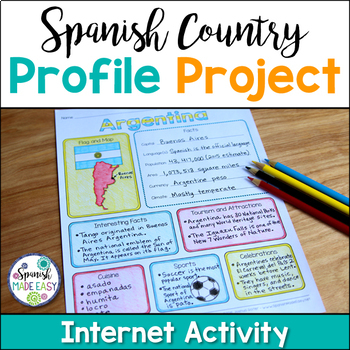
Spanish Country Profile Project
This is a country profile project over the 21 Spanish-speaking countries. Students will research important geographical and cultural facts about each country. This activity includes a blank country profile template, a template for each country, a list of Spanish-speaking countries, and a grading rubric in both English and Spanish. Research topics include: Countries flag, map, capital, language(s), population, area, currency, climate, interesting facts, tourism and attractions, cuisine, sports, a
Subjects:
Grades:
2nd - 12th
Types:
Also included in: Spanish Countries and Capitals Geography Bundle
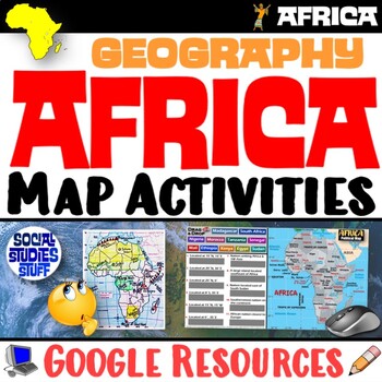
Geography of Africa Map Practice Activities | Print and Digital | Google
End the cycle of bored students copying from books to label maps! Your classes think critically with these digital, interactive, geography activities. First, students answer questions about Africa by analyzing various physical & political maps of the region. Then, a drag & drop challenge assesses their learning of the locations. This resource also includes a printable worksheet that takes labeling maps to the next level! They create a map using only absolute & relative location clues
Subjects:
Grades:
5th - 12th
CCSS:
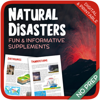
Natural Disasters
Let's learn about Natural Disasters! This worksheet includes 34 pages with a large variety of activities and exercises about natural disasters. Crosswords, word searches, puzzles and other kinds of activities are included to make it a fun and interesting class. The answers and an answer sheet are included. GOOGLE SLIDES AND FILLABLE PDF VERSIONS INCLUDED!Overview: Page 1-2: Introduction Page 3-4: EarthquakesPage 5-7: HurricanesPage 8-9: FloodsPage 10-11: Volcanic EruptionsPage 12-13: TsunamisPag
Subjects:
Grades:
5th - 12th
Types:
Also included in: Geography Bundle (Nature, Oceans, Ecosystems, and Natural Disasters)
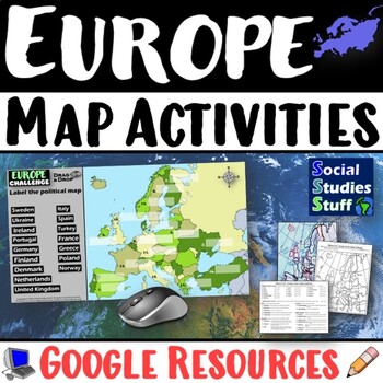
Geography of Europe Map Practice Activities | Print and Digital | Google
End the cycle of bored students copying from books to label maps! Your classes think critically with these digital, interactive, geography activities. First, students answer questions about Europe by analyzing various physical & political maps of the region. Then, a drag & drop challenge assesses their learning of the locations. This resource also includes a printable worksheet that takes labeling maps to the next level! They create a map using only absolute & relative location clues
Subjects:
Grades:
5th - 12th
CCSS:
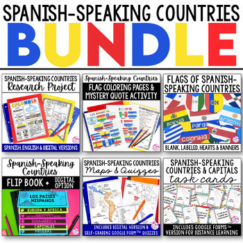
Spanish Speaking Countries BUNDLE Project Maps Flip Book Quizzes + DIGITAL
This money-saving bundle has everything you need to teach the Spanish-speaking countries, their locations, and capitals! Includes maps, quizzes, project, activities, and more! Save over 30% on this bundle of the following items:Spanish-Speaking Countries Flip BookNo cut, no waste, 6 page / 3 pieces of paper printable flip bookDigital flip book in Google Slides for paperless or distance learningWestern Europe map to label SpainWest Africa map to label Equatorial GuineaCentral America / North Am
Subjects:
Grades:
6th - 12th
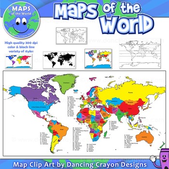
Maps of the World: Clip Art World Maps
Maps of the World: Clip Art World Maps
High quality color and black and white maps of the world.
This clipart map set contains the following commercial use graphics:
- Color maps of the world
- Black and white line art maps of the world
- Maps of the world with lines of latitude and without lines of latitude
- Maps of the world with larger countries labelled (color and black and white)
- Silhouette maps of the world
- A map of the world showing seven continents in color and black and white:
Grades:
3rd - 12th, Higher Education, Adult Education, Staff
Also included in: Maps of the World Clip Art - MEGA-BUNDLE
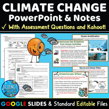
Climate Change PowerPoint with Notes, Questions, and Kahoot
⭐ ⭐ ⭐ ⭐ This Climate Change PowerPoint focuses on current greenhouse gas emissions, the greenhouse effect, global warming and climate change. This resource includes student notes, assessment questions, and custom Kahoot game! Also included are teacher notes and lesson plan. This engaging 45-slide editable Climate Change PowerPoint is accompanied by editable fill-in-the-blank-style notes, assessment questions, and a custom Kahoot! Standard printable files (MS Word and PDF) and Google Slides versi
Subjects:
Grades:
8th - 12th
NGSS:
HS-ESS3-3
, MS-ESS3-5
, HS-ESS3-1
, MS-ESS3-4
, HS-ESS3-5
...
Also included in: Climate Change Growing Discount Bundle
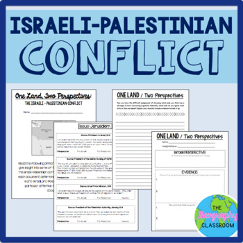
Israel Palestine Conflict History Set
This set includes several resources and activities to use when teaching the complicated Israeli-Palestinian conflict. This set includes:- A short reading on the "two-state solution"- Several primary source documents that help students understand the major issues preventing a two-state solution. As students read the documents, they have to decide whether each document has a pro-Israeli perspective, a pro-Palestinian perspective, or a neutral perspective. - 12 page PowerPoint slides for teachers t
Grades:
6th - 12th
Types:
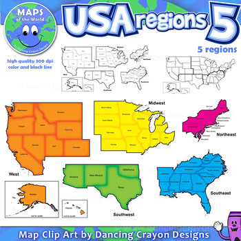
Regions of the USA: Five Regions - Map Clip Art
Regions of the USA: Five Regions - Map Clip Art
.............................................................................................
Please check the regions in this set before purchase. We offer a choice of THREE different US Region Map Sets:
USA divided into FOUR regions / NINE divisions (as set out by the United States Census Bureau)
USA divided into FOUR regions / TEN divisions (as taught in some states)
Please read on for more information about THIS region set:
............
Grades:
3rd - 12th, Staff
Also included in: Maps of the World Clip Art - MEGA-BUNDLE
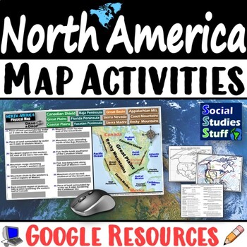
Geography of North America Map Practice Activities | USA Canada Mexico | Google
End the cycle of bored students copying from books to label maps! Your classes think critically with these digital, interactive, geography activities. First, students answer questions about North America by analyzing various physical & political maps of the region. Then, a drag & drop challenge assesses their learning of the locations. This resource also includes a printable worksheet that takes labeling maps to the next level! They create a map of the United States, Canada, and Mexico u
Subjects:
Grades:
5th - 12th
CCSS:
Global Issues Contemporary World Problems Human Geography Course Bundle
This tightly-woven semester course combines Human Geography, Current Events, Contemporary World Issues, and Environmental Science into a must-teach inquiry-driven, real-world, project-based experience.With these thematic, inquiry-driven units that build on each other, ask students to decide for themselves where they fit in this complex, competitive, and connected global village. You will guide them in exploring everything from the human population growth to globalization to natural resource sust
Subjects:
Grades:
9th - 12th
Types:
CCSS:
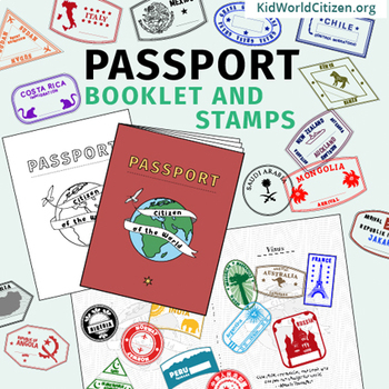
Passport Booklet & Stamps Growing Bundle: Around the World Unit, Geography Fair
These passport stamps and passport booklet are absolutely amazing!!! Perfect for an around the world unit, introduction to country studies, a Geography Fair, International Night, Social Studies Units, "Read Around the World" Passports, or Christmas Around the World (or Holidays Around the World). Save now by getting in early on this GROWING BUNDLE as we will be adding country stamps in the near future!The passport booklet is authentic, appropriate for students in any country ("Citizen of the Wor
Grades:
PreK - 12th
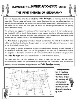
Surviving the Zombie Apocalypse using the Five Themes of Geography!
Students will use a website created for this project to analyze maps and gather information about different locations. The students will then interpret that information using the 5 Themes of Geography to decide if the locations benefit them during the Zombie Apocalypse. The students will finish off their research with a short essay explaining their choices and how the information they gathered from the maps helped them make their decision.This is a great way to get students to use their mapping
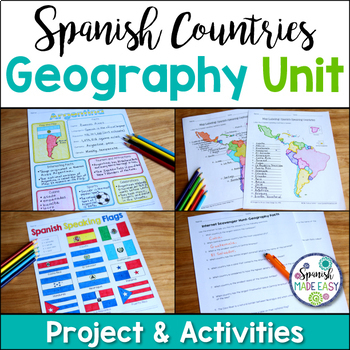
Spanish Countries and Capitals Geography Bundle
This is a Geography Unit with 4 resources over the 21 Spanish-Speaking Countries and Capitals. In this bundle you will receive a Spanish-speaking country profile project, 2 map labeling activities, a matching quiz activity, an internet scavenger hunt, and a 2 page coloring activity with the 21 flags of the Spanish-speaking world. Answer keys and examples are included. Purchase this bundle and save over 25% off the following resources:Spanish-Speaking Country Profile ProjectSpanish-Speaking Count
Subjects:
Grades:
6th - 12th
Types:
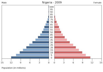
Population Pyramids Lesson and Activity
UPDATED 2023! This product now has an updated version with population data from 2020-2022 for the practice countries. This product will teach students the basics of how to read, understand and analyze population pyramids. The product has a student note piece along with an activity that can be used as an individual assignment or as a cooperative group activity. After students learn how to read a population pyramid they will construct their own using data provided and then analyze the pyramid(s)
Grades:
8th - 12th
Types:
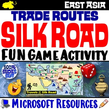
Silk Road Trade Routes FUN Game Activity | Cultural Diffusion and Geography
Play a FUN “Travels on the Silk Road” game that students LOVE! They must identify goods & ideas spread on the trade routes while competing to amass the greatest fortune along the way! Print & interactive, digital versions of the materials are included. Made for traditional in-class learning or digital 1:1 classrooms. Everything you need is included!Includes:Explain Slides: Game DirectionsFill-in Scorecard & ChartGame Task CardsGame BoardAnswer KeyTeacher Reference GuideVocabulary:Sil
Grades:
5th - 12th
CCSS:
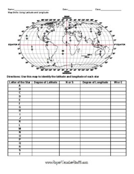
Latitude and Longitude Worksheet & Answer Key
This worksheet is an awesome way to teach Latitude and Longitude. The way that it is structured reinforces that Latitude measures North and South of the Equator, and that Longitude measures East and West of the Prime Meridian. This worksheet features a World Map with an Answer Key.
Subjects:
Grades:
3rd - 12th, Higher Education, Adult Education
Types:
Cultural Diffusion and Globalization 5-E Lesson | McDonalds in India | Google
This student-favorite lesson explores cultural diffusion and its effects on our world. The activities are engaging for students & the guided, 5-E format is easy for you to use! Begin with a fun “Name It” warm-up activity. Explore how culture is shared and adapted globally, then introduce key vocabulary. Fill-in notes accompany the lesson. A photo analysis activity challenges your class to compare McDonalds in India to the United States. Finally, a reading comprehension activity investigates
Grades:
6th - 12th
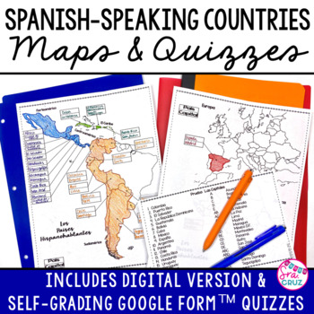
Spanish Speaking Countries and Capitals Maps and Quizzes Worksheet + DIGITAL
Spanish-Speaking Countries Maps and Quizzes - Included are blank maps of the Spanish-speaking countries for students to fill in, completed maps, a map quiz, and a matching capitals quiz. NEW: Now includes Google Slides™ version of the map for students to fill in digitally and self-checking Google Forms™ quizzes for the map and capitals quizzes.*Please see the thumbnails & preview for more details*Includes:✅ Blank Maps-One page map without Equatorial Guinea-Two page map with Equatorial Guinea
Subjects:
Grades:
6th - 12th
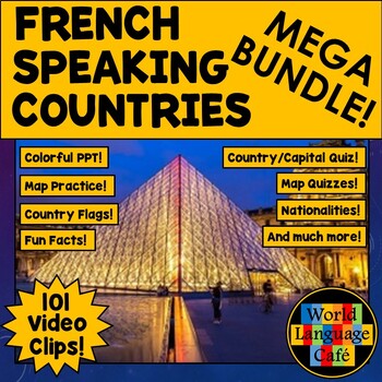
FRANCOPHONE COUNTRIES FRENCH SPEAKING COUNTRIES ⭐ Videos PPT Google Maps Quizzes
Do you struggle to make Francophone countries culture come alive? Want to bring your students on virtual field trips to all the major French speaking countries without ever leaving your classroom? Want to convince even your most reluctant learners to speak French so they can visit all these beautiful places? This is a whole year of Francophone culture. Hours of lesson plans including 101 Francophone countries video clips, colorful photos, facts, nationality practice, flashcards, a research pr
Subjects:
Grades:
2nd - 12th
Showing 1-24 of 29,006 results

