18 results
Middle school geography game images
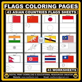
Asian Countries Flags Coloring Pages - 43 Worksheets
Let your kids or your class students Have fun learning about the countries of Asia with these flags coloring pages (Countries geographically located in Asia).HERE ARE SOME BENEFITS OF COLORING:1. Improves Motor Skills2. Prepares Them for School3. Stimulates Creativity4. Contributes to Better Handwriting5. Teaches Color Awareness, Recognition, and Discernment6. Improves Focus and Hand to Eye Coordination7. Helps Learn about Boundaries, Structure, and Spacial Awareness8. Improves Confidence and Se
Grades:
PreK - 6th
Also included in: Flags of the World BUNDLE Coloring Pages - 193 Worksheets
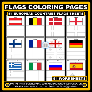
European Countries Flags Coloring Pages - 51 Worksheets
Let your kids or your class students Have fun learning about the countries of Europe with these flags coloring pages (51 countries geographically located in Europe).HERE ARE SOME BENEFITS OF COLORING:1. Improves Motor Skills2. Prepares Them for School3. Stimulates Creativity4. Contributes to Better Handwriting5. Teaches Color Awareness, Recognition, and Discernment6. Improves Focus and Hand to Eye Coordination7. Helps Learn about Boundaries, Structure, and Spacial Awareness8. Improves Confidence
Grades:
PreK - 6th
Also included in: Flags of the World BUNDLE Coloring Pages - 193 Worksheets
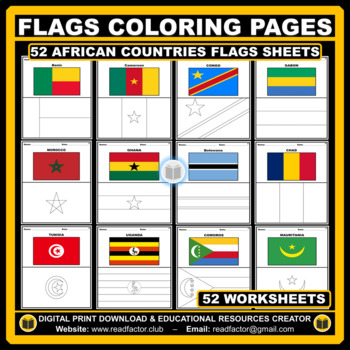
African Countries Flags Coloring Pages - 52 Worksheets
Let your kids or your class students Have fun learning about the countries of Africa with these flags coloring pages (52 countries geographically located in Africa).HERE ARE SOME BENEFITS OF COLORING:1. Improves Motor Skills2. Prepares Them for School3. Stimulates Creativity4. Contributes to Better Handwriting5. Teaches Color Awareness, Recognition, and Discernment6. Improves Focus and Hand to Eye Coordination7. Helps Learn about Boundaries, Structure, and Spacial Awareness8. Improves Confidence
Grades:
PreK - 6th
Also included in: Flags of the World BUNDLE Coloring Pages - 193 Worksheets
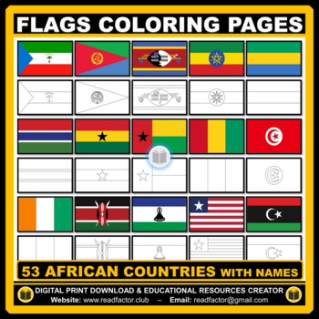
Flags Coloring Pages of African Countries with Names
Let your kids or your class students Have fun learning about the countries of Africa with these flags coloring pages (53 countries geographically located in Africa).HERE ARE SOME BENEFITS OF COLORING:1. Improves Motor Skills2. Prepares Them for School3. Stimulates Creativity4. Contributes to Better Handwriting5. Teaches Color Awareness, Recognition, and Discernment6. Improves Focus and Hand to Eye Coordination7. Helps Learn about Boundaries, Structure, and Spacial Awareness8. Improves Confidence
Grades:
PreK - 6th
Also included in: BUNDLE Countries of the World Flags Coloring Pages with Names
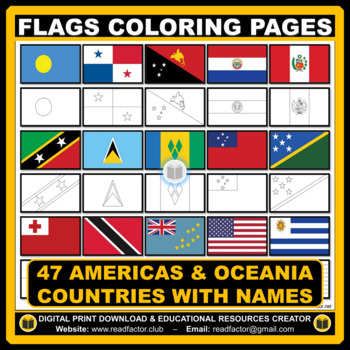
Flags Coloring Pages of Americas & Oceania Countries With Names
Let your kids or your class students Have fun learning about the countries of the Americas & Oceania with these flags coloring pages (Countries geographically located in America & Oceania).HERE ARE SOME BENEFITS OF COLORING:1. Improves Motor Skills2. Prepares Them for School3. Stimulates Creativity4. Contributes to Better Handwriting5. Teaches Color Awareness, Recognition, and Discernment6. Improves Focus and Hand to Eye Coordination7. Helps Learn about Boundaries, Structure, and Spacial
Grades:
PreK - 6th, Higher Education
Also included in: BUNDLE Countries of the World Flags Coloring Pages with Names
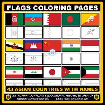
43 Flags Coloring Pages of Asian Countries With Names
Let your kids or your class students Have fun learning about the countries of Asia with these flags coloring pages (43 countries geographically located in Asia).HERE ARE SOME BENEFITS OF COLORING:1. Improves Motor Skills2. Prepares Them for School3. Stimulates Creativity4. Contributes to Better Handwriting5. Teaches Color Awareness, Recognition, and Discernment6. Improves Focus and Hand to Eye Coordination7. Helps Learn about Boundaries, Structure, and Spacial Awareness8. Improves Confidence and
Grades:
PreK - 6th
Also included in: BUNDLE Countries of the World Flags Coloring Pages with Names
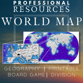
World Map | Regions | Board Game | Geography | Printable | Diplomacy | Risk
This file is a high resolution World Map with almost 160 land areas and 85 sea zones. It is ideal for a board game map for games like Diplomacy or Risk which can be used in the classroom. Could be useful for creating games, using teaching techniques like the World Peace Game or general use for Geography in the classroom.Also good for Social Studies and History. High quality image - 8848 x 5062 pixels* To print using a regular printer, insert the jpg file into Excel. You can make it any size requ
Subjects:
Grades:
5th - 8th
Types:
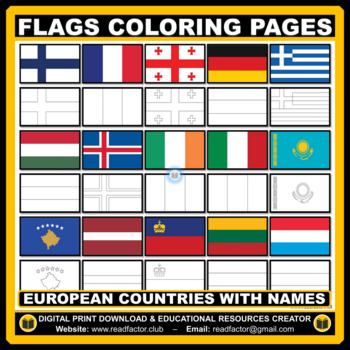
Flags Coloring Pages of European Countries with Names
Let your kids or your class students Have fun learning about the countries of Europe with these flags coloring pages (Countries geographically located in Europe).HERE ARE SOME BENEFITS OF COLORING:1. Improves Motor Skills2. Prepares Them for School3. Stimulates Creativity4. Contributes to Better Handwriting5. Teaches Color Awareness, Recognition, and Discernment6. Improves Focus and Hand to Eye Coordination7. Helps Learn about Boundaries, Structure, and Spacial Awareness8. Improves Confidence an
Grades:
PreK - 6th
Also included in: BUNDLE Countries of the World Flags Coloring Pages with Names
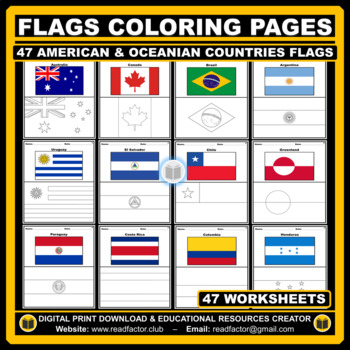
American and Oceanian Countries Flags Coloring Pages - 47 Worksheets
Let your kids or your class students Have fun learning about the countries of the Americas & Oceania with these flags coloring pages (Countries geographically located in America and Oceania).HERE ARE SOME BENEFITS OF COLORING:1. Improves Motor Skills2. Prepares Them for School3. Stimulates Creativity4. Contributes to Better Handwriting5. Teaches Color Awareness, Recognition, and Discernment6. Improves Focus and Hand to Eye Coordination7. Helps Learn about Boundaries, Structure, and Spacial A
Grades:
PreK - 6th
Also included in: Flags of the World BUNDLE Coloring Pages - 193 Worksheets
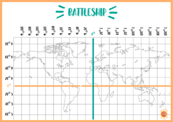
BATTLESHIP MAP
Map to work on coordinates, cardinal points and latitude/longitude.Mapa para trabajar las coordenadas, los puntos cardinales y la latitud y longitud.
Countries & Nationalities I. FREEBIE. Digital Game.
This FREEBIE and Digital Game developed by José An. is a collaboration with the great Ron Leishman, and will have students learning about Countries and Nationalities in a fun and digitally interactive way. The great thing about these games and activities is that you can scan and choose which game you would like to work on with your class, students, and/or child. You can spread the activities out to your liking, use for small group, centers, at home, and so much more!This Digital Countries a
Grades:
K - 6th
Types:
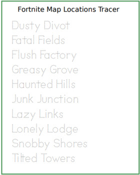
Fortnite Locations Tracing Sheet
This one's for the classes out there who love Fortnite. Encourages the kids to practice hand writing and Fortnite "Geography" skills associated with the game they love.
Subjects:
Grades:
2nd - 6th
Types:

Countries and nationalities II - Freebie . Digital Game.
This FREEBIE and Digital Game developed by José An. is a collaboration with the great Ron Leishman, and will have students learning about Countries and Nationalities in a fun and digitally interactive way. The great thing about these games and activities is that you can scan and choose which game you would like to work on with your class, students, and/or child. You can spread the activities out to your liking, use for small group, centers, at home, and so much more!These Digital Countries
Grades:
K - 6th
Types:
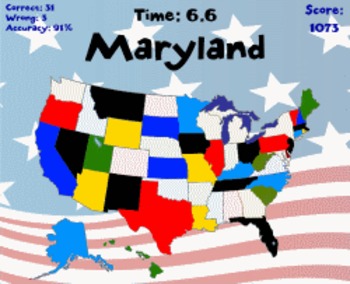
Click States | States, Capital Cities, and Nicknames | RoomRecess.com
You have 60 seconds to click on as many states as you can! Playable at RoomRecess.com for free!
Grades:
3rd - 6th
Types:
Países y Nacionalidades I - Freebie . Juego digital gratis.
Este FREEBIE y Juego Digital desarrollado por José An. es una colaboración con el gran Ron Leishman, y hará que los estudiantes aprendan sobre países y nacionalidades de una manera divertida e interactiva digitalmente.Lo mejor de estos juegos y actividades es que puede escanear y elegir qué juego le gustaría trabajar con su clase y alumnos Puede distribuir las actividades a su gusto, usarlas para grupos pequeños, centro, en casa y mucho más!Estos Juegos Digitales de Países y Nacionalidades I i
Grades:
K - 6th
Types:
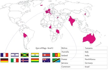
Quiz of Flags - level 2
Quiz of Flags,find the right country, its flag and its name.
Keywords: quiz, flag, flags, world, worldmap, geography, geography game
Waterfalls Zoom Virtual Background
Distance learning while teaching about water forms can be challenging. Make it fun by adding your own zoom background!Suggested ways to use:1. Change your background continuously and ask them what water form it is.2. Change your background and ask them to do the action for the specific water form.
Subjects:
Grades:
PreK - 6th
Types:

Tour the USA! Intermediate Directions Version Answers
Tour the USA! Intermediate Directions Version Answers
Showing 1-18 of 18 results


