25 results
4th grade african history classroom decor microsofts
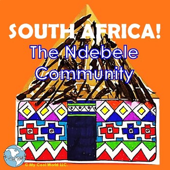
South Africa! Ndebele Community—Lesson, “Painted” House Craft w Geometry
Introduce students to the Ndebele community of South Africa, and learn how this small community is famous for its beadwork, attire, and painted houses! This product includes the following, all as Adobe files:An images file in a slideshow format with embedded lessons on each slide. Lessons explore the Ndebele community and the heritage they display in their arts and crafts. There is no printout needed.An art project with step-by-step instructions for making an Ndebele painted house, full of color
Subjects:
Grades:
K - 8th
Also included in: South Africa! The BIG Bundle Grades 3 to 5—Crafts, Lessons & Activities
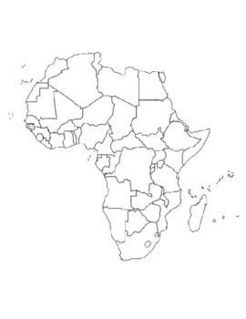
Global/U.S. - Maps Databank - Africa
40 pages of maps related to the continent of Africa. This databank of maps can be used for a variety of purposes depending on your lesson. Some examples of the types of maps included (but not limited to) are:- Political maps- Physical maps- Blank political maps- Vegetation Zone maps- Climate maps- Precipitation Rate maps- Satellite maps- Economic maps- Wealth / GDP maps- Resource / Land Use maps- Religion / language / ethnicity maps- Population density maps- Flag maps- Historical maps related to
Grades:
1st - 12th, Higher Education, Adult Education, Staff
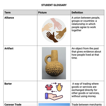
5th Grade: Vocabulary Words (23-24 Louisiana Social Studies Standards; Unit 2)
Teaching Social Studies in Louisiana? In need of ready-to-print student glossaries or vocabulary cards for your Word Wall? I've got you covered!This editable document contains a ready-to-print student glossary, as well as vocabulary cards for your SS Word Wall! With over 30 vocabulary terms aligned to the GL Course Frameworks (provided by the LDOE) and 23-24 5th Grade Social Studies, this resource will help you get prepared to teach your first unit of the year! Just print and laminate!Words incl
Grades:
3rd - 8th
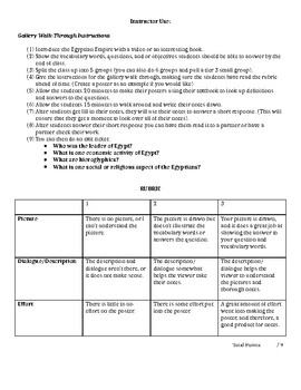
Ancient Egyptian Gallery Walk
Looking for an activity that has group work, getting students up off of their feet, and has engaging note taking! This is it! Students have directions and a rubric on how to make fun engaging posters on the main aspects of Ancient Egyptian Life (the pyramids, government, the Nile, social/ religious, and economic activities). Once they make their posters they will post them around the room and then students will take their notes on Ancient Egypt based upon what they see. I also include a short wr
Grades:
4th - 12th
Types:
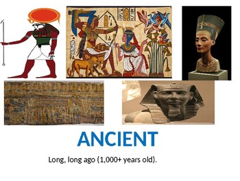
Ancient Egypt Vocabulary for Word Wall
This a PowerPoint presentation that contains key vocabulary words and definitions. Photos and illustrations are on each slide with the vocabulary. This makes your word wall accessible for all your students including your english language learners. Print and distribute as handouts, print as full slides to post on your word wall, or show presentation as an introduction to the vocab in you Egypt unit. Enjoy! Vocabulary selected based on VA 3rd grade Social Studies SOL 3.4 and 3.7 *This PP is editab
Grades:
2nd - 4th
Black History Month Guess Who
I post this in the hallway. Each day in February, I have a new person and the students have to guess who the mystery person is. There is a picture and a description for each person.
Grades:
2nd - 9th
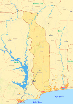
Togo map with cities township counties rivers roads labeled
Togo map with cities township counties rivers roads labeledTogo map is a type of map that includes geographical features such as towns, communes, counties, rivers and roads. These features are labelled with their respective names, allowing the user to easily identify them.This type of map is useful for anyone wishing to explore the country or better understand its geography.This download contains files that may be printed and copied or used digitally._____________________________________________
Grades:
4th - 8th, Higher Education
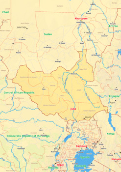
South Sudan map with cities township counties rivers roads labeled
South Sudan map with cities township counties rivers roads labeledSouth Sudan map is a type of map that includes geographical features such as towns, communes, counties, rivers and roads. These features are labelled with their respective names, allowing the user to easily identify them.This type of map is useful for anyone wishing to explore the country or better understand its geography.This download contains files that may be printed and copied or used digitally._______________________________
Grades:
4th - 9th, Higher Education
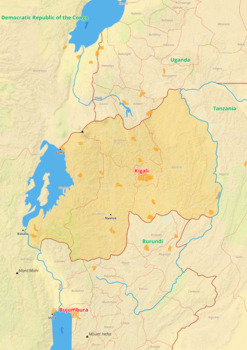
Rwanda map with cities township counties rivers roads labeled
Rwanda map with cities township counties rivers roads labeledRwanda map is a type of map that includes geographical features such as towns, communes, counties, rivers and roads. These features are labelled with their respective names, allowing the user to easily identify them.This type of map is useful for anyone wishing to explore the country or better understand its geography.This download contains files that may be printed and copied or used digitally._________________________________________
Grades:
4th - 9th, Higher Education
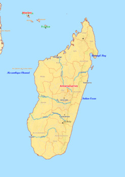
Madagascar map with cities township counties rivers roads labeled
Madagascar map with cities township counties rivers roads labeledMadagascar map is a type of map that includes geographical features such as towns, communes, counties, rivers and roads. These features are labelled with their respective names, allowing the user to easily identify them.This type of map is useful for anyone wishing to explore the country or better understand its geography.This download contains files that may be printed and copied or used digitally._________________________________
Grades:
4th - 8th, Higher Education
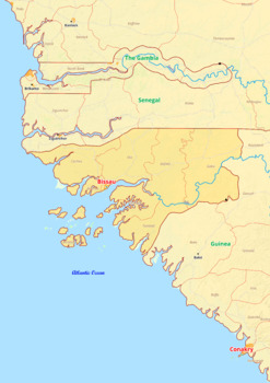
Guinea - Bissau map with cities township counties rivers roads labeled
Guinea-Bissau map with cities township counties rivers roads labeledGuinea Bissau map is a type of map that includes geographical features such as towns, communes, counties, rivers and roads. These features are labelled with their respective names, allowing the user to easily identify them.This type of map is useful for anyone wishing to explore the country or better understand its geography.This download contains files that may be printed and copied or used digitally.___________________________
Grades:
4th - 8th, Higher Education
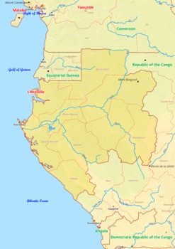
Gabon map with cities township counties rivers roads labeled
Gabon map with cities township counties rivers roads labeledGabon map is a type of map that includes geographical features such as towns, communes, counties, rivers and roads. These features are labelled with their respective names, allowing the user to easily identify them.This type of map is useful for anyone wishing to explore the country or better understand its geography.This download contains files that may be printed and copied or used digitally.___________________________________________
Grades:
4th - 8th, Higher Education
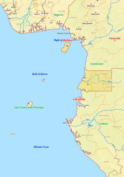
Equatorial Guinea map with cities township counties rivers roads labeled
Equatorial Guinea map with cities township counties rivers roads labeledEquatorial Guinea map is a type of map that includes geographical features such as towns, communes, counties, rivers and roads. These features are labelled with their respective names, allowing the user to easily identify them.This type of map is useful for anyone wishing to explore the country or better understand its geography.This download contains files that may be printed and copied or used digitally.___________________
Grades:
4th - 8th, Higher Education
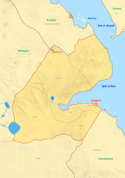
Djibouti map with cities township counties rivers roads labeled
Djibouti map with cities township counties rivers roads labeledDjibouti map is a type of map that includes geographical features such as towns, communes, counties, rivers and roads. These features are labelled with their respective names, allowing the user to easily identify them.This type of map is useful for anyone wishing to explore the country or better understand its geography.This download contains files that may be printed and copied or used digitally._____________________________________
Grades:
4th - 8th, Higher Education
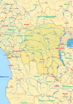
Democratic Republic of the Congo map with cities township counties rivers roads
Democratic Republic of the Congo map with cities township counties rivers roads labeledDemocratic Republic of the Congo map is a type of map that includes geographical features such as towns, communes, counties, rivers and roads. These features are labelled with their respective names, allowing the user to easily identify them.This type of map is useful for anyone wishing to explore the country or better understand its geography.This download contains files that may be printed and copied or used
Grades:
4th - 8th, Higher Education
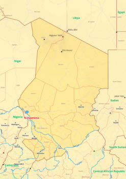
Chad map with cities township counties rivers roads labeled
Chad map with cities township counties rivers roads labeledChad map is a type of map that includes geographical features such as towns, communes, counties, rivers and roads. These features are labelled with their respective names, allowing the user to easily identify them.This type of map is useful for anyone wishing to explore the country or better understand its geography.This download contains files that may be printed and copied or used digitally._____________________________________________
Grades:
4th - 8th, Higher Education
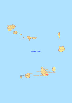
Cape Verde map with cities township counties rivers roads labeled
Cape Verde map with cities township counties rivers roads labeledCape Verde map is a type of map that includes geographical features such as towns, communes, counties, rivers and roads. These features are labelled with their respective names, allowing the user to easily identify them.This type of map is useful for anyone wishing to explore the country or better understand its geography.This download contains files that may be printed and copied or used digitally._________________________________
Grades:
4th - 8th, Higher Education
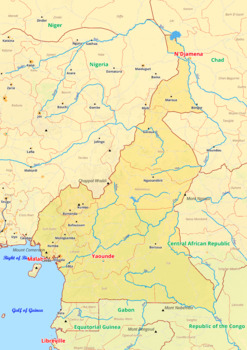
Cameroon map with cities township counties rivers roads labeled
Cameroon map with cities township counties rivers roads labeledCameroon map is a type of map that includes geographical features such as towns, communes, counties, rivers and roads. These features are labelled with their respective names, allowing the user to easily identify them.This type of map is useful for anyone wishing to explore the country or better understand its geography.This download contains files that may be printed and copied or used digitally._____________________________________
Grades:
4th - 9th, Higher Education
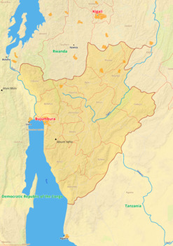
Burundi map with cities township counties rivers roads labeled
Burundi map with cities township counties rivers roads labeledBurundi map is a type of map that includes geographical features such as towns, communes, counties, rivers and roads. These features are labelled with their respective names, allowing the user to easily identify them.This type of map is useful for anyone wishing to explore the country or better understand its geography.This download contains files that may be printed and copied or used digitally._______________________________________
Grades:
4th - 8th, Higher Education
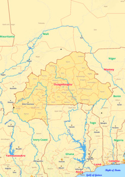
Burkina Faso map with cities township counties rivers roads labeled
Burkina Faso map with cities township counties rivers roads labeledBurkina Faso map is a type of map that includes geographical features such as towns, communes, counties, rivers and roads. These features are labelled with their respective names, allowing the user to easily identify them.This type of map is useful for anyone wishing to explore the country or better understand its geography.This download contains files that may be printed and copied or used digitally._____________________________
Grades:
4th - 8th, Higher Education
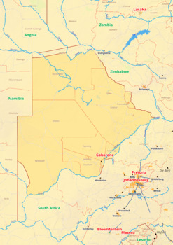
Botswana map with cities township counties rivers roads labeled
Botswana map with cities township counties rivers roads labeledBotswana map is a type of map that includes geographical features such as towns, communes, counties, rivers and roads. These features are labelled with their respective names, allowing the user to easily identify them.This type of map is useful for anyone wishing to explore the country or better understand its geography.This download contains files that may be printed and copied or used digitally._____________________________________
Grades:
4th - 8th, Higher Education
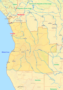
Angola map with cities township counties rivers roads labeled
Angola map with cities township counties rivers roads labeledThe Angola map shows the entire country, including its cities, townships, counties, rivers, and roads. Major cities are labeled and include the capital city of Luanda, as well as Lobito, Benguela, Huambo, and Lubango. Townships are labeled and include the provinces of Bengo, Cabinda, and Zaire. Counties are labeled and include the provinces of Kwanza Norte, Kwanza Sul, and Uige. Major rivers are labeled and include the Kwanza and the Z
Grades:
4th - 8th, Higher Education
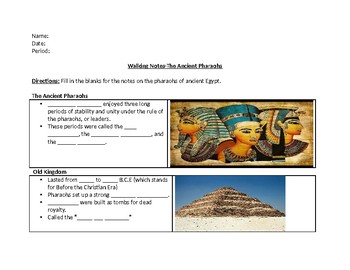
Ancient Pharaohs Walking Notes Activity
This product includes:A fill in the blank powerpoint on paper for students to fill in as they are taking notes on the ancient pharaohs. Goes perfectly with the powerpoint.
Grades:
4th - 6th
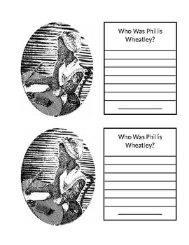
Phillis Wheatley mini poster and writing.
Phillis Wheatley was an African American writer who was brought to America and sold into slavery as a child. I made these mini posters for students to write about who she was and glue into their social studies interactive notebooks.
Grades:
2nd - 4th
Showing 1-24 of 25 results


