20 results
12th grade geography activities for Microsoft Excel
Global Trade Simulation - Teacher Mastersheet + National Wealth Spreadsheet
This file is the Trade Simulation master sheet that has all of the program data. The rules, scenarios and guiding principles for the simulation are all here. I have created them based on some of the realities of world systems so that the students can take part in an authentic learning experience. This will allow you to govern the world that is created in your classroom and oversee the economy that is created. In addition, you function as the World Bank so you need so this will be your guide rega
Grades:
6th - 12th
Types:
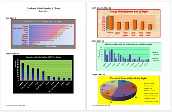
Continent Table Ver3 All Continents Full Pack Tech Lesson Plans&Mat.
A great way to learn about all the continents!
This lesson is in my Level 5 Curriculum Progression.
Recommended for Fifth through Twelfth Grade
Uses Microsoft Excel, but can be adapted for other spreadsheet software.
Summary of Creation: Students use the CIA World Factbook website to find information about all the countries of a specified continent and display the data in a table in an Excel spreadsheet.
Summary of Analysis: Using the table created in Continent Table Version 3 Creation or the
Grades:
5th - 12th
Types:
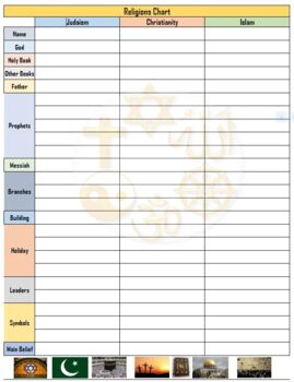
3 Religions of the Middle East Chart w/ Answers - Excel
Compare and contrast chart for Islam, Christianity and Judaism
Subjects:
Grades:
6th - 12th
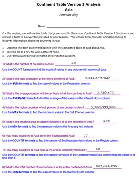
Continent Table Ver 3 Analysis Pack Tech Lesson Plans and Materials
A great way to learn about all the continents!
Summary: Using the table created in Continent Table Version 3 Creation or the Continent Table Version 3 Analysis Optional Student File, students use formulas and data sorting to analyze and answer questions about the countries of the continent.
This lesson is in my Level 5 Curriculum Progression.
Recommended for Fifth through Twelfth Grade
Uses Microsoft Excel, but can be adapted for other spreadsheet software.
Files Included:
Teacher Instructio
Grades:
5th - 12th
Types:
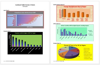
Continent Table Ver 3 Charts Pack Technology Lesson Plans and Materials
A great way to learn about all the continents!
Summary: Using the table created in Continent Table Version 3 Creation or the Continent Table Version 3 Analysis Optional Student File, students create charts to display selected information about the countries of the continent.
This lesson is in my Level 5 Curriculum Progression.
Recommended for Fifth through Twelfth Grade
Uses Microsoft Excel, but can be adapted for other spreadsheet software.
Files Included:
Teacher Instructions (pdf)
Studen
Grades:
5th - 12th
Types:
Continent Table Ver 3 Asia Pack Tech Lesson Plans & Materials
A great way to study Asia!
Summary of Creation: Students use the CIA World Factbook website to find information about all the countries of a specified continent and display the data in a table in an Excel spreadsheet.
Summary of Analysis: Using the table created in Continent Table Version 3 Creation or the Continent Table Version 3 Analysis Optional Student File, students use formulas and data sorting to analyze and answer questions about the countries of the continent.
Summary of Charts: Using
Grades:
5th - 12th
Types:
Continent Table Ver 3 South America Pack Tech Lesson & Materials
A great way to study South America!
Summary of Creation: Students use the CIA World Factbook website to find information about all the countries of a specified continent and display the data in a table in an Excel spreadsheet.
Summary of Analysis: Using the table created in Continent Table Version 3 Creation or the Continent Table Version 3 Analysis Optional Student File, students use formulas and data sorting to analyze and answer questions about the countries of the continent.
Summary of Char
Grades:
5th - 12th
Types:
Continent Table Ver 3 Oceania Pack Tech Lesson & Materials
A great way to study Oceania!
Summary of Creation: Students use the CIA World Factbook website to find information about all the countries of a specified continent and display the data in a table in an Excel spreadsheet.
Summary of Analysis: Using the table created in Continent Table Version 3 Creation or the Continent Table Version 3 Analysis Optional Student File, students use formulas and data sorting to analyze and answer questions about the countries of the continent.
Summary of Charts: Us
Grades:
5th - 12th
Types:
Continent Table Ver 3 North America Pack Tech Lesson & Materials
A great way to study North America!
Summary of Creation: Students use the CIA World Factbook website to find information about all the countries of a specified continent and display the data in a table in an Excel spreadsheet.
Summary of Analysis: Using the table created in Continent Table Version 3 Creation or the Continent Table Version 3 Analysis Optional Student File, students use formulas and data sorting to analyze and answer questions about the countries of the continent.
Summary of Char
Grades:
5th - 12th
Types:
Continent Table Ver 3 Europe Pack Tech Lesson & Materials
A great way to study Europe!
Summary of Creation: Students use the CIA World Factbook website to find information about all the countries of a specified continent and display the data in a table in an Excel spreadsheet.
Summary of Analysis: Using the table created in Continent Table Version 3 Creation or the Continent Table Version 3 Analysis Optional Student File, students use formulas and data sorting to analyze and answer questions about the countries of the continent.
Summary of Charts: Usi
Grades:
5th - 12th
Types:
Continent Table Ver 3 Africa Pack Tech Lesson Plans & Materials
A great way to study Africa!
Summary of Creation: Students use the CIA World Factbook website to find information about all the countries of a specified continent and display the data in a table in an Excel spreadsheet.
Summary of Analysis: Using the table created in Continent Table Version 3 Creation or the Continent Table Version 3 Analysis Optional Student File, students use formulas and data sorting to analyze and answer questions about the countries of the continent.
Summary of Charts: Usin
Grades:
5th - 12th
Types:
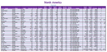
Continent Table Ver 3 Creation Pack Tech Lesson Plans and Materials
A great way to learn about all the continents!
Summary: Students use the CIA World Factbook website to find information about all the countries of a specified continent and display the data in a table in an Excel spreadsheet.
This lesson is in my Level 5 Curriculum Progression.
Recommended for Fifth through Twelfth Grade
Uses Microsoft Excel, but can be adapted for other spreadsheet software.
Files Included:
Teacher Instructions (pdf)
Student Instructions [One each for all six continents] (
Grades:
5th - 12th
Types:
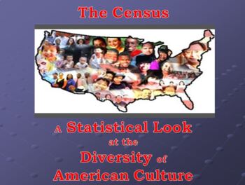
The Census - A Statistical Look at the Diversity of American Culture.
A Statistical Look at the Diversity of American Culture. Whether, it is used with a class or any group, the purpose is to open the eyes of the participants to how diverse our population really is. Preview presentation has notes to explain what the Census is and how to use the Spreadsheet. The spreadsheet sums up the results of data collected and automatically displays on both the Bar Graphs and the Pie Charts. Spreadsheet is compact and uncomplicated. It allows for easy to understand results
Subjects:
Grades:
7th - 12th, Higher Education, Adult Education
Types:
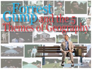
Forrest Gump and the 5 Themes of Geography - Excel
Chart that goes along with the Forrest Gump movie. Allows students to follow the 5 themes of geography as they show up in the movie. Also comes with a map of the US to label the places Forrest goes.Great way to add fun to a 5 Themes activity
Grades:
6th - 12th, Higher Education, Adult Education
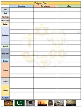
3 Religions of the Middle East Chart w/ Answers - PDF
Compare and contrast chart for Islam, Christianity and Judaism
Subjects:
Grades:
6th - 12th
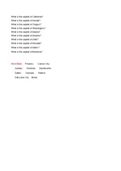
Western States Pixel Art
Here is a Pixel Art activity to help students learn about the 10 Western States- California, Hawaii, Alaska, Oregon, Washington, Idaho, Nevada, Arizona, Montana, and Utah. Students will answer 10 questions, and each correct answer will reveal a part of a drawing that relates to the Western States. This product can be purchased by itself or part of a bundle with a Western States Escape Room activity as well as a Western States Computer Graphics activity. I am offering this product at no cost to s
Subjects:
Grades:
4th - 12th
Types:
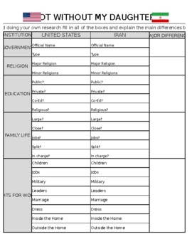
Not Without My Daughter Movie Chart and Questions - Excel
Students answer cultural differences between Iran and United States using the movie "Not Without My Daughter"
Grades:
6th - 12th
Types:

Population density
Students will consider population density within a household, in the world population, and in a particular country. Students are expected to be familiar with using formulas in google sheets prior to this activity. Math concepts include direct variation, indirect variation, and percent increase increase.
Subjects:
Grades:
9th - 12th, Adult Education
Types:
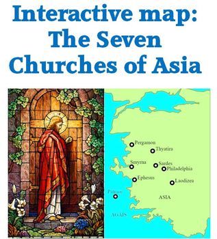
Interactive map of churches in Revelation 2 & 3
Interactive map of the 7 churches named in Revelations 2 and 3.
Mouse over the red triangle next to the circle locating the city and the corresponding scripture reference will pop up.
Mouse over the red triangle at the end of a city name for historical and modern information about that city.
Check out other geography and free products
World Geography: Human Impact Power Pont
Map of Paul's journeys freebie
Andean Mountain Geography 53 slide Power Point
Regions of the U. S. 63 slide Power Point
Subjects:
Grades:
4th - 12th, Adult Education
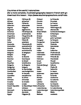
List of Countries / Nationalites in English & French
A handy excel file to use as a reference tool when looking up the correct spelling of a country in English / French and the corresponding nationality.
Grades:
7th - 12th, Adult Education, Staff
Showing 1-20 of 20 results


