16 results
4th grade geography outlines for Microsoft PowerPoint
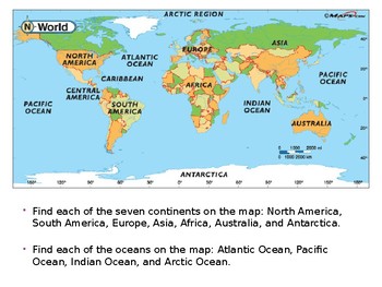
Geography Skills - How To Assess and Understand Maps
Geography Skills - How To Assess and Understand Maps
Teach how to read and understand maps. Do you know what a legend is? What is scale on a map? How are colors used to differentiate various aspects of maps? What are different types of maps? This quick presentation will introduce you to all the elements of maps.
Grades:
4th - 12th, Higher Education, Adult Education, Staff
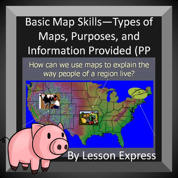
Basic Map Skills -- Types, Purposes, and Information Provided (PP + Notes)
In this Basic Map Skills students will learn about different types of maps, different features of the maps, how the maps are helpful and what maps tell us about the area and the people who live there. This is a great topic to teach to any social studies class and this PowerPoint and Modified notes (for the students) will help you do that.
This is intended for middle school or younger social studies students
Hey! you might like my other geography + map PowerPoint product How Landforms and Clima
Grades:
3rd - 10th

How Landforms and Climate Affect Civilizations -- PowerPoint and Notes
How Landforms and Climate Affect Civilizations engages students and asks them to look at the various ways land and the environment can affect people and civilizations. How can topography and climate affect cultures? To go along with the PowerPoint is modified notes for the students to fill in and review questions that go along with the PowerPoint.
This product was used for 7th grade social studies class but can be used for other grades as well
Grades:
4th - 12th
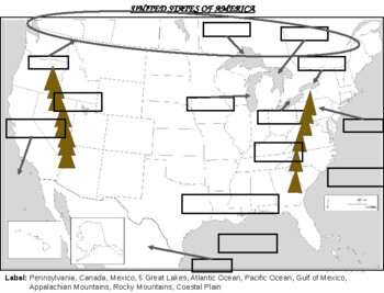
United States of America Major Waterways and Landforms
Interactive Map (printable or electronic manipulative) for students to identify major bodies of water, landforms, and countries surrounding the United States of America. Students will need access to a physical map of the United States.
Grades:
3rd - 12th
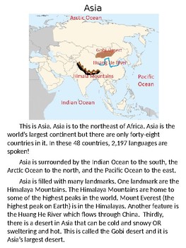
Asia Passage + Guided Notetaking + Map (SOL 3.6)
***BUY THE WHOLE GEOGRAPHY BUNDLE HERE**********************************************************
This includes:
- a passage about Asia (small or large)
- a fillable map of Asia (small or large)
- guided notes that go along with the passage (small or large)
- a completed map of Asia (small or large)
How I use it:
Day 1
1. Map: Students look in an atlas to locate all the required parts of the map
2. I show them where to draw each part of the map (rivers, oceans, etc)
Day 2
3. The students work
Subjects:
Grades:
2nd - 12th, Adult Education
Types:
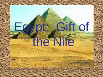
Egypt-The Gift of the Nile (Slideshow)
Egypt Slide Show: Use this slide show to show pictures (and maps) and give a an overview of important places, concepts, ideas about Ancient Egyptians.
Grades:
4th - 8th
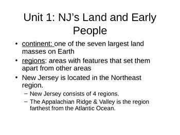
Unit 1 New Jersey Notes Harcourt Series
Notes for Unit 1: NJ Land & Early People. These notes line up exactly to the test questions for the end of the Unit. This is to be used as a study guide and a review for the test.
Subjects:
Grades:
3rd - 5th
Geography Subject Slide Powerpoint _ Google Slides - Chalkboard Theme
Use this as a PowerPoint or upload to Google Slides to use in your Google Classroom.
Subjects:
Grades:
PreK - 12th, Staff
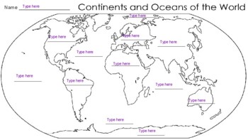
Label Continents and Oceans of the World (Type able)
Typeable - Label the Continents and Oceans of the World! Great to upload to Google Classroom and make a copy for each student to type into!
Subjects:
Grades:
3rd - 12th
Types:
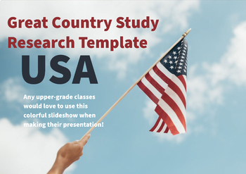
USA country research template! PPT
A great resource for country studies! Great Layout for students!
Subjects:
Grades:
3rd - 8th
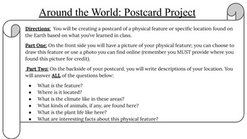
Places Around the World: Postcard Project
A fun way for students to teach one another abut different places around the world. This project gives students the directions of what to do and then present their final project. You can assign locations for students to study and share or they can have that choice. This can also be done by focusing on Earth's Physical Features. This can be edited for your grade level and student expectation. A fun way to introduce or conclude learning about different features on our planet!
Subjects:
Grades:
3rd - 7th
Types:

Design a Map Project
Design A Map Project! Needs some introduction to what are maps and parts of maps (keys, scales, compass rose, etc.). Students are given guidelines and an example to dream cup their own neighborhood or town! I let my students make as creative of a town as possible! We had cities based on candies, towns of fast food places, and even mini kingdoms where they had everything named after themselves!
Subjects:
Grades:
3rd - 8th
Regions PowerPoint Lesson
-PowerPoint or Google Slides lesson outline for teaching regions.
-Applies to the following Michigan Social Studies standards on regions:
K – G2.0.1 Identify and describe places in the immediate environment (e.g., classroom, home, playground).
1 – G2.0.2 Describe the unifying characteristics and/or boundaries of different school regions (e.g., playground, reading corner, library, restroom).
3 – G2.0.1 Use a variety of visual materials and data sources to describe ways in which Michigan can be
Subjects:
Grades:
K - 4th

Label South America
Interactive Map to Label South America (countries, bodies of water, and geographic features. Students need both a political map and physical map of South America to be successful with this learning activity!
Grades:
4th - 12th
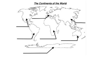
Label the Continents of the World
Label the 7 continents of the world!
Subjects:
Grades:
3rd - 8th
Types:
Social Studies World History
This power point is fun, inventive and interesting to students. You can use this in your classroom as a slide presentation to end the class with a fun ten minute learning session, or you can use this in an online classroom as your slides for your class. Shorten your lesson planning time and use this for half or all of your class period. If you can talk a lot this could be used for a whole class session. Have fun with it guys!
Grades:
3rd - 12th
Showing 1-16 of 16 results


