411 results
Middle school geography resources for Montessori under $5
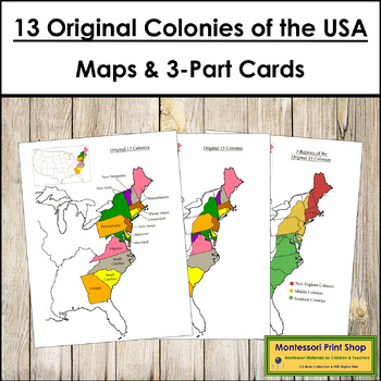
13 Original Colonies of the United States Maps, 3-Part Cards & Information
13 Original Colonies of the United States Maps & Information -Includes the following maps of the 13 original colonies of the USA as the states are divided today. The color maps are colored using the traditional Montessori map colors.Includes:1 black and white blank map1 black and white labeled map1 colored blank map1 colored and labeled map3 regions of the 13 colonies (includes maps for each of the 3 regions)It also includes the following maps of the 13 original colonies of the USA as the st
Grades:
3rd - 6th
Types:
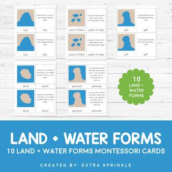
Land and Water Forms Montessori Cards
Check out my other MONTESSORI CARDSDear Educator,Thank you for purchasing the Land and Water Forms Montessori Cards. This set of nomenclature cards is an engaging way to teach your children about the various land and water forms.Included in this packet you will find 10 land and water forms represented:- bay- cape- gulf- peninsula- strait- isthmus- systems of lakes- archipelago- lake- islandFor each type or land and water form, there are TWO types of Montessori nomenclature cards. One card featur
Subjects:
Grades:
2nd - 6th
Types:
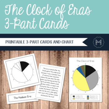
The Clock of Eras 3-Part Cards
Time can be an incredibly abstract topic for children to really grasp. For this reason, many Montessori cultural materials begin with an impressionistic lesson involving a timeline. Whether the students are creating a timeline of their own lives or diving into a study of the history of writing, a physical representation can make the abstract far more concrete.The Clock of Eras work is introduced after the First Great Lesson has been presented. The children have started their independent research
Grades:
2nd - 6th
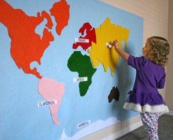
World Continent Map - Interactive on Felt or Paper, 3x5 ft.
Make an interactive 3 ft by 5 ft map on felt or paper.
File includes full 3x5' image, as well as tiles to print on 11x17" paper. Print right on colored paper, or on white paper as template to create felt map. Continents are colored for Montessori.
Not a DIYer? Buy the product and skip the template: https://www.etsy.com/listing/217193390/felt-map-of-world-continents-kid-baby
Pairs well with this spinning wheel and worksheet:
https://www.teacherspayteachers.com/Product/Montessori-Continents-Sp
Subjects:
Grades:
PreK - 6th
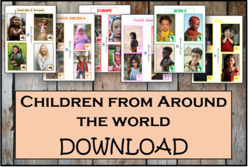
Children From Around The World - Montessori
As children work with these cards, they'll discover fascinating details about the lives and histories of people around the world. These Montessori-inspired children around the world cards will be a good fit to any classroom.This Montessori material is a part of peace education. The material consists of series of cards showing children of different nations, nationalities and races around the world. Each card contains a small map of the continent. There are 54 cards in the Download.
Subjects:
Grades:
PreK - 12th, Higher Education, Adult Education, Staff
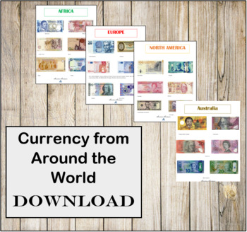
Currency from Around the World- Instant Download- Montessori
CURRENCY FROM AROUND THE WORLD INSTANT DOWNLOAD.There are 6 individual high resolution photos of different banknotes for countries around the world! This is a great addition to any Continent bag or Continent box. These photos are in regulations with the Department of Treasury for printing.
Subjects:
Grades:
PreK - 12th, Higher Education, Adult Education, Staff
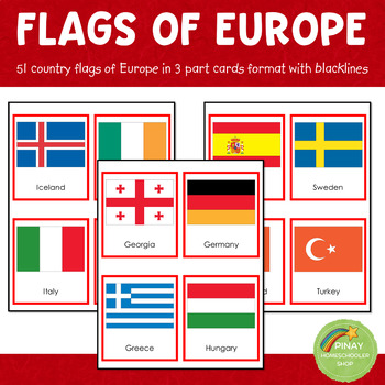
Montessori European Flags in 3 Part Cards and Blackline Masters
MONTESSORI EUROPE FLAGS 3 PART CARDSThis file contains 51 flags of Europe in red-bordered and no-bordered sets. This pack includes the following: ➥ 51 (3-part-card flags) with no border ➥ 51 (3-part-card flags) with red border ➥ 51 blackline master for coloring activities ➥ instruction on how to use the material⭐THIS IS PART OF A BUNDLE⭐This is part of the EUROPE IN A NUTSHELL learning pack. Please don't purchase if you own already own the said learning pack.NOTE: The flag set includes Euroa
Grades:
PreK - 12th
Types:
Also included in: Montessori Country Flags Bundle - COMPLETE
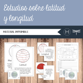
SPANISH - Estudios sobre latitud y longitud
El estudio de la geografía ayuda a inculcar una mayor comprensión y apreciación de las complejidades y la belleza del mundo físico que nos rodea. Estas tarjetas de nomenclatura introducen al niño(a) a los siguientes términos:• Latitud• Longitud• Meridiano cero• Ecuador• Hemisferio norte• Hemisferio sur• Hemisferio Oriental• Hemisferio OccidentalContenidoPágs. 2-5: Latitud y longitud – Tarjetas de 3 partesPágs. 6-7: Latitud y longitud – Tarjetas de 3 partes - ControlPágs. 8-15: Posters de latitud
Subjects:
Grades:
3rd - 6th
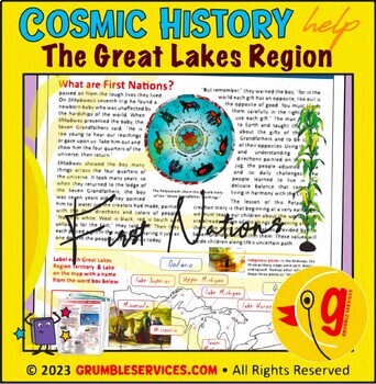
First Nations: Great Lakes Native American Tribes, Midwest Region Social Studies
First Nations: Great Lakes Native American Tribes, Midwest Region Social Studies • Potawatomi, Ho-Chunk, Menominee Tribes • SEMiPRO Elementary Montessori-inspired History & Geography help (5 printable pages + key): Who were the Menominee, Ho-Chunk and Potawatomi Indigenous Peoples? This learning resource will help guide young historians to:Learn who the Indigenous Menominee & Ho-Chunk Nations are and where they have livedFollow the journey of the Potawatomi along the Great Lakes and conn
Grades:
4th - 6th
Types:
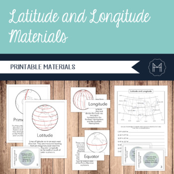
Latitude and Longitude 3-Part Cards, Posters, and Task Cards
The study of geography helps to instill a greater understanding and appreciation for the intricacies and beauty of the physical world around us. These nomenclature cards introduce the child to the following terms:•Latitude•Longitude•Prime Meridian•Equator•Northern Hemisphere•Southern Hemisphere•Eastern Hemisphere•Western HemisphereContentsPgs. 2-5: Latitude and Longitude 3-Part CardsPgs. 6-7: Latitude and Longitude 3-Part Cards ControlPgs. 8-15: Latitude and Longitude PostersPgs. 16-17: How to I
Subjects:
Grades:
3rd - 6th
Also included in: Imaginary Island Curriculum and Materials Bundle!
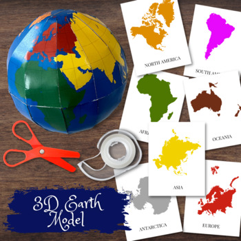
3D Earth Globe Model w/Montessori Colored Continents & Flashcards
Create a 3D Paper model of the earth with detailed outlines of the continents in Montessori colors. Exclusive design!! Comes with detailed instructions how to put the pieces together as well as flashcards to pair with the individual continents. Great activity to pair with both study of the continents as well as learning about space.
Subjects:
Grades:
PreK - 8th
Types:
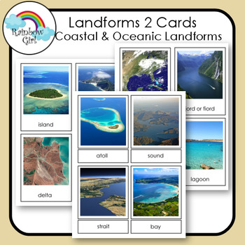
Landforms 2 Cards - Coastal & Oceanic Landforms
There are 20 Coastal & Oceanic Landform cards in this set. They include - island, peninsula, delta, beach, cove, cape, archipelago, isthmus, atoll, sound, strait, bay, gulf, fjord/fiord, estuary, lagoon, tidal pool, coral reef, sea cliff, sea cave.Be sure to check my other landform cards: Landforms 1Landforms 3 - Volcanic Landforms1. Print and use as flash cards / control cards.2. Print out cards and cut the word from the picture and use for matching word to picture.3. Print two sets and u
Subjects:
Grades:
K - 10th
Also included in: Landforms Bundle
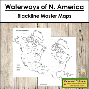
Waterways of North America Maps - Blackline Masters
Waterways of North America Maps -Includes the major waterways of North America:1 map with waterways and labels1 map with waterways1 blank mapMaps print on 8½ x 11" paper.The pin flags that accompany these maps can be found here.The color-coded pin flags that accompany these maps can be found here.You may be interested in the following:North America Control Maps and MastersNorth American Capital Cities Map
Subjects:
Grades:
3rd - 6th
Types:
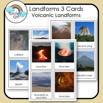
Volcanoes & Volcanic Landforms
There are 16 Volcanic Landform in this set. They include - caldera, crater lake, geyser, lava dome, lava flow, lava lake, lava plain/lava field, lava tube, fissure vent, volcanic plug, volcanic crater, volcanic cone, stratovolcano/composite volcano, shield, volcano, cinder cone volcano, volcano.Be sure to check my other landform cards: Landforms 1Landforms 2 - Coastal & Oceanic Landforms1. Print and use as flash cards / control cards.2. Print out cards and cut the word from the picture and u
Subjects:
Grades:
1st - 10th
Also included in: Landforms Bundle
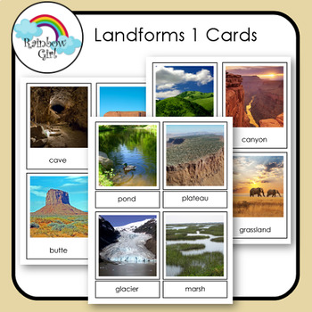
Landforms 1 Cards
There are 24 landform cards in this set. They include - desert, mountain, valley, plain, hills, canyon, forest, grassland, cave, mesa, butte, cliff, dune, oasis, river, lake, pond, plateau, glacier, marsh, swamp, creek/stream, waterfall, rapids.Be sure to check my other landform cards: Landforms 2 - Coastal & Oceanic LandformsLandforms 3 - Volcanic Landforms1. Print and use as flash cards / control cards.2. Print out cards and cut the word from the picture and use for matching word to pictu
Subjects:
Grades:
K - 10th
Also included in: Landforms Bundle
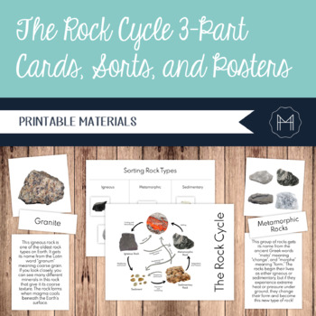
The Rock Cycle 3-Part Cards, Sorts, and Posters
ContentsPgs. 2-7: Rock Specimens 3-Part CardsPgs. 8-9: Rock Types and Rock Cycle 3-Part CardsPgs. 10-13: Rock Types ControlPgs. 14-16: Rock Types Sort MaterialsPgs. 17-19: Rock Cycle Sort Materials Pg. 20: Terms of Use3-Part Card Terms:-Obsidian-Granite -Pumice-Basalt-Slate-Marble-Gneiss-Quartzite-Shale-Conglomerate-Sandstone-Limestone-Igneous Rocks-Metamorphic Rocks-Sedimentary Rocks-The Rock CycleThe Lexile levels for these materials range from 880-1100.I recommend printing the 3-Part Cards, C
Subjects:
Grades:
3rd - 6th
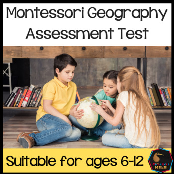
Montessori Geography Test for assessment
Montessori Geography Test. 2 tests for 6-12 Montessori students to assess knowledge of cultural geography and physical geography. This test can be given to fluent readers in a 6-9 Montessori class.It will help you quickly assess next learning steps and lessons. There are 2 tests, cultural geography and physical geography. In total 11 pages. (2 Marking rubrics are also included 3 pages in total) I have done these tests with my class. It takes between 20min to 1 hour per test dependent on child.
Grades:
2nd - 6th
Types:
Also included in: Montessori Elementary Test assessment Bundle
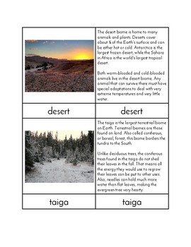
Biomes of the World - Three/Four Part Cards
This PDF can be used to make a set of three/four part cards that students can use to learn about eight different biomes of the world. For each Biome there is a control card (picture and word), a picture card, a word card, and an information card. Biomes included are Biomes (General overview of biomes), Wetland, Ocean, Tundra, Taiga, Deciduous Forest, Rainforest, Desert, and Grassland. Cards should be printed onto card stock, cut, and laminated prior to classroom use.
Check out my Etsy shop Mind
Subjects:
Grades:
K - 6th
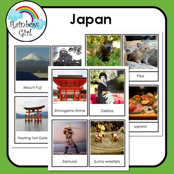
Japan
This product is in the Countries of the World Growing BundleThere are 28 Japan cards in this set. They include:General - map, flag, Tokyo, cherry blossoms.Landmarks - Mount Fuji, Floating Torii gate, Hiroshima peace memeorial, Golden Pavilion, Himeji castle, Matsumoto castle, Todaiji temple, Tokyo Imperial Palace, Shimogamo shrine.Cultural - Geisha, Samurai, Sumo wrestlers, ninja, karate, kimono, origami, bonsai tree.Food - sushi, sashimi.Animals - koi fish, red-crowned crane, Japanese Macaque (
Subjects:
Grades:
K - 6th
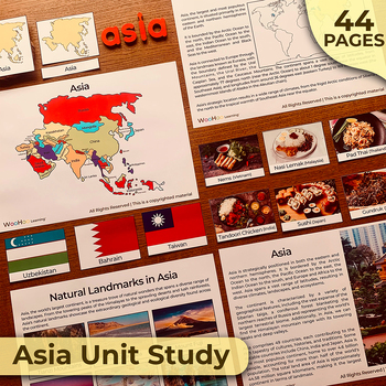
Asia Unit Study, Asia Activity Bundle, Asia Continent Montessori Unit Study
Asia Unit Study Activity BundleThis digital file contains 44 pages and includes the following activities:• Continents → Continents description → Continents cards (3-part cards) → World Map• Asia → Asia Description → Asia Maps → Asia Languages → Asia Important Cities → Asia Natural Landmarks → Asia Manmade Landmarks → 3-part cards: natural landmarks, manmade landmarks, typical food, flags and animals• IMPORTANT INFORMATION: This is a digital download, and n
Grades:
K - 6th
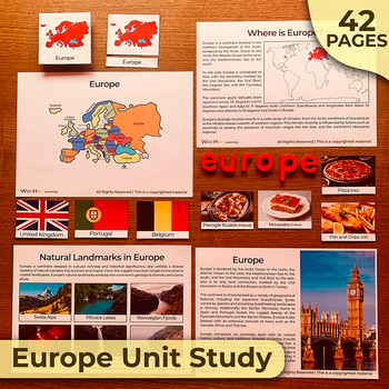
Europe Unit Study, Europe Activity Bundle, Europe Continent Montessori Unit
Europe Unit Study Activity BundleThis digital file contains 42 pages and includes the following activities:• Continents → Continents description → Continents cards (3-part cards) → World Map• Europe → Europe Description → Europe Maps → Europe Languages → Europe Important Cities → Europe Natural Landmarks → Europe Manmade Landmarks → 3-part cards: natural landmarks, manmade landmarks, typical food, flags and animals• IMPORTANT INFORMATION: This is a digital
Grades:
K - 6th
Types:
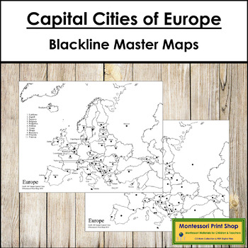
Capital Cities of Europe Maps - Blackline Masters
Capital Cities of Europe Maps (blackline masters) - Label the capital cities on the blank map and then check the accuracy using the labeled map.Includes the following maps:1 black & white map of Europe with capital city dots1 black & white map of Europe with labels and capital city dotsThe pin flags that accompany these maps can be found here.The color-coded pin flags that accompany these maps can be found here.You may be interested in the following:Europe Control Maps and MastersEuropea
Subjects:
Grades:
4th - 7th
Types:
Also included in: Montessori Maps Of The World Bundle - World Geography
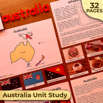
Australia Unit Study, Australia Activity Bundle, Australia Continent Montessori
Australia Unit Study Activity BundleThis digital file contains 34 pages and includes the following activities:• Continents → Continents description → Continents cards (3-part cards) → World Map• Australia → Australia Description → Australia Maps → Australia Languages → Australia Important Cities → Australia Natural Landmarks → Australia Manmade Landmarks → 3-part cards: natural landmarks, manmade landmarks, typical food, flags and animals• IMPORTANT INFORM
Grades:
K - 6th
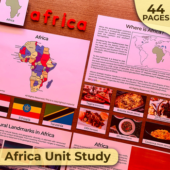
Africa Unit Study, Africa Activity Bundle, Africa Continent Montessori Unit
Africa Unit Study Activity BundleThis digital file contains 44 pages and includes the following activities:• Continents → Continents description → Continents cards (3-part cards) → World Map• Africa → Africa Description → Africa Maps → Africa Languages → Africa Important Cities → Africa Natural Landmarks → Africa Manmade Landmarks → 3-part cards: natural landmarks, manmade landmarks, typical food, flags and animals• IMPORTANT INFORMATION: This is a digital
Grades:
K - 6th
Showing 1-24 of 411 results


