TPT
Total:
$0.00
Selected
Grades
Formats
Types

Subjects

Arts & Music
English Language Arts
Foreign Language
Holidays/Seasonal
Math
Science
Social Studies - History
Specialty
For All Subject Areas
95 results

12th grade ancient history poster images
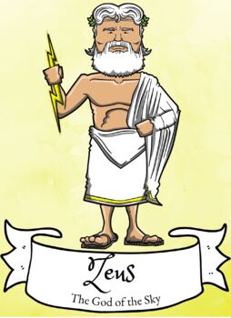
Preview of Greek Gods/Goddesses Posters- Color & Black and White
Greek Gods/Goddesses Posters- Color & Black and White

Created by
Rachel Spotz
These classroom posters are intended to assist students, including those who are ESL/ELL/Students with disabilities, identify different Greek Gods and Goddesses.These printables include an illustration of the God or Goddess, their name, and what they are known for. ***************************************************************************************************Teacher Tips-Print-Laminate-Spray with a matte clear coat-Display**********************************************************************
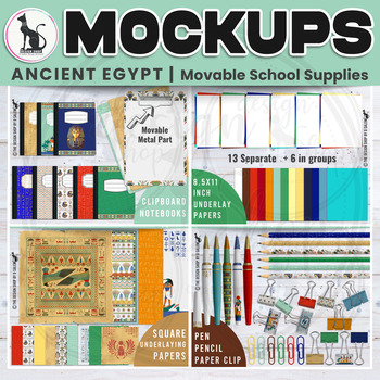
Preview of Ancient Egypt Movable Mockup School Supplies and Digital Underlaying Papers Set1
Ancient Egypt Movable Mockup School Supplies and Digital Underlaying Papers Set1

Ancient Egypt Theme Mock-ups with +100 Movable Elements, to help you create your thumbnails, covers, preview, social media posts,...SAVE your TIME with this set it is Easy to Use, Realistic, Practical, and Flexible.*************************************************About This Product: (Please check out preview section)* Product Line: Subjects Mock-ups | Around the World | Ancient History* Color Theme: Ancient Egypt color palette.* This Set: Ancient Egypt Mockup Scene Creator | School Supplies* Res
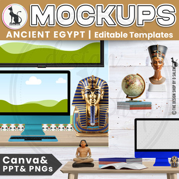
Preview of Ancient Egypt Mockup Desk and Smartboard Editable Templates Canva PowerPoint PNG

Ancient Egypt Mockup Desk and Smartboard Editable Templates Canva PowerPoint PNG

Ancient Egypt Theme Mock-ups Editable Canva & PowerPoint Templates with MOVABLE ELEMENTS to give you UNLIMITED POSSIBILITIES of scenes and keep your design UNIQUE. You can change the dimensions easily to create PINS & PREVIEWS. SAVE your TIME with this set it is Easy to Use, Realistic, Practical, and Flexible.*************************************************About This Product: (Please check out preview section)* Product Line: Subjects Mock-ups | Around the World | Ancient History* Color
Preview of World History Timeline – Five Thousand Years of Empires and Civilizations
World History Timeline – Five Thousand Years of Empires and Civilizations

What is it?A large and detailed timeline map outlining major civilizations and empires throughout history. It covers a period starting from 3000 BC (Ancient Egypt and Sumer Civilizations) until 2018 . What is included?· 45 empires, countries and civilizations· 7 wonders of the ancient world· 100 important wars and battles· 300 rulers – kings, queens, emperors, shah’s, presidents and legendary figures· 100 geniuses who changed the world (writers, inventors, scientists, philosophers)· 50 of the mo
Preview of SOCIAL STUDIES Coloring Doodle Page | US HISTORY Coloring Page | Binder Cover
SOCIAL STUDIES Coloring Doodle Page | US HISTORY Coloring Page | Binder Cover

Created by
STEAM Kid Club
Students will love this SOCIAL STUDIES or HISTORY coloring page binder cover for their Social Studies class! Color with crayons, markers, and pens etc. to personalize it. Use it as a divider for your students' journals, a coloring page, or as a label for your centers!This SOCIAL STUDIES or HISTORY Coloring Page is an instant download for you to edit and print. This file is a one-page PDF sized 8.5 x 11. No physical product will be sent. If you would prefer a landscaped orientation of this notebo
Preview of Wanderings of Aeneas Map

Wanderings of Aeneas Map

Created by
Ed DeHoratius
A map of Aeneas' wanderings through the Mediterranean from Troy to Italy as described by Vergil / Virgil in his Aeneid. All images carry the Creative Commons Attribution-NonCommercial-ShareAlike 4.0 International License. That means that, upon the purchase of these images, you are free to share them, i.e. copy and redistribute the material in any medium or format or adapt them, i.e. remix, transform, and build upon them. But this sharing and adapting cannot be applied to any commercial use of t
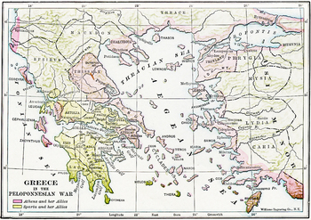
Preview of Map of Ancient Greece during the Peloponnesian Wars
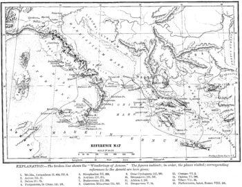
Map of Ancient Greece during the Peloponnesian Wars

Created by
Ed DeHoratius
A detailed map in color of ancient Greece and the Ionian Peninsula (Turkey) during the Peloponnesian Wars, detailing which cities were allied with Athens and which with Sparta. A high quality .jpg, 600 dpi, and at least 10" x 10" in size, which makes it suitable for printing as well as projecting (unlike many images available on the net). All images carry the Creative Commons Attribution-NonCommercial-ShareAlike 4.0 International License. That means that, upon the purchase of these images, you
Preview of Map of Charlemagne's Empire

Map of Charlemagne's Empire

Created by
Ed DeHoratius
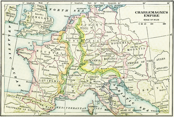
A map of Charlemagne's Empire. The first Holy Roman Emperor, crowned by the Pope in 800, Charlemagne united Europe during a mini-Renaissance, spearheaded by his court scholar Einhard. A high quality .jpg, 600 dpi, and at least 10" x 10" in size, which makes it suitable for printing as well as projecting (unlike many images available on the net). All images carry the Creative Commons Attribution-NonCommercial-ShareAlike 4.0 International License. That means that, upon the purchase of these image
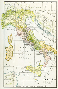
Preview of Color Map of Ancient Italy

Color Map of Ancient Italy

Created by
Ed DeHoratius
A color map of Ancient Italy with labels in Latin and Rome labeled prominently. A high quality .jpg, 600 dpi, and at least 10" x 10" in size, which makes it suitable for printing as well as projecting (unlike many images available on the net). All images carry the Creative Commons Attribution-NonCommercial-ShareAlike 4.0 International License. That means that, upon the purchase of these images, you are free to share them, i.e. copy and redistribute the material in any medium or format or adapt
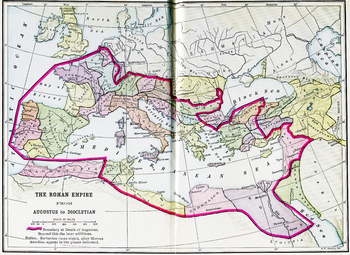
Preview of Color Map of the Roman Empire from Augustus to Diocletian
Color Map of the Roman Empire from Augustus to Diocletian

Created by
Ed DeHoratius
A color map of the Mediterranean with the border of the Roman Empire during both Augustus' and Diocletian's reign is clearly delineated. A high quality .jpg, 600 dpi, and at least 10" x 10" in size, which makes it suitable for printing as well as projecting (unlike many images available on the net). All images carry the Creative Commons Attribution-NonCommercial-ShareAlike 4.0 International License. That means that, upon the purchase of these images, you are free to share them, i.e. copy and re
Preview of Earliest Civilizations Map

Earliest Civilizations Map

Created by
Ed DeHoratius
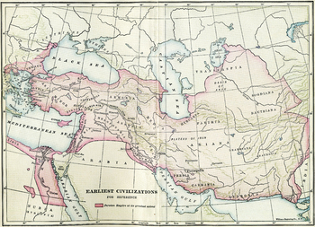
A map of the Near East, showing the earliest civilizations of the west, with the Persian Empire highlighted. Bactria, Assyria, Mesopotamia, and others are shown. A high quality .jpg, 600 dpi, and at least 10" x 10" in size, which makes it suitable for printing as well as projecting (unlike many images available on the net). All images carry the Creative Commons Attribution-NonCommercial-ShareAlike 4.0 International License. That means that, upon the purchase of these images, you are free to sha
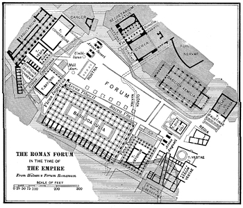
Preview of Roman Forum in the Time of the Empire Plan
Roman Forum in the Time of the Empire Plan

Created by
Ed DeHoratius
A detailed plan of the Roman Forum during the Empire, including in it the Basilica Julia, the Rostra, the Basilica Aemilia, the Curia, and the temples at the northwestern corner, among others. A high quality .jpg, 600 dpi, and at least 10" x 10" in size, which makes it suitable for printing as well as projecting (unlike many images available on the net). All images carry the Creative Commons Attribution-NonCommercial-ShareAlike 4.0 International License. That means that, upon the purchase of th
Preview of Grapes Poster- G.R.A.P.E.S Social Studies
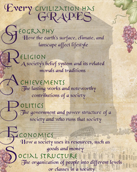
Grapes Poster- G.R.A.P.E.S Social Studies

This is an 8x10 print of "GRAPES". A perfect addition to any Social Studies classroom!
Preview of Map of Ancient Greece

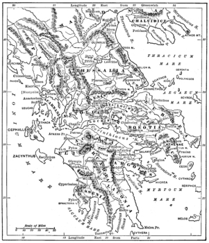
Map of Ancient Greece

Created by
Ed DeHoratius
A detailed map of ancient Greece. A high quality .jpg, 600 dpi, and at least 10" x 10" in size, which makes it suitable for printing as well as projecting (unlike many images available on the net). All images carry the Creative Commons Attribution-NonCommercial-ShareAlike 4.0 International License. That means that, upon the purchase of these images, you are free to share them, i.e. copy and redistribute the material in any medium or format or adapt them, i.e. remix, transform, and build upon th
Preview of Civilizations of Crete and Mycenae Map
Civilizations of Crete and Mycenae Map

Created by
Ed DeHoratius
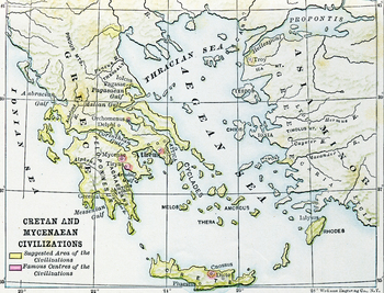
A map of the ancient Aegean, highlighting the Mycenean and Minoan civilizations, centered at Mycenae and Crete, home of Agamemnon, Minos, the Minotaur, Daedalus, etc.. A high quality .jpg, 600 dpi, and at least 10" x 10" in size, which makes it suitable for printing as well as projecting (unlike many images available on the net). All images carry the Creative Commons Attribution-NonCommercial-ShareAlike 4.0 International License. That means that, upon the purchase of these images, you are free
Preview of Plan of ancient Athens' Acropolis

Plan of ancient Athens' Acropolis

Created by
Ed DeHoratius
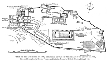
A plan of ancient Athens' acropolis, including the Parthenon, the Erectheum, the Propylea, and the museum. All images carry the Creative Commons Attribution-NonCommercial-ShareAlike 4.0 International License. That means that, upon the purchase of these images, you are free to share them, i.e. copy and redistribute the material in any medium or format or adapt them, i.e. remix, transform, and build upon them. But this sharing and adapting cannot be applied to any commercial use of the images. F
Preview of Map / Plan of Ancient Alexandria

Map / Plan of Ancient Alexandria

Created by
Ed DeHoratius
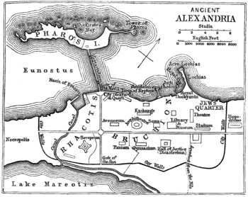
A map of the ancient Egyptian city of Alexandria, home to the most famous library in the ancient world. A high quality .jpg, 600 dpi, and at least 10" x 10" in size, which makes it suitable for printing as well as projecting (unlike many images available on the net). All images carry the Creative Commons Attribution-NonCommercial-ShareAlike 4.0 International License. That means that, upon the purchase of these images, you are free to share them, i.e. copy and redistribute the material in any me
Preview of A Keyed Map of Ancient Rome during the Time of the Emperors
A Keyed Map of Ancient Rome during the Time of the Emperors

Created by
Ed DeHoratius
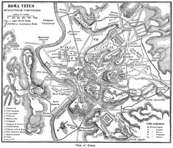
A detailed map of Imperial Rome, with 18 buildings identified by key, and the regions of the ancient city identified. A high quality .jpg, 600 dpi, and at least 10" x 10" in size, which makes it suitable for printing as well as projecting (unlike many images available on the net).All images carry the Creative Commons Attribution-NonCommercial-ShareAlike 4.0 International License. That means that, upon the purchase of these images, you are free to share them, i.e. copy and redistribute the materi
Preview of Map of the Empire of Alexander the Great
Map of the Empire of Alexander the Great

Created by
Ed DeHoratius
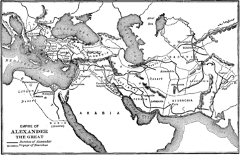
A map showing the extent of Alexander the Great's empire at its height, from Greece in the West to Persia and India in the West. A high quality .jpg, 600 dpi, and at least 10" x 10" in size, which makes it suitable for printing as well as projecting (unlike many images available on the net). All images carry the Creative Commons Attribution-NonCommercial-ShareAlike 4.0 International License. That means that, upon the purchase of these images, you are free to share them, i.e. copy and redistribu
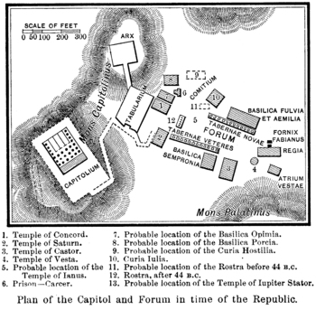
Preview of Plan of the Roman Forum and Capitoline during the Republic
Plan of the Roman Forum and Capitoline during the Republic

Created by
Ed DeHoratius
A plan of the early Roman Forum as well as the Capitoline hill with the probable locations of various structures identified. A high quality .jpg, 600 dpi, and at least 10" x 10" in size, which makes it suitable for printing as well as projecting (unlike many images available on the net). All images carry the Creative Commons Attribution-NonCommercial-ShareAlike 4.0 International License. That means that, upon the purchase of these images, you are free to share them, i.e. copy and redistribute t
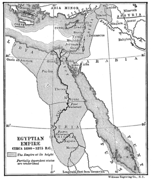
Preview of Map of the Egyptian Empire

Map of the Egyptian Empire

Created by
Ed DeHoratius
A map of the Egyptian Empire, c.1000 BCE, focusing on the Nile and the Nile Delta. Location of the pharoahs, pyramids and mummies, Egypt was one of the most dominant empires of the Mediterranean. A high quality .jpg, 600 dpi, and at least 10" x 10" in size, which makes it suitable for printing as well as projecting (unlike many images available on the net). All images carry the Creative Commons Attribution-NonCommercial-ShareAlike 4.0 International License. That means that, upon the purchase of
Preview of Reconstruction of the Basilica of Constantine
Reconstruction of the Basilica of Constantine

Created by
Ed DeHoratius
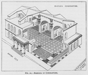
High quality, print-quality, drawing of a cutaway reconstruction of the Basilica of Constantine with the Sacra Via and the Temple of Venus and Rome identified as well. All images carry the Creative Commons Attribution-NonCommercial-ShareAlike 4.0 International License. That means that, upon the purchase of these images, you are free to share them, i.e. copy and redistribute the material in any medium or format or adapt them, i.e. remix, transform, and build upon them. But this sharing and adapt
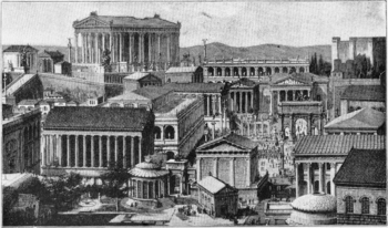
Preview of Reconstruction of the Roman Forum

Reconstruction of the Roman Forum

Created by
Ed DeHoratius
A reconstruction of Rome's forum, looking toward the Capitoline with the Temple of Vesta in the foreground. A high quality .jpg, 600 dpi, and at least 10" x 10" in size, which makes it suitable for printing as well as projecting (unlike many images available on the net). All images carry the Creative Commons Attribution-NonCommercial-ShareAlike 4.0 International License. That means that, upon the purchase of these images, you are free to share them, i.e. copy and redistribute the material in an
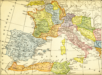
Preview of Color Map of the Roman Empire's Western Provinces

Color Map of the Roman Empire's Western Provinces

Created by
Ed DeHoratius
A color map of the Western Mediterranean with Spain at its leftmost border and the western coast of Greece at its rightmost, delineating the provinces of the Western Roman Empire. A high quality .jpg, 600 dpi, and at least 10" x 10" in size, which makes it suitable for printing as well as projecting (unlike many images available on the net). All images carry the Creative Commons Attribution-NonCommercial-ShareAlike 4.0 International License. That means that, upon the purchase of these images, y
Showing 1-24 of 95 results

Find Ancient History resources | TPT

If you’re an educator or parent looking for printable or digital resources to help your student learn about ancient history, TPT has got you covered. We’ve got a comprehensive collection of ancient history resources available, including activities and lessons on ancient Egypt, ancient Greece, ancient Rome, ancient China, and ancient Mesopotamia, to name just a few. With plenty of TPT high-quality resources at your fingertips, you’ll be able to teach ancient history to your students with ease.

Ancient history activities to try

Here are a few examples of the different types of activities and lessons you can find on TPT to help teach students about ancient history:

Map Making

With map-making activities you can not only teach students about ancient civilizations, but also incorporate geography into your lessons. As they label and color maps, students can learn about important places in ancient civilizations, chart trade routes, and learn how empires expanded (and fell) over time.

Primary Source Analysis

One of the best ways to learn about ancient civilizations is through the artifacts and writings of people from that particular period of time. Encourage students to analyze primary sources to gain a deeper understanding about bygone eras of history. For instance, you can have students read accounts of the destruction of Pompeii and discuss it as a class.

Centers & Stations

Through the use of centers, students can collaborate and discuss topics and content they examine for each era in history. For example, you can have students navigate through four or five different centers or stations to help them learn about different aspects of Ancient Chinese culture, like literature, geography, government, and major historical events or achievements.

By making ancient history come to life through a variety of interactive and immersive activities, teachers can help students develop a deeper appreciation for the subject.

Frequently asked questions for teaching about ancient history

What is ancient history?

Ancient history refers to the period of human history that takes place from the invention of writing to late antiquity (spanning from about 3000 BC to AD 650). This era includes the study of various ancient civilizations, such as Mesopotamia, Egypt, Greece, Rome, China, India, and others. Ancient history plays a critical role in helping us understand the origins and development of human civilizations and the influence it had on contemporary cultures and societies.

What are examples of ancient history?

The Persian Wars, the rise of the Tang Dynasty, the campaigns of Alexander the Great, and the decline and fall of the Roman empire are all examples of important milestones and events that you can teach about in ancient history.

What types of ancient history resources are available on TPT?

There are many different types of ancient history resources sold by Sellers on TPT — from worksheets to interactive notebooks to units.

How do I find ancient history resources on TPT?

Educators can save time preparing ancient history lessons with resources created by experienced teachers. Simply start a search for ancient history resources on the TPT marketplace, and filter by grade level, price, and/or resource type to find materials that've been proven to work in classrooms like yours. No matter what you’re teaching, there are plenty of lessons and activities sold by Sellers on TPT that are tailored to meet your students' skill levels.