
130,000+ results
World history resources under $5


Ancient Greece Geography Map Activity (Print and Digital Resource)
This activity will help students better understand the geography of Greece and its impact on Ancient Greek civilizations. They will label and color the blank map version and then answer a few questions. Alternatively, students can just color on the coloring page version. It's a great way to incorporate geography in your lesson.What's included with the Printed Versions:*Ancient Greece map for students to label, color, and answer 10 questions (1 page map, 1 page directions/questions, uneditable pd
Grades:
6th - 10th
Types:

Country Research Project (Print & Digital)
Send your students on a world-wide tour with this print-and-go Country Research Travel Brochure Project! This fun and engaging project includes everything you need to assign the travel brochure, stay organized, guide the students in their research, and assess the final projectDownload includes:Brochure Sample Country Research Project Instructions“My Country Choices” – 4 per page (give one to each student)Student Country Choices Tracking SheetTravel Brochure Layout DirectionsResearch Log Student
Grades:
4th - 6th
Types:

Ancient Egypt Map Activity (Print and Digital Resource)
Students will learn about important places in the Ancient Egypt civilization as they label and color a map. It's also a great way to incorporate geography in your lesson.What's included with the printed version:Blank Ancient Egypt map for students to label and color (1 page, uneditable pdf)Map Key (1 page, uneditable pdf)Ancient Egypt map for students to just color (1 page, uneditable pdf)Informational Reading (1 page, uneditable pdf) Animated PowerPoint shows each location and the key - perfect
Subjects:
Grades:
6th - 10th
Types:

Ancient China Map Activity Lesson (Print and Digital Resource)
This activity will help students better understand the geography of Ancient China. They will label and color the blank map version and answer a few questions. Alternatively, students can just color on the coloring page version. It's a great way to incorporate geography in your lesson.What's included with the printed versions:*Blank Ancient China map for students to label, color, and answer questions (1 page map, 1 page directions, uneditable pdf)*Blank Ancient China map for students to label, co
Grades:
6th - 10th
Types:

World War 1 Propaganda Analysis Activity
This lesson on WW1 Propaganda has students utilizing higher-level thinking skills to analyze 15 primary source propaganda posters. Everything you need is included for the lesson plan, including a worksheet, 15 full color propaganda posters, and an answer key.The worksheet explains the 5 main objectives of wartime propaganda and has students come up with their own personal definition of propaganda. They then determine the goal of each poster based on the objectives. This provides a framework for
Grades:
7th - 12th
Types:

Vietnam War Station Activity for the Cold War
This engaging lesson for the Vietnam War has students rotate through stations to learn about various aspects of America's War in Vietnam. The 7 different stations cover:The Cu Chi TunnelsVietcong Booby TrapsAgent OrangeHo Chi MinhSongs of the Vietnam WarThe Draft and ProtestsMilitary Deaths in the WarEach station engages different intelligences and learning styles. Students create a graph, listen to music, draw pictures, read, answer questions,and analyze pictures. My students are always engaged
Grades:
5th - 10th
Types:

Ancient Rome to 44 BCE Map Activity (Print and Digital)
Students will label and color a map of Ancient Rome in 44 BC/BCE to better understand the expansion of Roman power. Students will also answer 6 questions about the map. What's Included with the print versions:*Blank map with 6 questions for students to answer (2 pages, BC and BCE versions included, uneditable pdf)*Blank map without questions (1 1/2 pages, BC and BCE versions included, uneditable pdf)*Map for students to just color (1 page, BC and BCE versions included, uneditable pdf)*Answer key
Subjects:
Grades:
6th - 9th
Types:

Latitude and Longitude Fun Activities and Practice Worksheet | Google Slideshow
If you are looking for a creative and no-prep resource to teach about latitude and longitude, look no further! This printable and digital activity includes an editable Google Slideshow to teach your students about latitude and longitude, and three different practice activities, giving your students the chance to decode secret messages, figure out mystery locations on a world map, and determine the coordinates of various US states.This resource goes beyond traditional longitude and latitude works
Grades:
5th - 8th
Types:

World War 2 (World War II) Timeline Activity
This resource includes 2 World War II timeline activities! The Path to World War II Timeline Hunt includes 16 events beginning with the Japanese invasion of Manchuria in 1931 through the declaration of war against Germany by Great Britain and France in 1939. The World War II Timeline Hunt picks up with the signing of the Soviet-Nazi Pact in 1939 and goes through V-J Day in 1945 for a total of 42 events.Your Students Will Love This!In these World War II activities, the teacher scatters and hides
Subjects:
Grades:
6th - 11th
Types:

Mesoamerica (Olmecs, Maya, Aztecs) and Incas Map Activity - print & digital
Students will label and color a map to help them visualize and retain the location of the Olmecs, Maya, Aztecs, and Incas in Mesoamerica and South America. They will also label bodies of water and mountain ranges as well as use the map to answer 5 questions. What's Included with the Printed Map:*Blank map with 5 questions for students to answer (2 pages, uneditable pdf)*Blank map without questions (1 1/2 pages, uneditable pdf)*Map for students to just color (1 page, uneditable pdf)*Answer key fo
Subjects:
Grades:
6th - 9th
Types:

Holocaust Webquest (National Holocaust Museum Website)
Holocaust Webquest:Great for classroom and distance learning.Students will gain basic knowledge about the Holocaust by completing an internet-based worksheet. The Holocaust Webquest uses an amazing website created by United States Holocaust Museum. The website allows students to explore the key events of the Holocaust. The website is:Click here to view the website.The webquest contains 46 questions and is a great way to introduce or have students learn more about the Holocaust. An answer sheet i
Grades:
6th - 12th
Types:
Also included in: Holocaust Webquest Bundle (Sampler Collection)

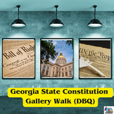
13 Colonies Map and Scavenger Hunt Activity
In this 13 Colonies activity and map scavenger hunt, students complete a gallery walk on the colonization of the 13 American Colonies. Students navigate around the room examining each colony's station to understand the reason behind its founding. Students can work individually or they can create groups and, before they are turned loose, divide up the responsibilities to research the founding of the 13 Colonies and detail the 13 Colonies map. This lesson is a great introduction to the 13 colo
Subjects:
Grades:
5th - 8th
Types:

Ancient Egypt Hieroglyphics Decoding Activity | Digital and Printable Worksheets
Teach your students about hieroglyphics in this engaging, digital and printable Hieroglyphics Activity! In this no-prep activity, students will decode 10 secret phrases and translate them to English. There are also a few slides of background information about hieroglyphics and the Rosetta Stone, in addition to an optional enrichment activity where students create their own secret messages.This Ancient Egypt Hieroglyphics Activity includes:Teacher GuideGoogle Slideshow with Editable Text (ready t
Grades:
5th - 8th
Types:
Also included in: Ancient Egypt Unit Bundle | Activities, Projects, Notes, Timeline, Test

World War 2 Battles Radio Show Project: Pearl Harbor, D-Day, & More
This World War II Battles Radio Show Project is a cooperative learning project that has students read about 7 key battles of World War 2 and create engaging radio news segments just like Americans would have heard in the 1940's!Everything you need to complete this fun, creative lesson about the key battles of World War 2 is included! You will receive:A directions page that explains how the war unfolded for Americans via the radio and what students need to do to create a radio news segment.Seven
Grades:
7th - 11th
Types:

September 11 Attacks - Webquest with Key
September 11 Attacks - Webquest with Key - This 6 page document contains a webquest and teachers key related to the basics of the September 11 attacks in America. It contains 25 questions from the history.com website.
Your students will learn about the history and the significance of the September 11 attacks in the United States. It covers all of the major themes and events of the September 11 attacks. Specifically, your students will learn about the fate of the four planes on September 11, the
Grades:
5th - 11th
Types:

Ancient China Dynasties Activity | Han, Qin, Zhou, Shang, Tang in Ancient China
This engaging activity on Ancient China Dynasties teaches the major contributions of the Shang, Zhou, Qin, Shang, and Tang dynasties in an engaging and informative way. In this China resource, student groups work together to fill out a graphic organizer timeline that shows these major dynasties of Ancient China. This lesson includes student-friendly text for each of the dynasties and a large graphic organizer for their team to record their information! ☆ ☆ Get this engaging resource (and a hug
Grades:
5th - 9th
Types:

Types of Governments Straw Activity Simulation
An interactive simulation to introduce the types of governments to middle-schoolers. Students get to compete with each other in groups to see who can build the best straw tower with straws and tape, but there's a slight catch: each group must build the straw tower how their assigned government would build it. This is guaranteed to be a fun activity that students will love while simultaneously learning about different types of governments!This Types of Governments Straw Activity includes:♦ Instru
Grades:
5th - 8th
Types:

World War I (World War 1) Timeline Activity for U.S. & World History
This resource begins with the assassination of Archduke Ferdinand and ends with the Treaties of Versailles and Sevres. In this World War I activity, the teacher scatters and hides 32 event cards around the room. Students use QR readers to find the dates of the events and record the information on a handout. Then, students place the events in the correct chronological order on a timeline.No QR readers? No problem! A non-QR version is also included!Note: The QR codes were designed for students to
Subjects:
Grades:
6th - 10th
Types:
CCSS:

COLD WAR -BUILD A BOMB SHELTER -The Arms Race - Print & Digital - FUN!
This is a fun and engaging activity when teaching about the arms race during the Cold War. Includes both print and digital versions. Students will begin by reading and watching an informational, 1950s film clip about how to create a bomb shelter and then they will create their own by designing their shelter and listing the items they will bring. Fun!Buyer Feedback:I used this resource as an intro to the Cold War to give my students an engaging first look at that period. They really enjoyed it; e
Grades:
9th - 12th
Types:

Ancient India Map Activity (Indus Civilizations, Maurya & Gupta Empire)
Students will label and color a map to help them visualize and retain the location of the Indus Civilizations, Maurya Empire, and Gupta Empire as well as key geographical features such as the Brahmaputra, Ganges, and Indus Rivers; Eastern and Western Ghats; Himalayas; Hindu Kush, and more. Students will also use the map to answer 5 questions. What's Included with the printed versions:*Blank map with 5 questions for students to answer (2 pages, uneditable pdf)*Blank map without questions (1 1/2 p
Subjects:
Grades:
6th - 9th
Types:
Also included in: Ancient India Bundle

Ancient China Fact Hunt and Doodle Poster about ancient Chinese civilization
Students will learn about ancient China’s geography, religion, achievements, politics, economy, and social structures during this fun activity. First, they’ll rotate around the classroom to find fact cards about ancient China. They’ll transfer critical information from the cards to their poster worksheets. Finally, they’ll glue their work together to make a doodle poster shaped like an ancient Chinese temple. Oh, and they’ll fill their posters with doodles as they complete 5 different doodle tas
Grades:
4th - 7th
Types:

September 11th (9/11) Terrorist Attacks Stations Activity (PDF and Digital)
"We had reached either the 51st or the 50th floor when we heard a huge explosion, which shook the building...the lights were flickering on and off. Then the building began to sink. The floor began to lower under my feet...People began screaming and crying"The intent of this NO PREP primary source lesson is to expose students to a variety of topics in a short amount of time using fun and engaging methods. The resource is available in print and Google Docs formats! Simply print and go for in-class
Grades:
6th - 10th
Types:
CCSS:
Also included in: US History - 1877 to the Present - Station Activities GROWING BUNDLE

MAIN Causes of World War I (WWI) Stations Activity (PDF and Google Docs Formats)
This NO PREP stations activity presents descriptions of the causes of WWI with visually appealing photos, political cartoons, maps, graphs, etc. The resource is available in both PDF and Google Docs formats! This activity will help to increase student growth using an engaging and effective method!Each station of this NO PREP activity contains a description of one of the causes of WWI. After completing this lesson, students will understand how tensions in Europe led to widespread and rapid warf
Grades:
5th - 10th
Types:
Also included in: World War I (WWI) Stations Activity BUNDLE (PDF and Google Docs Formats)

Doodle Style Notes, The Americas, Aztec, Maya & Inca Summary Activity Set
What a fun way to review the geography, religion, achievements, government/leadership, economy and social classes of the Americas! Students complete the Aztec, Maya, and Inca doodle note templates after class notes, reading textbook chapters or informational texts, at the end of the unit, or even after finishing a chapter test (while waiting for students to finish). This activity is a class favorite that is easy to implement. It's great to share and hang in the classroom. This also makes for a
Grades:
5th - 12th
Also included in: Aztec Resources Bundle: Interactive Notebook Independent Work Packet
Showing 1-24 of 130,000+ results

TPT is the largest marketplace for PreK-12 resources, powered by a community of educators.
IXL family of brands