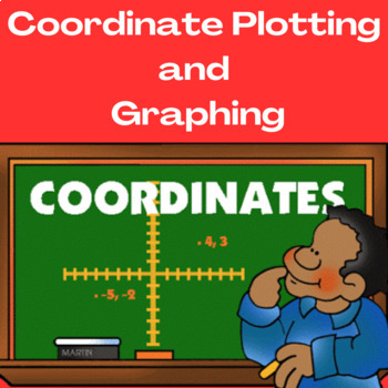
Coordinate Plotting and Graphing (Supports Virtual Learning/Google Classroom)
- Google Drive™ folder
- Easel Assessment

Description
This resource offers interactive teaching and learning opportunities for students everywhere. Options include activities that teach skills/concepts paired with numerous games and activities that practice and reinforce them. Students find immediate feedback while working and learning at their own pace or skill level in non-threatening ways. This resource meets the students' multiple intelligences as students quickly learn challenging concepts of plotting coordinates while having fun.
Materials Provided:
1. Resources include two instructional options to meet your students' or classroom needs:
- Coordinates Lesson Google Slides
- Coordinates POWERPOINT
- These adaptable 60 slides presentations are perfect for any instructional setting, including Smartboard, online, or Google Classroom.
2. Copies of two final assessments in PDF format for easy printing
3. Coordinate Game worksheet – (Optional for additional practice)
Lesson Benefits
- Students gain essential concepts in motivational and non-threatening ways.
- Lessons provide abundant skill practice opportunities while students receive immediate feedback via games and other interactives.
- Students learn at their own pace and style through varied learning and instructional opportunities, modes, and methods.
- Teachers find many opportunities to assess student progress and adapt to learning throughout the lessons to meet each student's needs.
- Students will solve natural world and mathematical problems by graphing points in all four coordinate plane quadrants. Lessons include using coordinates and absolute values to find distances between points with the same first coordinate or second coordinate.
Sit back and witness fantastic learning as students fully engage in learning. I used this resource with my fifth-grade class and was amazed at how quickly they grasped and applied these concepts.
Find all lessons embedded within the Coordinates Lesson Google Slides or the Coordinate Lesson PowerPoint.
Recommended Grade Levels: 4 - 6
Learning Objectives
- The student will graph points on the coordinate plane to solve natural world and mathematical problems (5GA.1).
- The student will represent real-world and mathematical problems by graphing points in the coordinate plane and interpreting coordinate values in real-world situations (5GA.2).
- The student will draw polygons in the coordinate plane given coordinates for the vertices; use coordinates to find the length of a side joining points with the same first coordinate or the same second coordinate. Apply these techniques in the context of solving real-world and mathematical problems (6GA.3).
- The student will use a pair of perpendicular number lines, called axes, to define a coordinate system, with the intersection of the lines (the origin) arranged to coincide with the zero on each line and a given point in the plane located by using an ordered pair of numbers, called its coordinates.
- The student will understand that the first number indicates how far to travel from the origin in one axis. The second number means how far to travel in the direction of the second axis, with the convention that the names of the two axes and the coordinates correspond (e.g., x-axis and x-coordinate, y-axis and y-coordinate).
Thank you for your interest and for purchasing products in my store. Your support is immensely appreciated, and as a valued customer, your feedback is always welcome. Feel free to connect with me in the following ways.
PLEASE STAY CONNECTED.
- Feel free to email me at fostbr@comcast.net
Follow me at Best Practice Learning Resources by Brenda Foster on:
WEBSITE| FACEBOOK | INSTAGRAM | PINTEREST
Join my Monthly Newsletter Blog, Best Practice Learning Resources by Brenda Foster
- Receive free teaching ideas and resources, new product announcements, giveaways, freebies, and special deals and promotions. New subscribers always receive freebies.
Click ★HERE★ to follow my store.
Copyright © Brenda Foster (Best Practice Learning Resources)
- LICENSING TERMS: This purchase includes a license for one teacher only for personal use in their classroom. Licenses are non-transferable, meaning they cannot be passed from one teacher to another. No part of this resource will be shared with colleagues or used by an entire grade level, school, or district without purchasing the proper licenses.
- COPYRIGHT TERMS: This resource may not be uploaded to the internet in any form, including classroom/personal websites or network drives, unless the site is password protected and can only be accessed by students.
Sincerely, Brenda Foster (National Board Middle Childhood Generalist)


