385 results
Adult education End of Year geography resources by TpT sellers for TpT sellers
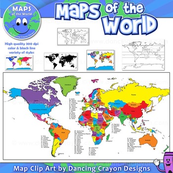
Maps of the World: Clip Art World Maps
Maps of the World: Clip Art World Maps
High quality color and black and white maps of the world.
This clipart map set contains the following commercial use graphics:
- Color maps of the world
- Black and white line art maps of the world
- Maps of the world with lines of latitude and without lines of latitude
- Maps of the world with larger countries labelled (color and black and white)
- Silhouette maps of the world
- A map of the world showing seven continents in color and black and white:
Grades:
3rd - 12th, Higher Education, Adult Education, Staff
Also included in: Maps of the World Clip Art - MEGA-BUNDLE
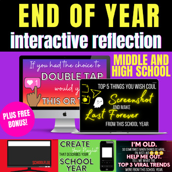
End of the Year Activities Fun for Middle and High School +BONUS free extras
Looking for some end of the year interactive fun for your third, fourth, and fifth grade students then these Google Slides are perfect.These end of year slides include modern assignments that have gen-z and social media themed fun.And enjoy an added free bonus: 1 printable end of year activity + 20 agenda templates! 15 slides in this bundle! 1 Title Page1 Table of ContentsMain Character Netflix DirectionsMain Character Netflix TemplateSnapchat Screenshot Top 5 DirectionsSnapchat Screenshot Top
Grades:
4th - 12th, Higher Education, Adult Education, Staff
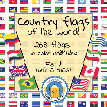
Country flags of the world: 263 Country flags - clip art bundle (1052 clips!)
Country flags of the world: 263 Country flags. HUGE clip art BUNDLE!
This clip art contains 263 flags, in 2 forms (flat and with mast) in color and black & white line art.
Contains all the flags of the countries of the world : 195 Countries.
Look at the complete list of flags by downloading the preview
A total of 1052 clips!
Included:
263 color flag (flat) clip art flag set- PNG format
263 B&W flag (flat) clip art set- PNG format
263 color flag (with mast) clip art set- PNG format
Grades:
PreK - 12th, Higher Education, Adult Education
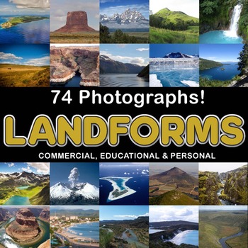
Photos Photographs LANDFORMS clip art
Photographs - Landforms. For sale are 74 beautiful, full color, high quality 300 dpi photographs for commercial, personal and educational use. No credit required to use these images, but it is always appreciated if you do! Why use clip art when you can use images of real objects? Every single image is available for you to use commercially in every one of your products. Buy with confidence! The thumbnail images are watermarked /cropped in the preview / thumbnails but the purchased photographs wil
Subjects:
Grades:
PreK - 12th, Higher Education, Adult Education
Also included in: Complete Photo Bundle
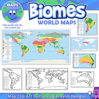
Biomes - Maps of the World and Continents Clip Art
Biomes World MapsHigh quality color and black and white maps of biome regions of the world. This clipart map set contains the following commercial use graphics:- Color maps of the world biome areas- Black and white line art maps of the world biome areas to color (with blank legend / key to also color)- Maps with and without the equator and geographic lines- Maps of continents showing biome regions- Maps of the world showing individual biome regions (for example: maps showing where the worlds tem
Grades:
3rd - 12th, Higher Education, Adult Education, Staff
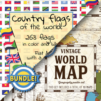
Country flags of the world & World map and continent - School Clip Art - BUNDLE
BUNDLE! Country flags of the world & World map and continent Product #1: Link to the productCountry flags of the world: 263 Country flags. HUGE clip art BUNDLE!This clip art contains 263 flags, in 2 forms (flat and with mast) in color and black & white line art.Contains all the flags of the countries of the world : 195 Countries.Look at the complete list of flags by downloading the previewA total of 1052 clips!Included:263 color flag (flat) clip art flag set- PNG format263 B&W flag
Grades:
PreK - 12th, Higher Education, Adult Education, Staff
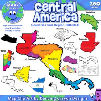
Maps of Central America: Clip Art Map BUNDLE
Maps of Central America: Clip Art Map BUNDLE
Map Collection: Central American Countries Bundle
VALUE-PACK: This is a money-saving bundle containing maps of the Central America region along with multiple maps of each country of Central America: Belize, Costa Rica, Honduras, Nicaragua, Panama, El Salvador, and Guatemala.
This clipart map set contains the following commercial use graphics:
- Color maps
- Black and white line art maps
- Silhouettes
- Maps of the world with individual count
Grades:
2nd - 12th, Higher Education, Adult Education, Staff
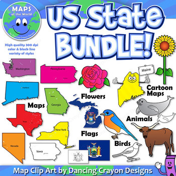
US State Symbols and State Map Clip Art BUNDLE
A BUNDLE set of Dancing Crayon's US State maps with US State symbols clip art.
Please note: This is a very large file (choc-full of clip art!). If you have any difficulty downloading this item, please contact TpT through their support page or leave a question on the Q&A tab of my store. We'll be happy to help!)
This US State clip art map and symbol set contains:
- Color maps and black and white maps of the fifty states of the United States of America - both labelled and blank. Labelled
Grades:
PreK - 12th, Higher Education, Adult Education, Staff
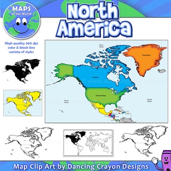
North America Continent Maps: Clip Art Map Set
North America Continent Maps: Clip Art Map Set
Map Collection: North American Continent
A set of clip art maps of North America. Note: These maps show the entire region of North America and do not contain individual country maps.
This clipart map set contains the following commercial use graphics:
- Color maps of North America
- Labelled maps and blank maps
- Black and white line art maps of North America
- Silhouette of the North American continent
- Map of the world hig
Grades:
PreK - 12th, Higher Education, Adult Education, Staff
Also included in: Maps of the World Clip Art - MEGA-BUNDLE
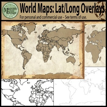
Maps: The World w/ Longitude & Latitude Overlays {Messare Clips & Design}
Sharpen your map skills!
This hugely diverse set of World Maps with Longitude and Latitude Overlays contains 25 individual high resolution graphics. All maps are shown in the thumbnail. There are 10 individual Latitude and Longitude Overlays that will provide you a wide range of uses.
There are two Latitude & Longitude scale variations used in the 10 overlays. One scale uses 30 degree intervals and the other uses 15 degree Latitude and 20 Degree Longitude intervals.
(Not all overlays de
Grades:
PreK - 12th, Higher Education, Adult Education
Summer Quotes Coloring Pages - End of the year - Back to school Activities
This coloring Pages contains beautiful quotes, intricate designs that are perfect for both children and adults. These images will keep you entertained and help induce meditation as you work to color between these intricate lines.You’ll be receiving an instant download you may print as many times as you like! Share these with as many friends or family!This book is ideal for anyone looking to aid a child’s development or to be used yourself for relaxation.What You will Get5 Coloring PAGESPDF + PNG
Subjects:
Grades:
PreK - 12th, Adult Education, Staff
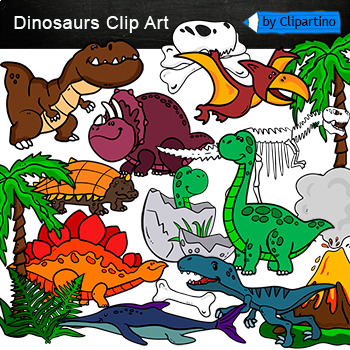
Dinosaurs Clip Art Commercial use
Cute Dinosaur Clip Art Commercial use/ Dino Clipart includes: fern * dino egg* volcano* Bones with skull Dinosaur* bone *dinosaur skeleton* ankylosaurus* apatosaurus* ichthyosaurus* pterodactyl* stegosaurus* triceratops* tyrannosaur* tyrannosaurus rex *tyrannosaurus rex.Download preview with free clipart inside license included!All18 png files transparent background+jpgand 17 png black-white coloring outlines files+jpgFor personal and small commercial use!!!! See more animals clipartDinosaurs of
Grades:
PreK - 12th, Higher Education, Adult Education, Staff
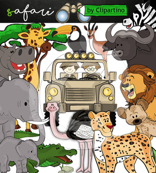
Cute Safari animals Clip Art /African Animals /Commercial use
Safari clipart bundle inclides 22 png files transparent background+jpgand safari clip art 22 png+jpg black-white filessize 1 files about 6 inch 300 dpiFor personal and commercial use!!!African Animals & Savanna clipart (Animal jungle clip art)BinocularjeepJeep with boysBoyscrocodileantelopehippoelephantbaby elephantbuffaloa lionleopardhyenarhinoceroshippostonebeaktreegrassostrich!!!! See more animals clipartOcean animals clipartSafari clipartBugs clipartBirds ClipartDinosaur ClipartArctic An
Grades:
PreK - 12th, Higher Education, Adult Education, Staff
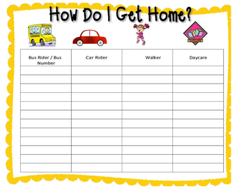
How Do I Get Home? Open house - transportation - Getting home
Great way to find out how each student gets home. Lay form out during open house/ meet the teacher and have parents fill out the paper. Great and easy way to find out how each student gets home!
Subjects:
Grades:
PreK - 12th, Higher Education, Adult Education, Staff
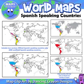
Spanish Speaking Countries | Maps of the World Clip Art
Maps of the World: Clip Art of Spanish Speaking Countries on World MapHigh quality color and black and white maps of the world with Spanish speaking countries labeled and highlighted. This clipart map set contains the following commercial use graphics:- Color maps of the world labeled with only Spanish speaking countries- Black and white line art maps of above- labeled and blank maps of above*Includes TWO versions. One showing only countries which have Spanish as an official language, and two,
Grades:
3rd - 12th, Higher Education, Adult Education, Staff
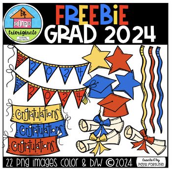
Graduation 2024 FREEBIE (P4 Clips Trioriginals Digital Clip Art)
This clip art set includes 22 images. There are 16 vibrant coloured images and 6 black and white images.This pack includes: (Primary Colour Scheme and Black and White))- 4 Streamers- 4 Congratulations Banners- 3 Bunting Banners- 4 Stars- 4 Graduation Caps- 4 CertificatesEnjoy using them to create resources and creative projects such as letters, cover pages, activity/task cards and more. All images are in png format so they can be layered and have high resolution so they can be easily enlarged a
Subjects:
Grades:
PreK - 12th, Adult Education
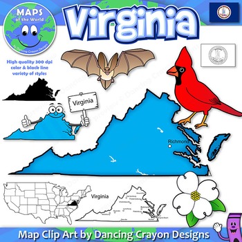
Virginia State Symbols and Map Clipart
This US State clip art map and symbol set contains:
- Color maps of Virginia - labelled and blank
- Black and white maps - labelled and blank
- State Flag (Color, black and white, waving, and country shape)
- Cartoon character of the state holding a sign
- Virginia Big-Eared Bat - State Bat
- American Dogwood - State Flower
- Cardinal - State Bird
- Color and black and white clipart
- Also added: map showing five geographic regions in color and black and white (not shown in previews).
High qua
Grades:
PreK - 12th, Higher Education, Adult Education, Staff
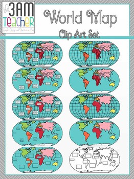
World Maps Clip Art: Flat World Map Set!!!
This set includes 18 beautifully detailed graphics in full color and black and white of the Western Hemisphere! Perfect for Common Core aligned lessons and resources!!
This set also includes Northern Hemisphere Globes:
without latitude/longitude lines
Labeled and blank
Country boundary lines
Continent boundary lines
Includes Fillable templates for student assessments!!
All images are in PNG format (translucent background)
300 DPI (Perfect resolution for printing and re-sizing)
Thank you for
Grades:
PreK - 12th, Higher Education, Adult Education, Staff
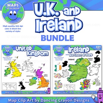
Maps of United Kingdom and Ireland (BUNDLE): Clip Art Maps
Maps of the United Kingdom and Ireland (BUNDLE): Clip Art Maps
Map Collection: UK and Ireland BUNDLE
This is a bundle containing two map sets: United Kingdom and Ireland.
This clipart map set contains the following commercial use graphics:
- Color maps of Ireland and the United Kingdom
- Black and white line art maps of Ireland and the United Kingdom
- Silhouettes of Ireland and the United Kingdom
- Map of the world with Ireland / UK highlighted
- Labelled maps and blank maps
Vi
Grades:
3rd - 12th, Higher Education, Adult Education, Staff
Summer Bucket Tags {Free!} Have Buckets of Fun This Summer!
I really hope you enjoy my product! If you are unsatisfied in any way, contact me right away and I will do my best to make it right :)
I hope you are able to use these cute little tags on your end of year buckets for your little peanuts! This makes an adorable and relatively simple end of year gift for your class!
Please follow me to be updated as I add more products to my store :) I really appreciate your support! Thank you!
Check out my blog at:
http://keepinitkoolinkinderland.blogspot.com
Subjects:
Grades:
PreK - 12th, Higher Education, Adult Education, Staff
Editable Borders - pick your color or fill in pattern
Borders
Picture Frame Borders
This is a set of 5 individual files, 4 png files that are not filled with color and a word document with more than 10 examples on how to fill the frames with colors.
You can use them for your TPT store products. I just ask that you give me credit by pasting a link to my TPT store in your document.
I will be adding more patterns for the frames and if you purchase this product you will get the updates for free!
Enjoy!
--------------------------------------------
Subjects:
Grades:
PreK - 12th, Higher Education, Adult Education, Staff

Father day Super Hero Chocolate bar Craft DIY Card Gift questionaire Activities
Products with amazing discounts:New!!! Geogusser Games cardsFather's day Surprise folding cardFather’s Day Coloring cardsFather’s day bouquet craftEnd of the year Flower Calculator CraftAlphabet tracingEnd of the year My robot Craft DIYTeacher Folding Surprise cardsTeacher Appreciation Stand-up cardsTeacher Appreciation Heart-flowers card bouquetTeacher Appreciation Coloring CardsMother's day Doodle CardsMother's day Standup cardsMother's day folding window craftMother's Day Spinner CraftMom Fol
Subjects:
Grades:
PreK - 12th, Higher Education, Adult Education, Staff

Photos Photographs ROCK CYCLE Bundle
Photographs - Rock Cycle. For sale are 66 beautiful, full color, high quality 300 dpi photographs for commercial, personal and educational use. No credit required to use these images, but it is always appreciated if you do! Why use clip art when you can use images of real objects? Every single image is available for you to use commercially in every one of your products. Buy with confidence! The thumbnail images are watermarked /cropped in the preview / thumbnails but the purchased photographs wi
Subjects:
Grades:
PreK - 12th, Higher Education, Adult Education
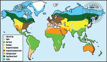
Maps: Biomes of the World {Messare Clips & Design}
This custom request set of World Biomes contains 20 individual high resolution (300 dpi) maps. All maps are shown in the thumbnail/preview. There are 10 full color and black and white maps depicting the following biomes:
- Alpine
- Tundra
- Rain Forest
- Taiga (Boreal Forest)
- Polar Ice Cap
- Subtropical Desert
- Temperate Grasslands
- Temperate Deciduous Forest
- Shrubland
This set is exported in both PNG and JPEG formats.
If you have questions, or you're looking for additions or specific
Subjects:
Grades:
PreK - 12th, Higher Education, Adult Education
Showing 1-24 of 385 results


