49 results
4th grade geography lessons on sale
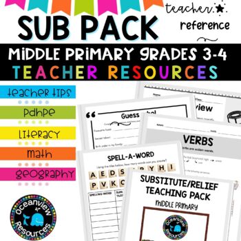
Grade 3-4 Sub Plans for Emergency Teaching days and Relief Teachers
⭐Being a relief teacher and a substitute teacher can come with its own set of challenges. This Relief Teacher Survival Kit is your one-stop resource for handling a job assignment with confidence and ease! Your students will LOVE all of the easy-to-use activitiesIf you are just starting out in your teaching career, or if you need a spark of new ideas, this resource is jam-packed with activities you can use with your students. It includes hundreds of fun, authentic, and engaging activities that I
Subjects:
Grades:
3rd - 4th, Staff
Types:
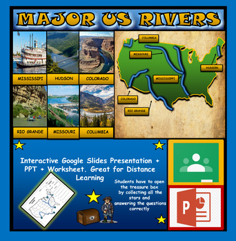
The US Major Rivers : Google Slides. Mississippi. Colorado. Hudson + Worksheets
The US Major Rivers : Google Slides, Distance Learning + Powerpoint Version + Worksheets. Interactive presentation & quiz on US major rivers. Please view the video previewINTERACTIVE GOOGLE SLIDES/POWER POINT PRESENTATION on The US major rivers. It can be used for distance learning and google classroom or on a interactive smartboard in the classroom.Once downloaded: Please view the GOOGLE SLIDES/POWERPOINT IN 'PRESENT ▶️' modeWorksheet also included in ZIP file 'Label the US rivers'. This is
Subjects:
Grades:
2nd - 7th
Also included in: U.S.A Geography Bundle: Google Slides Presentations + PPT's + Worksheets
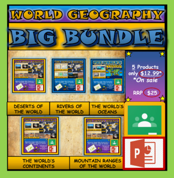
World Geography Bundle: Google Slides Presentations + PPT's + Worksheets
World Geography Bundle: Google Slides Presentations + PPT's + Worksheets5 Products included in this bundle covering several main topics regarding World GeographyPlease watch the preview video of 'The World's Oceans' before purchasing this bundle - to understand the depth of content, the quality and interactivity of these presentations. All presentation follow the same layout and have good quality design.Google Slides/PPT Presentations included in this bundle:Mountain Ranges Of The WorldRivers Of
Subjects:
Grades:
3rd - 8th
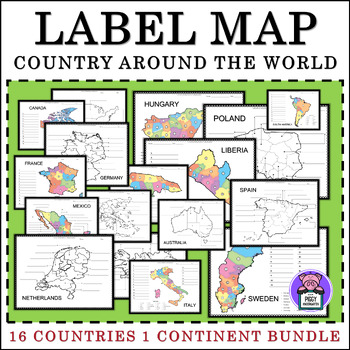
Labeling Map Quiz Countries Around the World - BUNDLE
Labeling Map Around the World 16 Countries and 1 Continent16 Countries Included:MexicoAustraliaFranceItalyGermanyCanadaSpainGreeceJamaicaIcelandLiberiaPolandSwedenHungaryNetherlandsUnited States (2versions) - 4 Regions - 5 Regions1 Continent Included:South America3 Labeling Versions Included:Numbered Label- with word bankIdentify LabelBlank Map for Writing and ColorAlso Includes:PosterColor and BW VersionsAnswer keyTHANK YOU!I appreciate you purchasing my teaching resources, and
Subjects:
Grades:
3rd - 6th
Types:
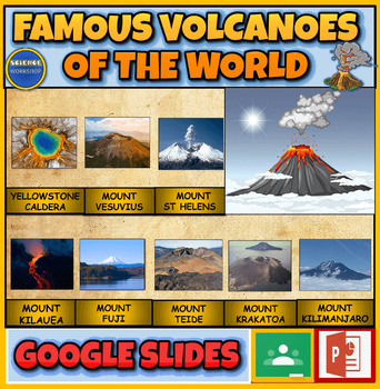
Famous Volcanoes Of The World: Earth Science: Interactive Powerpoint
Famous Volcanoes Of The World: Volcanology: Interactive Powerpoint + Google Slides Version + 2 Printable WorksheetsInteractive presentation & quiz on Famous Volcanoes Of The World. Please watch the preview video to get an understanding of how this product worksINTERACTIVE GOOGLE SLIDES/POWER POINT PRESENTATION on Famous Volcanoes Of The WorldThe presentation is interactive, animated and fun to use.The presentation can be presented to the class by the teacher and students can view also it ind
Subjects:
Grades:
4th - 9th
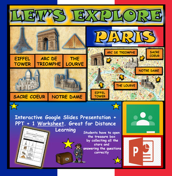
Lets Explore Paris, France Landmarks: Google Slides, Interactive Powerpoint
Let's Explore: Paris Landmarks: Interactive Google Slides, Distance Learning + WorksheetInteractive Paris Landmarks Map (click on each landmark to find out more) & Interactive quiz on Paris Landmarks. Please watch the preview video to understand how this product worksThis presentation works great for interactive whiteboard/smartboard lesson, where students can come up and touch the board. Students can also view /interact with the presentation individually.INTERACTIVE GOOGLE SLIDES/POWER POIN
Grades:
2nd - 6th
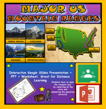
Major US Mountain Ranges: Google Slides, Distance Learning + PPT + Worksheet
Major US Mountain Ranges: Google Slides, Distance Learning + PPT + WorksheetInteractive presentation & quiz on Major US Mountain Ranges. Please view the powerpoint previewINTERACTIVE GOOGLE SLIDES/POWER POINT PRESENTATION on Major US Mountain Ranges. It can be used for distance learning and google classroom or within the classroom.Once downloaded: Please view the GOOGLE SLIDES/POWERPOINT IN 'PRESENT ▶️' modeWorksheet also included in ZIP file 'Label the Major US Mountain Ranges' .This are wo
Subjects:
Grades:
3rd - 7th
Also included in: U.S.A Geography Bundle: Google Slides Presentations + PPT's + Worksheets
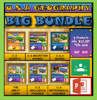
U.S.A Geography Bundle: Google Slides Presentations + PPT's + Worksheets
U.S.A Geography Bundle: Google Slides Presentations + PPT's + Worksheets6 Products included in this bundle covering different aspects of U.S.A Geography.Google Slides Presentations included in this bundle:U.S.A The Great LakesU.S.A Major RiversU.S.A Mountain RangesU.S.A DesertsU.S.A Natural Hazards (Meteorological) U.S.A Geological HazardsInteractive presentations & interactive quizzes on different aspects of U.S.A GeographyINTERACTIVE GOOGLE SLIDES/POWER POINT PRESENTATION on US geography.
Subjects:
Grades:
3rd - 7th
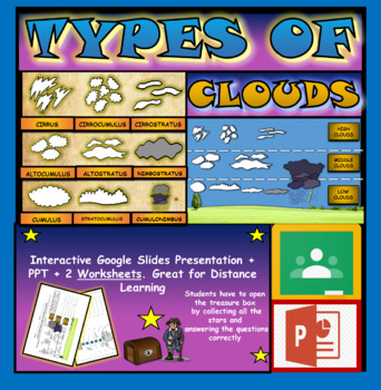
Types of Clouds. The Atmosphere and Weather Powerpoint. Cirrus. Stratus. Cumulus
Types of Clouds. Interactive Google Slides, Powerpoint + 2 Printable worksheetsInteractive presentation & interactive quiz on Types of Clouds. Please watch the preview video before purchasing to understand the depth of content and interactivity of this product.INTERACTIVE GOOGLE SLIDES/POWER POINT PRESENTATION on Types of Clouds. It can be used for distance learning and google classroom or within the classroom.Once downloaded: Please view the GOOGLE SLIDES/POWERPOINT IN 'PRESENT ▶️' mode2 Wo
Subjects:
Grades:
2nd - 5th
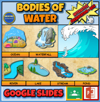
Bodies Of Water: Interactive Google Slides + PPT Version + Printable Worksheet
Bodies Of Water: Interactive Google Slides + PPT Version + Printable WorksheetInteractive presentation & quiz on different types of bodies of water. Please watch the preview video to get an understanding of how this product worksINTERACTIVE GOOGLE SLIDES/POWER POINT PRESENTATION on different types of bodies of waterThe presentation is interactive, animated and fun to use.The presentation can be presented to the class by the teacher and students can view also it independently also. The presen
Subjects:
Grades:
2nd - 8th
Also included in: Middle School Earth Science: Powerpoint Presentations Lessons Bundle
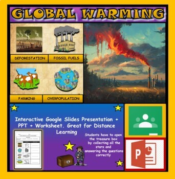
Causes of Global Warming: Interactive Google Slides+ PPT + Worksheet
Causes of Global Warming: Interactive Google Slides + PPT + WorksheetInteractive presentation & quiz on Causes of global warming. Please view the powerpoint previewINTERACTIVE GOOGLE SLIDES/POWER POINT PRESENTATION on the causes of global warming . It can be used for distance learning and google classroom or within the classroom.Once downloaded: Please view the GOOGLE SLIDES/POWERPOINT IN 'PRESENT ▶️' modeWorksheet also included in ZIP file 'Causes of global warming' .This is a word files.do
Subjects:
Grades:
2nd - 6th
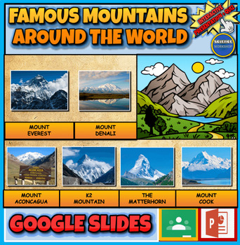
Famous Mountains Of The World: Earth Science: Interactive Powerpoint
Famous Mountains Of The World: Earth Science: Interactive Powerpoint + Google Slides Version + Printable WorksheetInteractive presentation & quiz on Famous Mountains Of The World. Please watch the preview video to get an understanding of how this product worksINTERACTIVE GOOGLE SLIDES/POWER POINT PRESENTATION on Famous Mountains Of The WorldThe presentation is interactive, animated and fun to use.The presentation can be presented to the class by the teacher and students can view also it inde
Subjects:
Grades:
4th - 7th
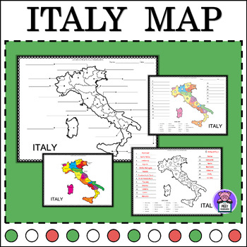
Italy Map Quiz Labeling the State | Numbered | Geography Map of Italy
Label Map of ItalyEnhance your geography lessons with this Italy Map resource! Perfect for educators, this set includes labeled maps of Italy, showcasing its different states. Use these maps to teach students about the geography and regions of Italy in an engaging and informative way.3 Labeling Versions Included:Numbered Label- with word bankIdentify LabelBlank Map for Writing and ColorAlso Includes:PosterColor and BW VersionsAnswer keyYou may also like this16 Countries:MexicoAustraliaFranceItal
Subjects:
Grades:
3rd - 6th
Types:
Also included in: Labeling Map Quiz Countries Around the World - BUNDLE
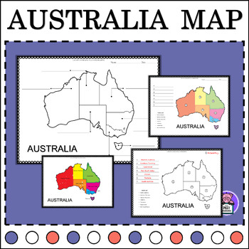
Australia Map Quiz Labeling State and Territories | Geography Map of Australia
Label Map of AustraliaEnhance your geography lessons with this Australia Map resource! Perfect for educators, this set includes labeled maps of Australia, showcasing its different states. Use these maps to teach students about the geography and regions of Australia in an engaging and informative way.3 Labeling Versions Included:Numbered Label- with word bankIdentify LabelBlank Map for Writing & ColorAlso Includes:PosterColor and BW VersionsAnswer keyYou may also like this16 Countries:MexicoA
Grades:
2nd - 5th
Types:
Also included in: Labeling Map Quiz Countries Around the World - BUNDLE
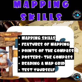
Mapping Skills, co ordinates, features of a map, create your own map, grid ref
Unlock the world of maps with our comprehensive Mapping Resource – the ultimate toolkit for educators! Dive into engaging lessons, interactive activities, and captivating videos that make teaching cartography a breeze.Contents:Table of Contents: Navigate seamlessly through a well-organized structure.Suggested Teaching Activities: Fuel creativity with hands-on and immersive learning experiences.Features of a Map: Uncover the secrets of maps with detailed insights.Create an Imaginary Map: Ignite i
Subjects:
Grades:
3rd - 6th
Types:
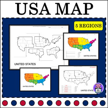
5 Regions of the United States Map Quiz Labeling
Map of the United States LabellingEnhance your geography lessons with this United States Map resource! Perfect for educators, this set includes labeled maps of the United States, showcasing its different 5 regions. Use these maps to teach students about the geography and regions of the United States in an engaging and informative way.4 Labeling Versions Included:Numbered Label- with word bankIdentify Label (2 Versions)Blank Map for Writing and ColorAlso Includes:PosterColor and BW VersionsAnswer
Subjects:
Grades:
3rd - 6th
Types:
Also included in: Labeling Map Quiz Countries Around the World - BUNDLE

United States Map Quiz Labeling the Regions | Numbered | Geography Map of USA
Map of the United States LabellingEnhance your geography lessons with this United States Map resource! Perfect for educators, this set includes labeled maps of the United States, showcasing its different 4 regions. Use these maps to teach students about the geography and regions of the United States in an engaging and informative way.3 Labeling Versions Included:Numbered Label- with word bankIdentify LabelBlank Map for Writing and ColorAlso Includes:PosterColor and BW VersionsAnswer keyYou may a
Subjects:
Grades:
3rd - 6th
Types:
Also included in: Labeling Map Quiz Countries Around the World - BUNDLE
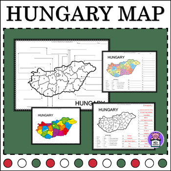
Hungary Map Quiz Labeling the Counties | Numbered | Geography Map of Hungary
Map of Hungary LabellingEnhance your geography lessons with this Hungary Map resource! Perfect for educators, this set includes labeled maps of Hungary, showcasing its different counties. Use these maps to teach students about the geography and regions of Hungary in an engaging and informative way.3 Labeling Versions Included:Numbered Label- with word bankIdentify LabelBlank Map for Writing and ColorAlso Includes:PosterColor and BW VersionsAnswer keyYou may also like this16 Countries:MexicoAustr
Grades:
4th - 6th
Types:
Also included in: Labeling Map Quiz Countries Around the World - BUNDLE

Liberia Map Quiz Labeling the Counties | Numbered | Geography Map of Liberia
Label Map of LiberiaEnhance your geography lessons with this Liberia Map resource! Perfect for educators, this set includes labeled maps of Liberia, showcasing its different counties. Use these maps to teach students about the geography and regions of Liberia in an engaging and informative way.3 Labeling Versions Included:Numbered Label- with word bankIdentify LabelBlank Map for Writing and ColorAlso Includes:PosterColor and BW VersionsAnswer keyYou may also like this16 Countries:MexicoAustralia
Grades:
3rd - 6th
Types:
Also included in: Labeling Map Quiz Countries Around the World - BUNDLE
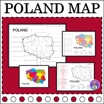
Poland Map Quiz Labeling the Provinces | Numbered | Geography Map of Poland
Label Map of PolandEnhance your geography lessons with this Poland Map resource! Perfect for educators, this set includes labeled maps of Poland, showcasing its different provinces. Use these maps to teach students about the geography and regions of Poland in an engaging and informative way.3 Labeling Versions Included:Numbered Label- with word bankIdentify LabelBlank Map for Writing and ColorAlso Includes:PosterColor and BW VersionsAnswer keyYou may also like this16 Countries:MexicoAustraliaFra
Grades:
3rd - 6th
Types:
Also included in: Labeling Map Quiz Countries Around the World - BUNDLE

Jamaica Map Quiz Labeling the Parishes | Numbered | Geography Map of Jamaica
Label Map of JamaicaEnhance your geography lessons with this Jamaica Map resource! Perfect for educators, this set includes labeled maps of Jamaica, showcasing its different parishes. Use these maps to teach students about the geography and regions of Jamaica in an engaging and informative way.3 Labeling Versions Included:Numbered Label- with word bankIdentify LabelBlank Map for Writing and ColorAlso Includes:PosterColor and BW VersionsAnswer keyYou may also like this16 Countries:MexicoAustralia
Grades:
3rd - 6th
Types:
Also included in: Labeling Map Quiz Countries Around the World - BUNDLE
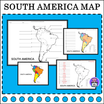
South America Map Quiz Label | Numbered | Geography Map of South America
Label Map of South AmericaEnhance your geography lessons with this South America Map resource! Perfect for educators, this set includes labeled maps of South America, showcasing its different countries. Use these maps to teach students about the geography and regions of South America in an engaging and informative way.3 Labeling Versions Included:Numbered Label- With countries listIdentify LabelBlank Map for Writing Also Includes:PosterColor and BW VersionsAnswer keyYou may also like this16 Coun
Grades:
3rd - 6th
Types:
Also included in: Labeling Map Quiz Countries Around the World - BUNDLE
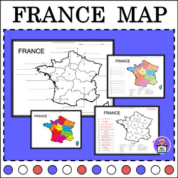
France Map Quiz Labeling the State | Numbered | Geography Map of France
Label Map of FranceEnhance your geography lessons with this France Map resource! Perfect for educators, this set includes labeled maps of France, showcasing its different states. Use these maps to teach students about the geography and regions of France in an engaging and informative way.3 Labeling Versions Included:Numbered Label- with word bankIdentify LabelBlank Map for Writing and ColorAlso Includes:PosterColor and BW VersionsAnswer keyYou may also like this16 Countries:MexicoAustraliaFrance
Grades:
3rd - 6th
Types:
Also included in: Labeling Map Quiz Countries Around the World - BUNDLE
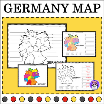
Germany Map Quiz Labeling the States | Numbered | Geography Map of Germany
Label Map of GermanyEnhance your geography lessons with this Germany Map resource! Perfect for educators, this set includes labeled maps of Germany, showcasing its different states. Use these maps to teach students about the geography and regions of Germany in an engaging and informative way.3 Labeling Versions Included:Numbered Label- with word bankIdentify LabelBlank Map for Writing and ColorAlso Includes:PosterColor and BW VersionsAnswer keyYou may also like this16 Countries:MexicoAustraliaFr
Subjects:
Grades:
2nd - 5th
Types:
Also included in: Labeling Map Quiz Countries Around the World - BUNDLE
Showing 1-24 of 49 results


