
1,901 results
Geography resources on sale


Map Skills - Me on the Map
Map Skills: Me on the map - Hi teachers! Are you beginning to teach your kiddos map skills? Well this unit might be just what you need. There are tons of activities included just take a look below:Vocabulary PostersMaps of the World: Identify ContinentsMaps of the Word: Identify OceansMaps of the World: Identify the Continent you live onDescribe a MapGlobe: Identify Poles, Equator, Continents, OceansDescribe a GlobeCompare and Contrast Globes and MapsSort Maps and GlobesIdentify Neighboring C
Subjects:
Grades:
K - 2nd
Types:

Causes of the American Revolution Differentiated Nonfiction Reading Passages
In this resource, there is a nonfiction reading passage based on the Causes of the American Revolution. It is differentiated for your high, mid, and lower level students as you study the colonies, Great Britain, taxes, and more events leading to the Revolutionary War. Integrate geography content with your reading texts and meet each reader's needs with this set. Guided Reading levels are M-P-U.
Looking to complete this lesson? The video link below perfectly compliments this resource! Causes of
Subjects:
Grades:
3rd - 7th
Types:

Reading Map Skills Clip Art
Map clip art that is great for map skills activities and more. This maps clipart set contains 52 image files, which includes 26 color images and 26 black & white images in png. All images are 300dpi for better scaling and printing.* The globe and world maps are not accurateThe maps clip art set includes:* Boy pointing to a pulldown world map* Globe* (2) trees* Road* Railroad* Pond/lake* Mountains* Snow covered mountains* (2) Compass rose* Girl holding a globe* Boy holding a world map* World
Subjects:
Grades:
PreK - 5th

Five Themes of Geography Nonfiction Reading Texts BUNDLE - SOCIAL STUDIES
There are five differentiated nonfiction reading passages based on each of the Five Themes of Geography included in this social studies resource bundle:
US Regions
Place
Location
Movement
Human-Environment Interaction
The text discusses an overview of each of the five themes of geography with relevant examples. It is differentiated for your high, mid, and lower level students. 4 types of rigorous questions are included, along with an answer key. Integrate geography content with your reading t
Subjects:
Grades:
3rd - 7th
Types:

Alberta Grade 3 Social Studies- BUNDLE- 7 Units + 1 Reading Comprehension
Introducing the Ultimate Grade 3 Alberta Social Studies Resource Bundle!Are you a teacher looking to enhance your Grade 3 Social curriculum in Alberta? Look no further! Our comprehensive Grade 3 Alberta Social Studies Resource Bundle is here to support your teaching journey!This meticulously curated bundle is designed specifically to align with the Alberta curriculum, ensuring that you have all the essential tools and materials at your fingertips. Say goodbye to hours spent searching for individ
Subjects:
Grades:
3rd
Types:

Layers Of The Atmosphere: Interactive Google Slides + PPT Version + Worksheet
Layers Of The Atmosphere: Interactive Google Slides + PPT + Worksheet (Distance Learning)Interactive presentation & quiz on Layers of the atmosphere. Please view the powerpoint previewINTERACTIVE GOOGLE SLIDES/POWER POINT PRESENTATION on layers of the atmosphere. It can be used for distance learning and google classroom or within the classroom.Once downloaded: Please view the GOOGLE SLIDES/POWERPOINT IN 'PRESENT ▶️' modeWorksheet also included in ZIP file 'Parts of the atmosphere' .These are
Subjects:
Grades:
3rd - 8th

Earth Science worksheet: Label stages of the water cycle
Earth Science worksheet: Label stages of the water cycle2 VERSIONS OF WORKSHEET (Worksheet with a word bank & Worksheet with no word bank)Students have to label the stages of water cycle by looking at the diagram (Evaporation, Collection, Precipitation and Condensation)Students can color in the pictures they are doneWorksheet aimed at higher kindergarten/lower primary levelAnswer Key includedBoth PDF and Editable Word Versions included within the ZIP file
Subjects:
Grades:
K - 6th
Types:

Map Skills & Five Themes of Geography Activity Bundle | Unit Activities
My Map Skills & 5 Themes of Geography Activity Bundle | Unit Activities includes four of my activities resources for your unit on map skills and the five themes of geography at a discounted rate.★ You may also want to check out my "Less Mess" Map Skills and Geography Interactive Notebook Activities as well. Included resources are:1. The Five Themes of Geography Posters with Mr. HelpSometimes all it takes is something comical, silly, or colorful for students to remember a concept. These poste
Subjects:
Grades:
4th - 7th
Types:

Map Skills & Geography Unit | Interactive Notebook Activities| Activity Pages
My “Less Mess” Map Skills & Geography Unit | Interactive Notebook Activities| Activity Pages are ready to use whether you are using interactive notebooks in your classroom or not! They could even function as worksheets if needed. For notebooks, they allow for two simple steps: cut around the border and glue it in. That’s it! They are perfect for teachers who may have their students for just one short period per day. However, if you are a big fan of the “folds and flaps” that usually come wit
Grades:
4th - 7th

Map Skills Book
Discover the world of map skills with this engaging book for students! This comprehensive resource covers essential topics such as the globe, map symbols, cardinal directions, United States map, classroom maps, home maps, and community maps. Dive into the exciting world of geography and navigation with this informative and enjoyable booklet.Check out some of my other ResourcesPumpkin DayTurkey DayHalloween Word ProblemsFollow meFacebookKathryn Loves Teaching BlogTeachers Pay TeachersThank you fo
Subjects:
Grades:
PreK - 2nd
Types:

Social Studies, Map Skills & Geography Activities| Interactive Notebooks
My "Less Mess" Social Studies, Map Skills & Geography Activities/Interactive Notebook/ Activity Pages Bundle is ready to use whether you are using interactive notebooks in your classroom or not! They could even function as worksheets if needed. For notebooks, they allow for two simple steps: cut around the border and glue it in. That’s it! They are perfect for teachers who may have their students for just one short period per day. However, if you are a big fan of the “folds and flaps” that u
Grades:
4th - 7th

USA state symbols Clip Art BUNDLE-part #1/ Commercial use
USA state symbols clipart BUNDLE-part #1 includes 26 states A-MAlabama-Alaska-Arizona-Arkansas-California-Colorado-Connecticut-Delaware-Florida-Georgia-Hawaii-Idaho-Illinois -Indiana-Iowa-Kansas-Kentucky-Louisiana-Maine-Maryland-Massachusetts-Michigan-Minnesota-Mississippi-Missouri-Montana!!!!! USA state symbols clipart BUNDLE-part #2Size one image about 7 inch by 4 inch PNG+JPG & black-white filesFor personal and commercial use.* State flags will soon be available for free. Subscribe to not
Grades:
Not Grade Specific

Introduction to Geography Bundle | Reading & Notes - Print and Digital
Geography is such an important academic skill to master-Without it, learning about history can be more difficult! This bundle of resources will provide your students with the geography foundation they need to be successful across all subject matters! This bundle has everything to keep your students learning and engaged, including maps and globe activities, videos, PowerPoint presentations, vocabulary study, and even a BONUS interactive notebook! Planning fun and engaging lessons can take time a
Grades:
6th - 8th

Minnesota + Me | Minnesota History Course GROWING BUNDLE
Bring life and engagement to your Northern Lights and Minnesota Studies and History curriculum this year by using interactive, challenging, and creative activities, instruction, and assessments in your class! This resource bundle aligns with Minnesota's 6th grade social studies standards and the Northern Lights textbook curriculum created by the Minnesota Historical Society.NOTE: This GROWING BUNDLE will be added to and updated until complete, with the price increasing as each item is added. By
Grades:
4th - 8th
Types:

Types of Maps - USA
This set contains 39 images, wich includes 18 color images and 21 black line versions as shown on preview pages. Images saved at 300 dpi in png files.Included in this set:-Political map-Physical map-Landform map-Historical map (USA territorial acquisitions)-Weather map-Climate zone map-Time zone map-Regions map-Transportation map-USA contour map (2 colors)-Compass rose (2 styles)-3 different examples of maps scales-Elevation model-Contour elevationPLEASE NOTE: These are not exact maps, are gr
Grades:
PreK - 12th, Staff
Also included in: USA Maps - BUNDLE

Latin America Countries Clip Art Bundle -PART 4 /Brazil /Mexico /Cuba /Argentina
Latin America Countries Clip Art Bundle - PART 4 (South America/Central America) Clipart Countries symbols : Argentina * Bolivia * Brazil * Chile * Columbia* Costa Rica * Cuba * Mexico * Peru * Venezuela clipart color + black white more than 100 filesYou'll like it!All countries of the worldSize one image about 8 inch by 4 inchFor personal and commercial use.Download the archive with the license and logo by the linkhttps://www.teacherspayteachers.com/Product/License-Credit-logo-by-Clipartino-3
Grades:
Not Grade Specific

Biomes And Landforms Clip Art Commercial use
Biomes And Landforms Clip Art Bundle includes 68 files (34 color files PNG/JPG & 34 black white files. ) + 68 files NO FRAMESize one file about 6 inch 300 dpi. For personal and commercial use.Citycountrysidedesert mountainsocean pond rainforest savanna tundravolcano polar desertbay chaparral grassland taiga boreal foresttemperate deciduous forestbutte canyon cliff deltas dunes fjord glaciers hillsIsland Isthmus lake river peninsulas plains plateaus strait valleys waterfallYou will like other
Subjects:
Grades:
PreK - 6th, Staff

USA state symbols Clip Art BUNDLE-part #2 Commercial use
USA state symbols clipart BUNDLE-part #2 includes 24 states N-WNebraska-Nevada-New Hampshire-New Jersey-New Mexico-New York-North Carolina-North Dakota-Ohio-Oklahoma-Oregon-Pennsylvania-Rhode island -South Carolina-South Dakota-Tennessee-Texas-Utah-Vermont-Virginia-Washington-West Virginia-Wisconsin-Wyoming!!!!! USA state symbols clipart BUNDLE-part #1Size one image about 7 inch by 4 inch PNG+JPG & black-white filesFor personal and commercial use.* State flags will soon be available for free
Grades:
Not Grade Specific

Alberta Grade 3 Social Studies - MAPPING - Full Unit
This is a COMPLETE UNIT to deliver the Grade 3 Alberta Social Studies Unit - MappingThis is a ready-to-teach resource that you can use in any elementary classroom. These activities are sure to engage your students with hands on mapping experiences where they learn about the cardinal and intermediate directions, parts of a map, create their own island, learn where they are on a map as well as learning about the continents, oceans, equator, prime meridian and the location of Ukraine, Peru, India a
Subjects:
Grades:
2nd - 3rd
Types:

Major Rivers and Mountains of the United States Leveled Texts BUNDLE
Teaching about the major rivers and mountain ranges in the United States? For each of the major U.S. rivers and Appalachian and Rocky Mountains, there is a differentiated reading passage leveled three times for easy differentiation! Use these differentiated reading passages to further integrate geography into your reading instruction during guided reading, centers, or even as homework! View what is included and the guided reading levels of the passages by clicking on the individual product descr
Subjects:
Grades:
3rd - 6th
Types:

Great Lakes {Differentiated Close Reading Passages & Questions}
In this geography leveled text, there is a nonfiction reading passage based on the Great Lakes. It is differentiated for your high, mid, and lower level students. 3 types of questions are included, along with an answer key. Integrate geography content with your reading texts and meet each reader's needs with this set. Guided Reading Levels: N-R-U$Why should I purchase this passage set?$• Textbooks aren't what they used to be...if we have them at all. Often textbooks are written well above grade
Subjects:
Grades:
3rd - 6th
Types:

Neighborhood Map Skills
This set contains 64 images files as shown on preview pages wich includes 32 color images and 32 black line versions. Images saved at 300 dpi in png files.Check out these related clipart sets:Map Skills Clip ArtMap PointersTypes of Maps Clip Art (USA)I also have quite a complete selection of clipart in the following bundle:USA Maps - BUNDLEUS Regions BundleLandforms Bundle☆ Click to follow me to get freebies and updates on new products!☆ Follow Color Idea Clipart on Pinterest☆ Follow Color Ide
Grades:
PreK - 12th

Continents And Oceans | Maps & Globes 7 Continets & Oceans | Facts Activities
Learning about continents and oceans on a map is a great way to engage students and help them remember all seven continents and major oceans in geography. This resource provides tons of practice on maps to help your kids identify the continents and oceans, as well as learn fun new information about each continent and ocean.The facts about continents and oceans are designed in different interactive formats to help your kids engage and have fun while completing them.As there are many questions reg
Subjects:
Grades:
2nd - 5th
Types:

Geography, Maps, & Globes General Latitude and Longitude Differentiated Passages
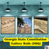
In this resource, there is a nonfiction reading passage based on general concepts of Geography such as maps, globes, latitude, longitude, hemisphere, and more. It is differentiated for your high, mid, and lower level students. Multiple choice and short answer questions and a writing prompt are included, along with an answer key. Integrate geography content with your reading texts and meet each reader's needs with this set. Aligned to Georgia Standards of Excellence but generic enough for any sta
Subjects:
Grades:
3rd - 6th
Types:
Also included in: Social Studies Passage Bundle interventions included
Showing 1-24 of 1,901 results

TPT is the largest marketplace for PreK-12 resources, powered by a community of educators.
IXL family of brands