
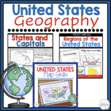
United States Map Skills | Latitude and Longitude | Compass Rose


- Google Drive™ folder

What educators are saying
Also included in
 This social studies product includes two interactive resources designed to engage your learners. Students can have some fun learning about the states, capitals, and regions, with task cards, puzzles, and map tasks. Click HERE to follow my store for more great products and sales. ❤️ U.S. Regions inclPrice $11.72Original Price $16.75Save $5.03
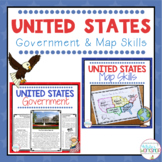 Engage your students in U.S. map skills with these United States physical map, political map, and regional map tasks. These map skills are perfect for small group centers and whole group social studies projects. Integrate federal, state, and local government into your ELA block! With vocabulary cardPrice $8.60Original Price $9.50Save $0.90
Description
Engage your students in U.S. map skills which include labeling political, physical, and regional maps, identifying cities and states on a map using lines of latitude and longitude, and comparing locations using cardinal and intermediate directions.
These map skills are perfect for small groups, centers, whole group social studies projects, homework, and substitute plans.
⭐️ PDF and Google Slides formats ⭐️
Follow my White's Workshop store for more great resources! ❤️
Includes:
PDF Version
8 Colorful vocabulary posters (1/2 page size)
3 Map task activities
- Label the states on a US political map
- Label the physical features of a US physical map
- Label the 5 regions and specific states within that regions
Worksheets:
- Latitude and Longitude worksheet
- Latitude and Longitude: Read Between the Lines
- Latitude and Longitude: State the Cities
- Intermediate and Cardinal Directions - political map (multiple choice)
- Intermediate and Cardinal Directions - political map (open response)
- Intermediate and Cardinal Directions - political map (open response)
- Intermediate and Cardinal Directions - physical map (multiple choice)
- You be the Teacher - students create the questions (political and physical maps)
Digital
Vocabulary Posters
Drag and drop vocabulary
3 Digital map task (drag and drop activities)
4 different United States maps (political, 2 physical, regional)
8 Worksheets
Answer Keys
If you have any questions, comments, or concerns, please email me at kjwhite2552@yahoo.com or reach out through the Q/A tab.
Here are other resources you will ❤️
Regions of the United States Worksheets
Regions of the United States Informational Text BUNDLE
Regions of the United States Informational Text and Activities
United States Map Skills Task Activities
Continents and Oceans Map SkillsRegions of the United States Worksheets
