Montessori: Imaginary Island Capstone Project (Upper Elementary)
Description
The Imaginary Island Study begins in the Children’s House with the introduction to the land and water forms. The work continues through the elementary years. In the upper elementary the child integrates all the former learning into one project. For the older child, the imaginary island is a culmination of the elementary geography study and synthesizes the concepts from a variety of geographical studies. The idea is to let the imagination take over, to put to work all of the ideas the child has been studying for the past five years and create an imaginary island that could conceivably exist in today’s world.
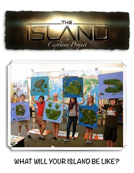
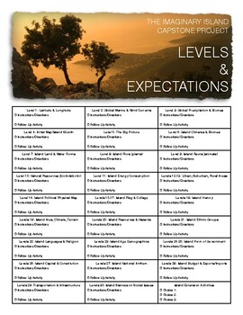
In the lessons that lead to the final project (the Imaginary Island) the child is asked to consider the parts of an island in isolation and is presented the rudiments of map making. In the final work the child is offered questions that will lead to creating a complete imaginary island. The island must be large enough to support a variety of life forms and all aspects must be realistic. For example, if the island is located in the North Temperate climate zone, the biomes, plants, and animals must fit the climate. The final portion of the project will be a 3D model along with a series of maps that illustrate the various aspects of the island. The maps are drawn to scale and are accompanied by explanation of the island’s flora and fauna and economic development. The study also entails producing a detailed CIA World Factbook analysis of the country/island. The project’s entire process presupposes a strong understanding of the major geography concepts taught in the elementary level and will require several months complete.
The concepts considered in the Imaginary Island Study can be posed as questions:
- What are the horizontal configurations of the coastline?
The child will consider the previous studies which included types of coastlines (low, high, irregular, regular), coastlines of emergence (peninsula, promontory, cape, point, spit, isthmus) and coastlines of submergence (gulf, fjord, bay, cover, harbor, channel, strait, artificial canal, and lagoon).
- What are the vertical configurations of the island?
The child will consider the surface of the island and its possible features, whether is will have plains,
mountains, hills valleys, etc.
- What types of hydrosphere does the island have?
The child will identify the oceans and/or seas surrounding the island. Inland water forms will depend on
other configurations.
- What is the size of the island?
The island should be at least the size of Australia or larger to give opportunity for a variety of land and water
configurations, natural resources, climate, vegetation, and animal life.
- What is the longitude and latitude of the imaginary island?
The child must be able to place the island on the globe.
- What winds affect the island?
The child will use maps of world wind currents to determine winds affecting his/her island.
- What ocean currents affect the island?
The child will use maps of world marine currents to determine ocean currents affecting his/her island.
- What is the precipitation on the island?
The child will use tables of annual precipitation to determine average precipitation on his/her island.
- In what climate zone(s) is the island?
Based on the previous determinants and research of neighboring landmasses, the child will determine
the types of climate.
- What are the biomes on the island?
Based on the land and water configurations, location, and climate the child will determine areas
of forest, grassland, desert, tundra, etc.
- What vegetation is indigenous to the island?
Based on climate and biomes, the child will determine possible species of flora.
- What animals are indigenous to the island?
Based on climate and biomes, the child will determine possible species of fauna.
- What are the island’s natural resources?
Based on the land and water configurations, the child will determine possible natural resources.
- How do the people meet their fundamental needs?
The child will consider how the island inhabitants meet their needs of: clothing, money, transportation,
communication, shelter, food, defense, and religion.
- Where do the people live?
The child will determine areas of habitation depending upon the previous decisions.


