Groundwater Fill-In-The-Blanks Diagram with Coloring Activity
Mountain Magic Science
108 Followers
Grade Levels
7th - 10th
Subjects
Resource Type
Standards
NGSS5-ESS2-2
NGSSMS-ESS3-1
NGSSHS-ESS3-1
Formats Included
- Zip
Pages
15 pages
Mountain Magic Science
108 Followers
What educators are saying
I utilized this as a reference for students when they were building their aquifer models and answering questions. Very useful and simplistic!
Description
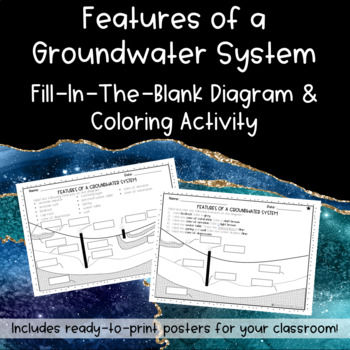
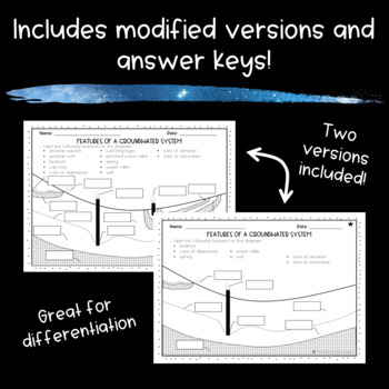
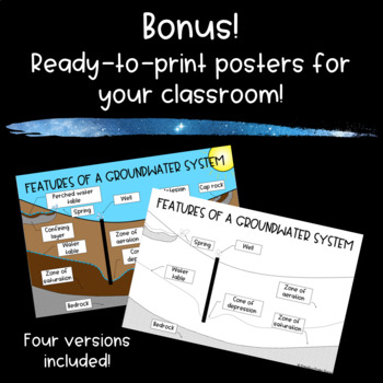
Looking for a clear diagram that shows the different parts of a groundwater system? Look no further. This download includes two versions of a fill-in-the-blank diagram, two versions of a coloring activity, and ready-to-print posters for your classroom!
This product includes a fill-in-the-blank diagram of the features of a groundwater system, including:
artesian aquifer*
artesian well*
bedrock
cap rock*
cone of depression
confining layer*
perched water table*
spring
water table
well
zone of aeration
zone of saturation
*not included on the modified version
Looking for more activities about groundwater systems?
Groundwater PowerPoint with Notes (Includes Google Slides for Distance Learning)
Total Pages
15 pages
Answer Key
Included
Teaching Duration
N/A
Last updated Jun 2nd, 2020
Report this resource to TPT
Reported resources will be reviewed by our team. Report this resource to let us know if this resource violates TPT’s content guidelines.
Standards
to see state-specific standards (only available in the US).
NGSS5-ESS2-2
Describe and graph the amounts of salt water and fresh water in various reservoirs to provide evidence about the distribution of water on Earth. Assessment is limited to oceans, lakes, rivers, glaciers, ground water, and polar ice caps, and does not include the atmosphere.
NGSSMS-ESS3-1
Construct a scientific explanation based on evidence for how the uneven distributions of Earth’s mineral, energy, and groundwater resources are the result of past and current geoscience processes. Emphasis is on how these resources are limited and typically non-renewable, and how their distributions are significantly changing as a result of removal by humans. Examples of uneven distributions of resources as a result of past processes include but are not limited to petroleum (locations of the burial of organic marine sediments and subsequent geologic traps), metal ores (locations of past volcanic and hydrothermal activity associated with subduction zones), and soil (locations of active weathering and/or deposition of rock).
NGSSHS-ESS3-1
Construct an explanation based on evidence for how the availability of natural resources, occurrence of natural hazards, and changes in climate have influenced human activity. Examples of key natural resources include access to fresh water (such as rivers, lakes, and groundwater), regions of fertile soils such as river deltas, and high concentrations of minerals and fossil fuels. Examples of natural hazards can be from interior processes (such as volcanic eruptions and earthquakes), surface processes (such as tsunamis, mass wasting and soil erosion), and severe weather (such as hurricanes, floods, and droughts). Examples of the results of changes in climate that can affect populations or drive mass migrations include changes to sea level, regional patterns of temperature and precipitation, and the types of crops and livestock that can be raised.


