TPT
Total:
$0.00

Coordinate Graph (Ordered Pairs) Project & Rubric "Design Your Town"

Rated 4.9 out of 5, based on 401 reviews
4.9 (401 ratings)
;
Poppy's Bell
185 Followers
Grade Levels
3rd - 8th, Homeschool
Subjects
Resource Type
Standards
Formats Included
  • PDF
Pages
5 pages
$3.00
$3.00
Share this resource
Report this resource to TPT
Poppy's Bell
185 Followers

What educators are saying

My students worked on their projects during workshop and were super engaged. They were excited to share their work with their classmates.
The students enjoyed creating their own town and being creative in they way they used their math knowledge.

Description

Coordinate Graph (Ordered Pairs) Project and Rubric

Design Your Town

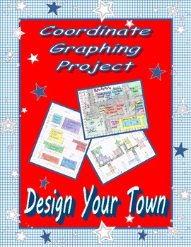
This fun project allows students to demonstrate their knowledge of coordinate graphing and ordered pairs by designing their own town. Instructions include requirements for minimum number of buildings, areas, and points in the town, which they must label. Students must also list coordinates for each item on a separate sheet of paper so it may be recreated, and they must write questions about the town they designed. I've included student samples you may use as a model.

All of my classes have really enjoyed this activity, and it is a great performance assessment for a coordinate graphing unit.

Included: directions, rubric, & student samples

I truly value all feedback and encourage you to contact me if you have any questions, comments, or suggestions for improvement.

Total Pages
5 pages
Answer Key
Rubric only
Teaching Duration
N/A
Report this resource to TPT
Reported resources will be reviewed by our team. Report this resource to let us know if this resource violates TPT’s content guidelines.

Standards

to see state-specific standards (only available in the US).
Use a pair of perpendicular number lines, called axes, to define a coordinate system, with the intersection of the lines (the origin) arranged to coincide with the 0 on each line and a given point in the plane located by using an ordered pair of numbers, called its coordinates. Understand that the first number indicates how far to travel from the origin in the direction of one axis, and the second number indicates how far to travel in the direction of the second axis, with the convention that the names of the two axes and the coordinates correspond (e.g., 𝘹-axis and 𝘹-coordinate, 𝘺-axis and 𝘺-coordinate).
Represent real world and mathematical problems by graphing points in the first quadrant of the coordinate plane, and interpret coordinate values of points in the context of the situation.

Reviews

Questions & Answers

185 Followers