
Cold War Map Activity: The Iron Curtain and Alliances (Color and Label!)


- PDF
What educators are saying
Also included in
 This is everything you need for an entire unit on the Cold War! Focusing on a US History perspective, this resource is complete with Guided Notes, a Prezi Presentation (a fun alternative to PowerPoint!), a Teacher Guide, and Assessments. It is aligned with state standards of US and American HistoryPrice $11.00Original Price $13.97Save $2.97
 Throw your back out? Need a mental health day (or days)? New to teaching US History? Or, simply... do you want to shift away from constant teacher-led instruction? Then this 400+ page bundle is a MUST for your classroom! Many of these resources will supplement US History units that you teach thPrice $21.95Original Price $37.49Save $15.54
 Take a break once in a while, or to be more precise, a few times per quarter! This US History "Make Life Easy Each Quarter" bundle will ease your lesson-planning burden throughout the school year by providing you with four entire units (one per quarter) and six additional time-saving resources! ThPrice $39.00Original Price $53.94Save $14.94
 Be ready for the school year with this massive bundle of US History resources, AND SAVE LOTS OF $$. My smaller "Make Life Easy" Bundles were created to give Social Studies teachers a hand when it comes to lesson planning and instructional preparation. This "Big Bundle" combines all of those resourPrice $59.95Original Price $95.68Save $35.73
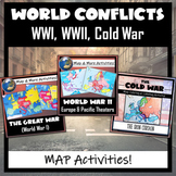 Three Global Conflicts- The Great War (WWI), World War II, and the Cold War, with FIVE different map coloring and labeling activities. Each resource comes with easy-to-follow student directions, follow-up map tasks or questions, and completed sample maps to use as reference. These are very easy fPrice $6.25Original Price $7.50Save $1.25
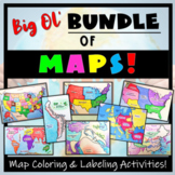 Humans love coloring- tap into your students' interests and apply it to your Social Studies and Geography lessons! 21 different map activities are available and cross many different social studies topics- like American History or Ancient Civilizations. All maps are completely student-centered andPrice $27.99Original Price $37.89Save $9.90
Description
Don't just show your students a map of the Iron Curtain, N.A.T.O. and the Warsaw Pact, have them make one! Each student will make their own, personalized map of Europe during the Cold War, and enhance their knowledge of the Democratic and Communist alliances. They will label and color their blank map, complete a "Fast Facts" section, and quiz themselves with an "I Can" self-assessment. A completed map is included, and a link to Google Compatible directions, questions, and a sample map has also been added.
Included:
- TWO blank maps of Europe (one with the countries labeled, and one without so that the students can label them).
- TWO sets of map coloring and labeling directions (one for each map).
- A "Fast Facts" section to complete
- An "I Can" identify countries and alliances self-assessment
- A completed map- colored and labeled- for reference
- A link to a Google version for 1:1 classrooms.
Want an ENTIRE Cold War unit, ready to use?? Click here for a US History classroom, or here for a World History classroom!
**Please give feedback (and you will earn TpT $$!), and ‘Follow Me’ so that you are the first to get updates and new products!
