Bundle: 13 Colonies & Backcountry Presentation + Doodle Notes + Mapping

Products in this Bundle (2)
Description
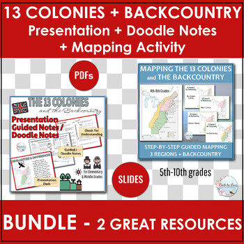
This BUNDLE: Bundle: 13 Colonies & Backcountry Presentation + Doodle Notes + Mapping is everything you need to teach the 13 Colonies! The following two resources are included in the bundle:
1) The 13 Colonies & The Backcountry: Presentation & Guided Notes / Doodle Notes®
Explore the 13 Colonies and the Backcountry with this comprehensive resource that combines engaging Doodle Notes / Guided notes, presentation slide deck, and evaluation. If you're searching for a way to deliver top-notch content while keeping your students actively engaged, your search ends here! The presentation deck exactly matches the Guided Notes / Doodle Notes, ensuring that as you guide your students through the material, they can easily fill in their notes to capture key information.
Additionally, the Guided Notes / Doodle Notes have lots of opportunities for doodling, higher level thinking, and memorable interactivity!
What you get:
- 59 slide presentation Google Slides* deck (No access to Google Drive required; you will be forced to make a copy)
- 20 slide Guided Notes / Doodle Notes in Google Slides* (perfect for electronic assignments)
- 20 page PDF Guided Notes / Doodle Notes for students to write on
- 3 pages PDF "Let's Recap" to be used as exit tickets, summative evaluation, or checking for understanding
- PDF Answer Key for Guided Notes / Doodle Notes
This resource package covers the foundational information about the 13 Colonies including hard-to-find materials on the Backcountry. Each region is thoroughly explored through the presentation slide deck. Introductory and background information about backers and sponsors and why people chose to come to North America is also included.
Topics explored:
- Background
- New England Colonies (including info about Jamestown and Plymouth)
- Middle Colonies
- The Backcountry
The information is divided into the THREE COLONIAL REGIONS (New England, Middle, and Southern Colonies) and THE BACKCOUNTRY. The following topics are developed for each region:
- Reasons for Settling
- How Governed Selves
- Geography
- Climate
- Resources, Products, Crops
- Economy/Jobs
- Interactions With Native People
- Cities and Challenges
The best part? There's virtually no prep work involved other than copying the notes sheet, (unless you prefer to assign it electronically, of course).
The student pages are expertly crafted in a Cornell Note format, with the left-hand column reserved for instructions, questions and responses, while the right-hand column provides space for filling in the blank notes as the teacher guides students through the presentation and doodling.
Additionally, the resource incorporates Guided Notes / Doodle Notes™: a skillful integration of words, images, numbers, and shapes for the purposes of learning. It is an approach that combines traditional methods with visual elements like drawings, diagrams, and icons.
The "Let’s Recap" pages are designed to help students consolidate their learning. These pages feature a variety of question types, including cause & effect, fill-in-the-blank, open-ended, multiple choice, fact or opinion, and choose-one questions. While teachers don't have to use all three pages, they serve as fantastic tools for checking understanding, as exit tickets, or even as a summative assessment.
Bring The 13 Colonies and the Backcountry to life in the classroom with this engaging, informative resource!
2) 13 Colonies Map + the Backcountry | Label and Color
The mapping activity includes a 27-slide Google Slides deck provides background information about the Colonies and the regions. The slides go step-by-step adding one region or label at a time for the teacher to guide the students through coloring and labeling the map. Physical features such as the Appalachian Mountains and the Atlantic Ocean are part of the labeling process as well.
Additionally, there are three different PDF maps of the 13 Colonies (teacher chooses which map to use) for the students to color and label.
Regions Included:
- New England Colonies
- Middle Colonies
- Southern Colonies
- The Backcountry
What You Get:
- 27 page Google Slides Deck
- 3 Thirteen Colonies Maps
- 1 blank map (For a challenge, quiz or exit ticket!)
- 1 labeled Colonies - 3 Regions Legend/Key
- 1 labeled Colonies - 3 Regions + Backcountry Legend/Key
This easy to use, no-prep activity is ready to use today!


