
Australian Map Display and Geography Activities


- Zip
Also included in
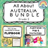 The ultimate bundle to help decorate your classroom and teach your Year 2 students about their connection to the world.Two of our best selling resources are included in this bundle: Year 2 Geography Flipbook and Australia Map and matching activities.The aim of these resources is for students to idenPrice $5.20Original Price $6.50Save $1.30
Description
A hand-drawn map display of Australia plus activity worksheets to teach your students about Australia’s States, Territories and Capital Cities.
This pack includes a large hand-drawn map of Australia for your classroom wall. We have broken the states and territories up to one per page. They are all scaled to size. You can print as is (on A4 paper) or print and enlarge to A3 for a larger map.
Resource Activity List:
- Each Australian State and Territory scaled to size to put together as a display map
- State/Territory and Capital City labels
- Map of Australia – State and Territory labelling task
- Map of Australia – State & Territory colour code + capital city labelling task
- Australia Fact File Task
- Australian State Mini Research Task
- Australian Map Puzzle Activities (4 activity variations)
- State and Territory emblems of Australia
- BONUS: Exit Tickets
Five activity pages are included to complement your lessons about Australia and its geography. There is a cut and paste activity, two researching tasks, as well as a hands-on, collaborative puzzle activity.
Provided is a table containing the state and territory emblems of Australia. This table could be used for students to challenge each other in recalling the facts or drawing/searching for the images of each emblem to add to the map. As a collaborative task allocate a state/territory to a group of students and have them find the image of each emblem to add to the class map.
Optional exit tickets are included to be used as a pretest or informal assessment.
----------------------------------------------------------------------
Terms of Use: Copyright of this material is reserved in accordance with the Copyright Act 1968. This purchase is for single classroom/home use only. Additional reproduction of part or all of this resource is prohibited without the written authority of Rainbow Sky Creations. All content and clipart in these files have been created by Rainbow Sky Creations and therefore remain the property of Rainbow Sky Creations.
****************************************************
Contact: If you have any feedback, queries, or concerns, please don’t hesitate to contact us via the online form or at admin@rainbowskycreations.com
If you love this resource, we would LOVE you to leave us some feedback!
********************************************
Follow us on Facebook or Instagram or Pinterest for more teaching resources and inspiration!
Thanks for visiting!
