43 results
2nd grade Earth Day geography resources for ActiveInspire Flipchart
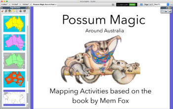
Possum Magic around Australia map - activinspire (PROMETHEAN)
Activities based on the Classic Australian Book POSSUM MAGIC. An interactive Presentation that you can use with a class, small group during literacy Groups or by individuals. You can print off to keep a record of understanding.
-Geograph
-Location
-Direction
Subjects:
Grades:
K - 2nd
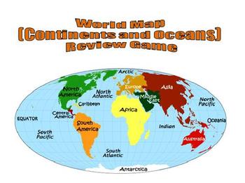
World Map (Continents and Oceans) Review Game - Promethean Flipchart
This 1-page Promethean flipchart helps students learn the location of the continents and oceans through a container game. Students can drag and drop continent and ocean names to their proper locations, with incorrect answers being "kicked" back. This flipchart can easily be used as a whole-group or small-group activity.
Subjects:
Grades:
1st - 8th
Map Scale Activity for Promethean Board
This is an interactive map scale activity for users of Promethean boards. Students are introduced to the concept of map scale and shown an example. Then, students visit a town and use the onscreen ruler tool (found under math tools) to measure the distance between points in inches. Students convert inches to the unit found on the map scale.
Two different map scale activities are included - one with inches converting to miles, the other with inches converting to yards.
You will need Activinsp
Subjects:
Grades:
2nd - 3rd
Types:
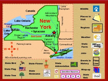
All About New York State
This is a flipchart file about the state of New York. It is intended as an introduction to the state. It contains state symbols, places of interest, fun facts, regions, history, jobs, wildlife, and more.
It includes 2 wrap up activities, quizzes, worksheets, and video clips. Teacher notes and suggested uses are also included as are some answer keys. It can be modified to suit your classroom's needs.
Grades 2-5
A FLIPCHART file is a presentation created with ActivInspire, an educational lesson
Subjects:
Grades:
2nd - 5th
Types:
Earth Day Earth Conservation Classroom Feud flipchart
This game is created using ActivInspire. It is very interactive and students will enjoy playing this family feud game using Earth conservation questions about recycling, ecofriendly choices, and endangered animals. This is not only a game but each question has a link to a website that has games, videos, songs, and factual information about the topic!! Students will have so much fun and learn so much! Be sure to read the page notes so you know how to operate the pages to play the game.
If yo
Subjects:
Grades:
2nd - 8th
Types:
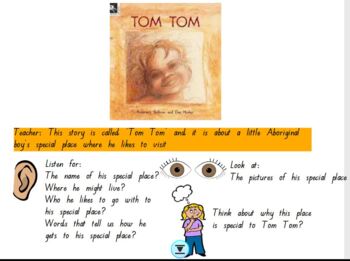
HASS Prep 'Tom Tom' by Rosemary Sullivan and Dee Huxley
This is a FlipChart for Interactive Whiteboards.This is based on the book Tom Tom for Prep HASS (My Special Place). This is a great task for online learning and also to engage the whole class. There are numerous interactive activities to help the student's engage with the task. It also introduces the concept 'bird's eye view' by using a kookaburra flying over Tom Tom's town. The students have to label the map and also engage with the story about Tom's special place and their own special places.
Grades:
PreK - 2nd
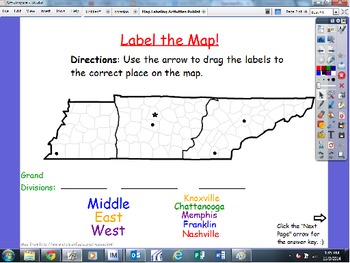
Map Labeling Activities: Continents, North America, USA, Tennessee
This flipchart has 4 different activities, with answer key slides.
1) Labeling major cities in Tennessee
2) Labeling TN on the USA map, and filling in the blank for the name of our country
3) Labeling major countries/areas of North America
4) Labeling the 7 continents
Let us know if you have any questions! Enjoy! :)
~Megan and Jenn
Map Labeling Activities: Continents, North America, USA, Tennessee by Megan and Jenn in First is licensed under a Creative Commons Attribution-NonCommercial-NoDe
Subjects:
Grades:
1st - 3rd
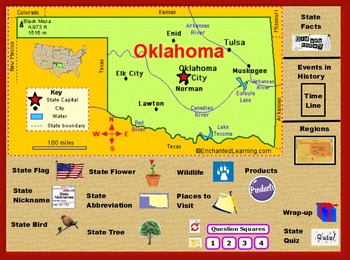
All About the State of Oklahoma
This is a flipchart file about the state of Oklahoma. It is intended as an introduction to the state. It contains state symbols, places of interest, fun facts, regions, history, wildlife, and more.
It includes 2 wrap up activities, quizzes, worksheets, and video clips. Teacher notes and suggested uses are also included as are some answer keys. It can be modified to suit your classroom's needs.
Grades 2-5
Subjects:
Grades:
2nd - 5th
Types:
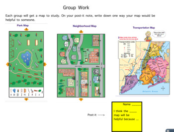
2nd Grade Social Studies Geography Map lesson on map keys and compass rose
This is an interactive flipchart (can be used on smartboard too) that combines lesson 1 and lesson 2 from the NYC Scope and Sequence.
Subjects:
Grades:
2nd
2nd Grade Geography Unit Flipchart
Interactive geography unit Flipchart introduces geography and it's key parts! Great for all ages, but made to cover all 2nd grade standards. Excellent interactive piece to excite students about learning geography!
*15 slides!
*Topics included: Geography, compass rose, maps, continents, countries, states, cities and more!
If you like this product, try:
Weather Unit Plan & Flipchart
Matter Unit Plan & Flipchart
Writing Unit Plans & Flipcharts
Subjects:
Grades:
1st - 4th
All About the Compass Rose Promethean Activinspire Flipchart Lesson
With this flipchart, your students will learn where the Cardinal and Intermediate directions are located on a Compass Rose.
This flipchart is highly interactive with containers, restrictors, interactive games and activities, plus an assessment.
Your students will be sure to love learning directions with this lesson. Enjoy!
Grades:
1st - 5th
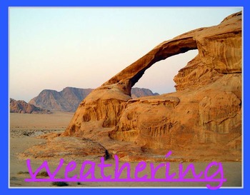
Weathering
Lesson about types of weathering. It includes how ice weathering, water weathering and wind weathering occur. It is interactive and has pictures and video links to engage all learning styles. A lesson the could prelude erosion. It has page notes to help the teacher with a suggested activity at the end.
Weathering by Mike Bailey is licensed under a Creative Commons Attribution 4.0 International License.
Subjects:
Grades:
2nd - 9th

Exploring China with Our Five Senses! Promethean Flipchart
Every Friday with my first graders, we "travel" to a new country. We use our five senses to explore the country. After we explore, we do a cultural activity related to the visited country. At the end of the lesson they each get their passports stamped.
Enjoy your way seeing, hearing, tasting, smelling and touching through CHINA!
Subjects:
Grades:
K - 5th
Types:

Super Holidays Flipchart for Activ Board
This is a flipchart I have used for Christmas Around the World with my class. Each country has the following:
Map
Pictures
Current weather (click on the icon)
Facts-Santa, Cultural Figures, Foods, and traditions
**Please note, pictures are from google images and are linked to sites such as travel websites. Do not reproduce.
**Also it is important to stress that the information for each country is from research done from Santa Net, Travel websites for each country, personal narratives from teac
Grades:
1st - 10th

Earth Day Conservation Deal or No Deal game flipchart
This flipchart is very interactive and students REALLY enjoy reviewing Earth Day /conservation concepts with this game show theme. It has sound effects and music from the game which the students find so fun! It was created using ActivInspire. You may use with activotes, activexpressions, or use dry erase boards. See page notes for answers. Some questions have more than one answer.
I also have this same flipchart in my store as a regular activote without the Deal or No Deal game theme. If
Subjects:
Grades:
2nd - 8th
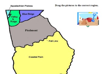
GA Land Regions
This flipchart includes multiple interactive features, including 2 labeling activities and an independent activity ideas. This also includes a link to a video that shows multiple land form pictures of GA.
Subjects:
Grades:
2nd - 3rd
Types:
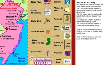
All About New Jersey State
This is a flipchart file about the state of New Jersey. It is intended as an introduction to the state. It contains state symbols, places of interest, fun facts, regions, history, jobs, wildlife, and more.
It includes 2 wrap up activities, quizzes, worksheets, and video clips. Teacher notes and suggested uses are also included as are some answer keys. It can be modified to suit the needs of your classroom.
Grades 2-5
Subjects:
Grades:
2nd - 5th
Types:
Earth Day activote flipchart
This flipchart is great for reviewing Earth Day /conservation concepts. It was created using ActivInspire. You may use with activotes, activexpressions, or use dry erase boards. See page notes for answers. Some questions have more than one answer. Students have fun reviewing with this flipchart!
I have this same flipchart in my store in the Deal or No Deal game show theme if you prefer to make it more fun with a game theme.
It is also available as a powerpoint in my store if you do not hav
Subjects:
Grades:
1st - 4th
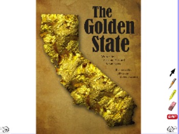
Golden State - ActivInspire Flipchart - Projectable Big Book
Readers can learn about California from this informational text, The Golden State, which includes interesting facts and features about the state. By showcasing the diversity of a single state, the book offers engaging content for readers from any state. Developed to CCSS-ELA. Companion printable leveled reader available at TpT.
This work is licensed under a Creative Commons Attribution-NonCommercial 3.0 Unported License.
Subjects:
Grades:
2nd - 4th
Earth Day sort flipchart
This fun activity is a container/sort activity flipchart made with Activinspire software. Students decide whether the word or phrase are good or bad for the Earth and drag the word or phrase to the correct globe. If it belongs there a sound will play. If it doesn't belong there then the word or phrase will bounce back.
Subjects:
Grades:
1st - 4th
Explore Scotland with your Five Senses (Promethean Presentation)
Every Friday for a Fun Friday activity we travel to another country! My first graders have passports that I stamp after each visit. We take about 45 minutes to use our fives senses to explore the country on the board. This includes an activity at the end.
The Scotland one features what you would see, hear, taste, smell and touch in Scotland. The game is called Bools Marble Game which is a fun game where students try to earn as many marbles as they can. The kids love it!
Enjoy!
Subjects:
Grades:
K - 5th
Types:
Our World on Interactive Whiteboard
This is a Geography flip chart that takes students through the continents, maps, and oceans. Music has been attached to some of the pages. Students will be able to manipulate the chart to complete tasks using a pen or a mouse.
Subjects:
Grades:
K - 2nd
Fifty States
Here's a great little flipchart for teaching the 50 States by region. It's simple, easy to use and interactive. Also included are printable region maps and a United States map.
Subjects:
Grades:
1st - 5th
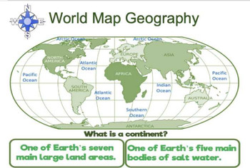
World Map Geography Flipchart
World map that covers geography vocabulary- continents, oceans, compass rose, cardinal directions, equator, prime meridian, and hemispheres. Circle the correct answer. Twenty-two question slides and 22 answer slides. Three geography riddles at the end of the slides.Flipchart file -uses Activinspire software to open.
Subjects:
Grades:
1st - 3rd
Showing 1-24 of 43 results


