35 results
5th grade geography cultural activity images
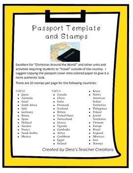
"Around the World" Passport Template and Stamps
This set jam-packed with a template for a passport and destination stamps for 40 countries. More stamps here.
The passport template includes the outer cover and inside cover with your choice of 2 reflections prompts to be completed at the end of your "travels".
There are 20 stamps per page for the following countries in full color:
• Japan
• Australia
• Israel
• South Africa
• Italy
• Germany
• Russia
• Spain
• Holland
• Sweden
• France
• Saudi Arabia
• Mexico.
• Canada
• China
• India
• Denm
Grades:
1st - 12th
CCSS:
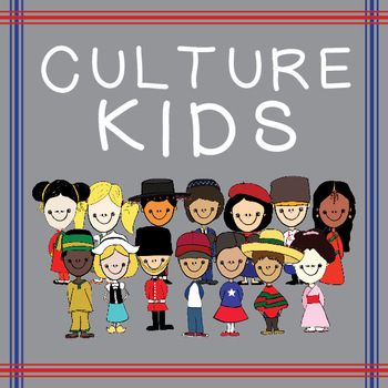
Culture Kids from Around the World!
This product includes 28 .png images of children from around the world!
There are 14 children representing 13 countries.
America (Boy & Girl/ racially ambiguous)
China (G)
England (B)
France (G)
Germany (G)
Holland (G)
India (G)
Israel (B)
Japan (G)
Mexico (B)
Nigeria (B)
Russia (B)
Spain (B)
Teach your children about other cultures from around the world with these children in their cultures traditional clothing.
You can use these however you'd like, just please be sure to credit me in t
Subjects:
Grades:
PreK - 6th
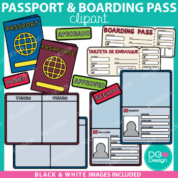
Passport And Boarding Pass Clipart & Editable File {FREEBIE}
Thank you so much for supporting my shop and providing me with wonderful feedback. I really appreciate you. I hope you enjoy this freebie! All of my fun FREEBIES are announced on my Instagram @dammgooddesign follow me to be the first to know about all the deals. - KelsieThis resource is so much more then just clipart. It includes and editable PowerPoint file so you can add your students name, photos, and travel stamps to the passports. These passports are a fun way to let your students "travel".
Subjects:
Grades:
3rd - 6th
Types:
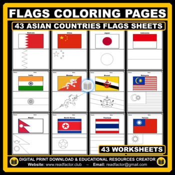
Asian Countries Flags Coloring Pages - 43 Worksheets
Let your kids or your class students Have fun learning about the countries of Asia with these flags coloring pages (Countries geographically located in Asia).HERE ARE SOME BENEFITS OF COLORING:1. Improves Motor Skills2. Prepares Them for School3. Stimulates Creativity4. Contributes to Better Handwriting5. Teaches Color Awareness, Recognition, and Discernment6. Improves Focus and Hand to Eye Coordination7. Helps Learn about Boundaries, Structure, and Spacial Awareness8. Improves Confidence and Se
Grades:
PreK - 6th
Also included in: Flags of the World BUNDLE Coloring Pages - 193 Worksheets
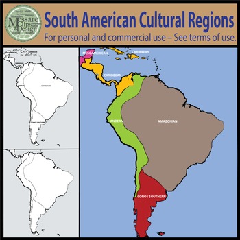
Map Clipart: South American Native Cultural Regions {Messare Clips and Design}
This South America, Native American Cultural Regions Map set contains 14 individual high resolution graphics/maps.
All maps can be scaled to 17 x 22 inches and retain their quality.
The set contains two black and white maps with identified regions. All maps come in a labeled and non-labeled version.
Regions Identified in the South America Native American Map Set:
Amazonian Region
Andean Region
Cono-Southern Region
Caribbean Region
Mesoamerican
See similar products:
Click to see the Nor
Grades:
PreK - 9th
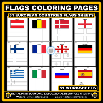
European Countries Flags Coloring Pages - 51 Worksheets
Let your kids or your class students Have fun learning about the countries of Europe with these flags coloring pages (51 countries geographically located in Europe).HERE ARE SOME BENEFITS OF COLORING:1. Improves Motor Skills2. Prepares Them for School3. Stimulates Creativity4. Contributes to Better Handwriting5. Teaches Color Awareness, Recognition, and Discernment6. Improves Focus and Hand to Eye Coordination7. Helps Learn about Boundaries, Structure, and Spacial Awareness8. Improves Confidence
Grades:
PreK - 6th
Also included in: Flags of the World BUNDLE Coloring Pages - 193 Worksheets
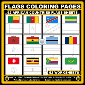
African Countries Flags Coloring Pages - 52 Worksheets
Let your kids or your class students Have fun learning about the countries of Africa with these flags coloring pages (52 countries geographically located in Africa).HERE ARE SOME BENEFITS OF COLORING:1. Improves Motor Skills2. Prepares Them for School3. Stimulates Creativity4. Contributes to Better Handwriting5. Teaches Color Awareness, Recognition, and Discernment6. Improves Focus and Hand to Eye Coordination7. Helps Learn about Boundaries, Structure, and Spacial Awareness8. Improves Confidence
Grades:
PreK - 6th
Also included in: Flags of the World BUNDLE Coloring Pages - 193 Worksheets
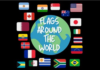
Flags Around The World- Jumbo Cards
Flags Around The World!!These Jumbo Cards contain 87 countries! Perfect for social studies and fun learning activities!!
Grades:
PreK - 12th, Higher Education, Adult Education
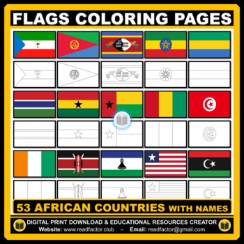
Flags Coloring Pages of African Countries with Names
Let your kids or your class students Have fun learning about the countries of Africa with these flags coloring pages (53 countries geographically located in Africa).HERE ARE SOME BENEFITS OF COLORING:1. Improves Motor Skills2. Prepares Them for School3. Stimulates Creativity4. Contributes to Better Handwriting5. Teaches Color Awareness, Recognition, and Discernment6. Improves Focus and Hand to Eye Coordination7. Helps Learn about Boundaries, Structure, and Spacial Awareness8. Improves Confidence
Grades:
PreK - 6th
Also included in: BUNDLE Countries of the World Flags Coloring Pages with Names
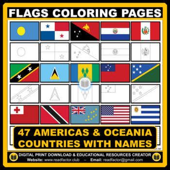
Flags Coloring Pages of Americas & Oceania Countries With Names
Let your kids or your class students Have fun learning about the countries of the Americas & Oceania with these flags coloring pages (Countries geographically located in America & Oceania).HERE ARE SOME BENEFITS OF COLORING:1. Improves Motor Skills2. Prepares Them for School3. Stimulates Creativity4. Contributes to Better Handwriting5. Teaches Color Awareness, Recognition, and Discernment6. Improves Focus and Hand to Eye Coordination7. Helps Learn about Boundaries, Structure, and Spacial
Grades:
PreK - 6th, Higher Education
Also included in: BUNDLE Countries of the World Flags Coloring Pages with Names
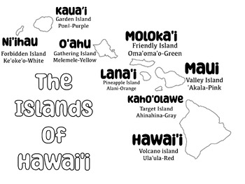
Names, Colors and Nicknames of Hawaiian Island Coloring Sheet
A Coloring sheet of the Hawaiian Islands including each islands Official Color and Nickname. Activity Idea:Use white air-dry clay and have students fill each island with the clay. Make sure they include texture, mountains and ridges on each island. with washable markers have students color each island their respective Official color. If you don't have access to air-dry clay, you can have students make "clay-dough" using:2 cups flour1 cup salt1 cup waterMix and useclay can be set out to dryThis l
Subjects:
Grades:
PreK - 5th
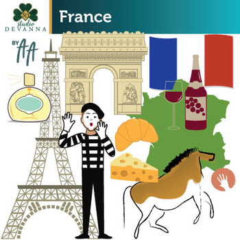
France Clip Art
20 piece France clip art set. Includes images related to French culture including architecture, food and products.The set includes 10 PNG color illustrations, and 10 PNG grayscale versions. These are high resolution (300 dpi) transparent background graphics. No watermarks will appear on the files that you download. The clip art illustrations measure approximately 6 inches to preserve image quality when re-sizing. Included are the following:● Arc De Triomphe● Cheese● Croissant● Eiffel Tower●
Subjects:
Grades:
PreK - 5th
Also included in: Europe - France, Germany, Italy, Spain - Clip Art Bundle
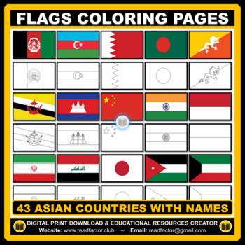
43 Flags Coloring Pages of Asian Countries With Names
Let your kids or your class students Have fun learning about the countries of Asia with these flags coloring pages (43 countries geographically located in Asia).HERE ARE SOME BENEFITS OF COLORING:1. Improves Motor Skills2. Prepares Them for School3. Stimulates Creativity4. Contributes to Better Handwriting5. Teaches Color Awareness, Recognition, and Discernment6. Improves Focus and Hand to Eye Coordination7. Helps Learn about Boundaries, Structure, and Spacial Awareness8. Improves Confidence and
Grades:
PreK - 6th
Also included in: BUNDLE Countries of the World Flags Coloring Pages with Names
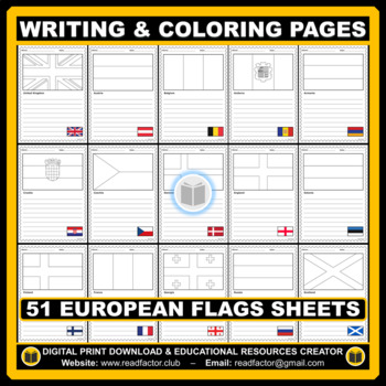
Writing and Coloring EUROPEAN Flags Worksheets
Coloring and Writing European Flags Worksheets (Countries geographically located in Europe).We really appreciate you purchasing our digital resources and we hope you'll enjoy using them.Please FOLLOW US if you'd like to receive notifications when we upload new products and freebies.DOWNLOAD. PRINT. DONE!RATING AFTER DOWNLOADING IS VERY APPRECIATED.
Grades:
PreK - 6th
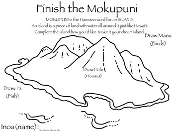
Create your own Island Work Sheet
Print and use this worksheet to have students finish the island. Add fish, birds, houses.. anything they'd like!
Subjects:
Grades:
PreK - 5th
"Around the World" Passport Stamps SET 2 (Add-On)
A NEW STAMP SET TO COMPLEMENT THE POPULAR "Around the World Passport Template and Stamps set.
This new add-on set contains ONLY destination stamps for countries and regions around the world.
There are 20 stamps per page for the following countries in full color:
• Tibet
**More to come! Send me suggestions for any countries you require for your around the world needs!**
These stamps can be cut and pasted into any passport. The stamps are country-specific and therefore can be used for more th
Grades:
1st - 12th
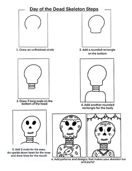
Day of the Dead Skeleton
A simple way to draw a skeleton to teach your students about Day of the Dead. Day of the Dead is a Mexican holiday (although it can be celebrated all over the world) where people honor and remember family members who have died. This holiday is celebrated on Nov. 1 and 2.
Subjects:
Grades:
2nd - 5th
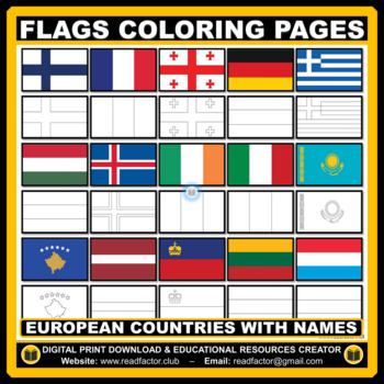
Flags Coloring Pages of European Countries with Names
Let your kids or your class students Have fun learning about the countries of Europe with these flags coloring pages (Countries geographically located in Europe).HERE ARE SOME BENEFITS OF COLORING:1. Improves Motor Skills2. Prepares Them for School3. Stimulates Creativity4. Contributes to Better Handwriting5. Teaches Color Awareness, Recognition, and Discernment6. Improves Focus and Hand to Eye Coordination7. Helps Learn about Boundaries, Structure, and Spacial Awareness8. Improves Confidence an
Grades:
PreK - 6th
Also included in: BUNDLE Countries of the World Flags Coloring Pages with Names
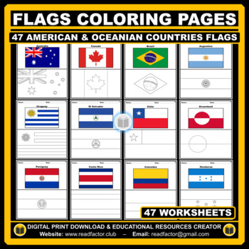
American and Oceanian Countries Flags Coloring Pages - 47 Worksheets
Let your kids or your class students Have fun learning about the countries of the Americas & Oceania with these flags coloring pages (Countries geographically located in America and Oceania).HERE ARE SOME BENEFITS OF COLORING:1. Improves Motor Skills2. Prepares Them for School3. Stimulates Creativity4. Contributes to Better Handwriting5. Teaches Color Awareness, Recognition, and Discernment6. Improves Focus and Hand to Eye Coordination7. Helps Learn about Boundaries, Structure, and Spacial A
Grades:
PreK - 6th
Also included in: Flags of the World BUNDLE Coloring Pages - 193 Worksheets
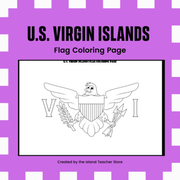
U.S. Virgin Islands Flag Coloring Page
Introduce your students to the flag of the U.S. Virgin Islands with this coloring page. This coloring flag is perfect for your lesson about the U.S. territories.This resource includes: ✏ Coloring page ✏ No prep! Simply print and distribute. If you liked this product, you might also like: ✏ Related Products• U.S. Virgin Islands Map Coloring Page• U.S. Virgin Islands Stilt Dancers Coloring Page• U.S. Virgin Islands Traditional Dancers Coloring PagePlease download the preview to view a sample
Grades:
K - 5th
Panda Bear Eye Mask (sewing template)
Supplies Needed:Black, white, and red feltSmall button (for nose)Black, white, and red threadNeedleElastic band spool (you can get at your local craft store, or on Amazon. The one I used I got on Amazon, click here for exact product.)What to do:Download templatePrint template on heavy duty paper, like card stockCut out pieces to use as stencilsUsing white colored pencil, trace semi-circles and large circles on black feltUsing a pen or marker, trace hearts on red feltUsing a pen or marker, trace
Subjects:
Grades:
3rd - 6th
Also included in: Panda Bear Sewing Bundle
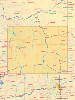
Wyoming map with cities township counties rivers roads labeled
Wyoming map with cities township counties rivers roads labeledThis download contains files that may be printed and copied or used digitally.___________________________________________________________________World City MapsBooksPinterestInstagramFacebookTikToK
Subjects:
Grades:
4th - 12th, Higher Education
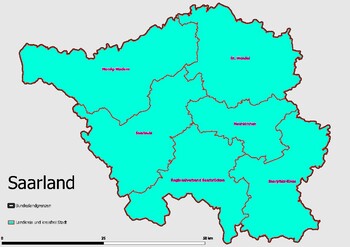
Map Administrative Structure Federal State Saarland
Map Administrative Structure Federal State SaarlandThe administrative structure of the federal state of Saarland is composed of three layers: the federal government, the state government, and the local government. The executive branch of the federal government is headed by the Federal President and is composed of the Federal Ministries and Federal Agencies. The state government is headed by the Minister-President and is composed of the State Ministries and State Agencies. The local government is
Subjects:
Grades:
4th - 12th, Higher Education, Staff

India Bollywood sign
Welcome to India / Bollywood sign. Fun poster for unit on India.
Subjects:
Grades:
PreK - 8th
Showing 1-24 of 35 results


