
Maps of North America: Montessori Map or Geography Activities


- PDF
What educators are saying
Also included in
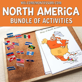 Use this Montessori North America bundle to create engaging activities that your students will love! You can use these cards to teach children how the flags of North American countries look, food from Canada and Mexico, and even more! This Montessori North America Bundle also includes several lifePrice $31.00Original Price $62.00Save $31.00
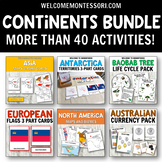 Use this comprehensive Montessori Continents Bundle to create engaging activities that your students will love! You can use these cards to teach children how the flags of different countries look, food from different continents, plant and animal life cycles, and even more!This bundle will help you tPrice $99.50Original Price $176.75Save $77.25
Description
Use these maps of North America to create hands-on geography activities for your students. These maps and activities are ideal for a Montessori primary classroom and lower elementary aged students.
Use the maps provided to offer a variety of activities to your students. The teacher instructions included in this pack offer ideas for crafts and different hands-on activities you can present to your class.
Children can label the maps with the countries or capital cities. Control maps, color and black and white maps are all included.
Pin map and flags are also included! Children can match the flags to the corresponding countries. Instructions are provided for making pin flags. On the back of each flag is the name of the country and its capital city.
Several pin poking variants are also provided. Children can punch out the continent of North America. After the children have punched out the continent, you can store it for later use to make a map of the world.
Make it more difficult by offering the pin poking map that features the countries of North America separately. The children can punch out each country, glue them onto a piece of paper, and then make labels for each country.
Introduce the different biomes that are present in North America. You can study the biome map provided in the Maps of North America Pack. The children can study the coloured map, and then make their own.
... and more!
⏩⏩If you need more geography activities, consider our $$ Saving North America Bundle to complete your study of North America. ⏪⏪
Maps of North America Pack Includes:
- Instructions and Tips for Hands-on Activities
- Map of North America with countries labeled (color)
- Map of North America with not labeled (color)
- Black and white maps labeled
- Blank Map of North America (black and white)
- Map - no countries for pin poking or craft templates
- Biomes maps
- Lacing template
- Flags pin map and tutorial
- Map with flags
- Map with capital cities labeled
More Geography Activities
- Flags of South America Up-Close Cards
- Flags of North America Up-Close Cards
- Asia Theme Bundle
- Beautiful Places in China 3 Part Cards
✨ Please follow our shop to be the first to be notified about new resources or special deals! ✨
For questions and inquiries, please contact us at: admin@welcometomommyhood.com
Please note: if you are a member of the Hand-on Kids Activities Club, this material is in your North America Theme.
