TPT
Total:
$0.00

Indian Removal Act & Trail of Tears MAP activity: engaging step-by-step lesson

Rated 4.77 out of 5, based on 337 reviews
4.8 (337 ratings)
;
Standards
Formats Included
  • Zip
  • Google Appsâ„¢
Pages
1 page and 25 slides
$6.30
List Price:
$8.00
Bundle Price:
$7.00
You Save:
$1.70
$6.30
List Price:
$8.00
Bundle Price:
$7.00
You Save:
$1.70
Share this resource
Report this resource to TPT
Includes Google Appsâ„¢
The Teacher-Author indicated this resource includes assets from Google Workspace (e.g. docs, slides, etc.).

What educators are saying

The step by step directions and accompanying visuals were fantastic. The students were able to accurately create the map. They had a better understanding of the movement of the Native Americans.
This activity went well with the Indian Removal Act that we were discussing during the Age of Jackson Unit. I used the map as a printable worksheet and had the students fill out the map while I went through the slides. The students really enjoyed the hands-on activity that this helped with.
Also included in
  1. THIS IS A MUST-HAVE FOR ANY TEACHER LOOKING TO MAKE THE EVENTS OF INDIAN REMOVAL AND THE TRAIL OF TEARS ACCESSIBLE AND VISUALIZED ON A MAP. STUDENTS FOLLOW ALONG WITH SIMPLE STEP-BY-STEP DIRECTIONS TO CREATE THEIR OWN DETAILED MAPS BY THE END. ***GOOGLE COMPATIBLE*** 1) Drag and Drop the Word Doc
    Price $11.70Original Price $17.49Save $5.79

Description

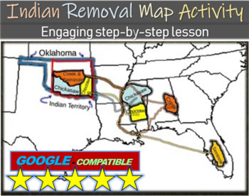
THIS IS A MUST-HAVE FOR ANY TEACHER LOOKING TO MAKE INDIAN REMOVAL AND THE TRAIL OF TEARS EASY TO UNDERSTAND AND VISUALIZE ON A MAP. STUDENTS FOLLOW ALONG WITH SIMPLE STEP-BY-STEP DIRECTIONS TO CREATE THEIR OWN DETAILED MAPS BY THE END.

***GOOGLE COMPATIBLE***

1) Drag and Drop the PowerPoint into Google Drive

2) Then Go to "FILE", and "SAVE AS GOOGLE SLIDES"

This download comes with a blank map of the Southern United States in both PDF and MS WORD format, AND a 25-slide PowerPoint that guides students in adding relevant information to their maps.

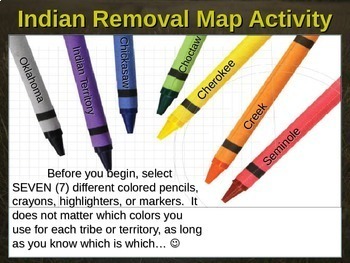
By the end of the lesson, students will have a color-coded map of former territories, trail locations, and new Oklahoma Indian Territories of the Five Civilized Tribes (Choctaw, Chickasaw, Cherokee, Seminole, Creek). There is also a writing prompt with key terms for students to put on the back of their maps. Enjoy!

***Now also includes an original word sort activity with three levels of difficulty for easy differentiated instruction (PowerPoint slides, printable handouts, & answer key)

***Designed for classrooms, ideal for distance learning as well #distancelearningTpT

Total Pages
1 page and 25 slides
Answer Key
Included
Teaching Duration
45 minutes
Report this resource to TPT
Reported resources will be reviewed by our team. Report this resource to let us know if this resource violates TPT’s content guidelines.

Standards

to see state-specific standards (only available in the US).
Add audio recordings and visual displays to presentations when appropriate to enhance the development of main ideas or themes.
Pose and respond to specific questions by making comments that contribute to the discussion and elaborate on the remarks of others.
Include multimedia components (e.g., graphics, sound) and visual displays in presentations when appropriate to enhance the development of main ideas or themes.
Integrate visual information (e.g., in charts, graphs, photographs, videos, or maps) with other information in print and digital texts.

Reviews

Questions & Answers