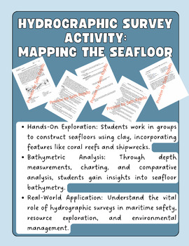
Hydrographic Survey Activity: Mapping The Seafloor (Hands-On)
Seth Rojello
11 Followers
Grade Levels
6th - 12th, Higher Education, Adult Education, Homeschool
Subjects
Resource Type
Standards
NGSSHS-ESS2-4
NGSSMS-ESS2-2
NGSSMS-ESS2-4
NGSSHS-ESS2-2
Formats Included
- PDF
Pages
12 pages
Seth Rojello
11 Followers
Description
Hydrographic Survey Activity: Mapping the Seafloor - NGSS Aligned
Transform your classroom into an oceanic exploration center with this engaging Hydrographic Survey Activity. Students will delve into the world of hydrography, exploring the methods used to map the seafloor, understanding the importance of accurate charts for maritime safety, resource exploration, and environmental management.
Key Features:
- Hands-On Exploration: Students work in groups to construct seafloors using clay, incorporating features like coral reefs and shipwrecks.
- Bathymetric Analysis: Through depth measurements, charting, and comparative analysis, students gain insights into seafloor bathymetry.
- Real-World Application: Understand the vital role of hydrographic surveys in maritime safety, resource exploration, and environmental management.
- Safety Emphasis: Adheres strictly to safety measures, ensuring a secure learning environment.
Teacher Tips:
- Foster group collaboration with safety guidelines and continuous supervision.
- Encourage critical thinking with analysis questions exploring accuracy and challenges faced during the activity.
- Aligns with NGSS, providing a comprehensive Earth science learning experience.
Ignite your students' curiosity about the depths of the ocean and the science behind hydrographic surveys with this immersive and educational activity. Engage them in the wonders of mapping the seafloor while meeting NGSS standards for middle and high school. Dive into hydrography today!
Total Pages
12 pages
Answer Key
Included
Teaching Duration
N/A
Report this resource to TPT
Reported resources will be reviewed by our team. Report this resource to let us know if this resource violates TPT’s content guidelines.
Standards
to see state-specific standards (only available in the US).
NGSSHS-ESS2-4
Use a model to describe how variations in the flow of energy into and out of Earth's systems result in changes in climate. Examples of the causes of climate change differ by timescale, over 1-10 years: large volcanic eruption, ocean circulation; 10-100s of years: changes in human activity, ocean circulation, solar output; 10-100s of thousands of years: changes to Earth's orbit and the orientation of its axis; and 10-100s of millions of years: long-term changes in atmospheric composition. Assessment of the results of changes in climate is limited to changes in surface temperatures, precipitation patterns, glacial ice volumes, sea levels, and biosphere distribution.
NGSSMS-ESS2-2
Construct an explanation based on evidence for how geoscience processes have changed Earth’s surface at varying time and spatial scales. Emphasis is on how processes change Earth’s surface at time and spatial scales that can be large (such as slow plate motions or the uplift of large mountain ranges) or small (such as rapid landslides or microscopic geochemical reactions), and how many geoscience processes (such as earthquakes, volcanoes, and meteor impacts) usually behave gradually but are punctuated by catastrophic events. Examples of geoscience processes include surface weathering and deposition by the movements of water, ice, and wind. Emphasis is on geoscience processes that shape local geographic features, where appropriate.
NGSSMS-ESS2-4
Develop a model to describe the cycling of water through Earth’s systems driven by energy from the sun and the force of gravity. Emphasis is on the ways water changes its state as it moves through the multiple pathways of the hydrologic cycle. Examples of models can be conceptual or physical. A quantitative understanding of the latent heats of vaporization and fusion is not assessed.
NGSSHS-ESS2-2
Analyze geoscience data to make the claim that one change to Earth’s surface can create feedbacks that cause changes to other Earth systems. Examples should include climate feedbacks, such as how an increase in greenhouse gases causes a rise in global temperatures that melts glacial ice, which reduces the amount of sunlight reflected from Earth’s surface, increasing surface temperatures and further reducing the amount of ice. Examples could also be taken from other system interactions, such as how the loss of ground vegetation causes an increase in water runoff and soil erosion; how dammed rivers increase groundwater recharge, decrease sediment transport, and increase coastal erosion; or how the loss of wetlands causes a decrease in local humidity that further reduces the wetland extent.


