Graphing Seismic Waves: Evidence For Earth's Layers
- Zip
What educators are saying
Also included in
- Engage students in the discovery of Earth's structure, particularly Earth's layers and convection in the mantle, through these NGSS-aligned exploration tasks that dig into the evidence that supports our current understanding of Earth's interior. This bundle includes:exploration-style 3D learning actPrice $21.00Original Price $31.50Save $10.50
Description
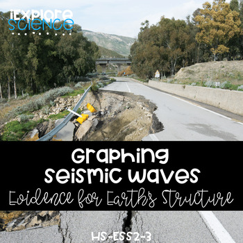
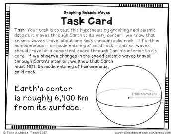
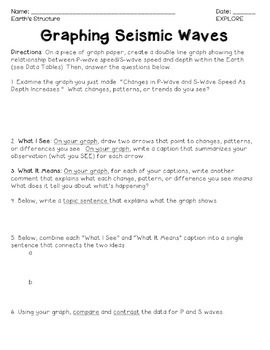
How do we know the Earth has layers? Discover the Earth has layers by analyzing seismic data to develop an understanding of the evidence that supports our knowledge of Earth’s interior in this graphing activity.
Learning Targets:
- Students will be able to explain how seismic data suggests the Earth has unique layers.
This lesson includes:
- 3 student pages
- 6 class pages (instructions, data sets, scaffolds)
- teacher lesson guide (3 pages)
- answer keys
How Can This Resource Be Used?
- to discover the evidence that supports our understanding of Earth’s layers
- to practice analyzing and interpreting data
How much class time will this take?
- This lesson is designed to take no more than one 60-minute class period. However, students may need support in graphing if they have not developed these skills.
Is this NGSS-aligned?
This resource is part of a storyline designed to work toward the tagged Next Generation Science Standards. Because Performance Expectations are designed to assess learning by the end of the grade band, unit material may not fully assess every Performance Expectation tagged in the post.
- HS-ESS2-3Develop a model based on evidence of Earth’s interior to describe the cycling of matter by thermal convection.
- HS-ESS1-5 Evaluate evidence of the past and current movements of continental and oceanic crust and the theory of plate tectonics to explain the ages of crustal rocks.
- HS-ESS2-1 Develop a model to illustrate how Earth’s internal and surface processes operate at different spatial and temporal scales to form continental and ocean-floor features. (progress towards)
Explore the complete Earth’s Structure bundle here or the complete Plate Tectonics bundle here or access it through the Spark Subscription.
Three Dimensional Learning Targets
This activity engages students in the following Science and Engineering Practices:
- Analyzing and Interpreting Data
This activity encourages students to think about the following Crosscutting Concepts:
- Patterns
What Other Teachers Are Saying:
⭐️ “This was excellent! We gained so much from analyzing the graph and the discussion that developed from the data! Outstanding!”
⭐️ “Loved this activity, great graphing practice and it really helped students to visualize the difference between the types of seismic waves.”
⭐️ “This was exactly what I was looking for! Thanks! Graphing skills and alignment to content!!”
Can I see an example of how you structure your lessons and student materials?
Download my Let's Talk Trash Anchor Phenomenon freebieHERE</a>!
What if I have questions?
You can email me at nvantassel@iexplorescience.com with questions about resources or implementation. I'm happy to help!
Check Out These Related Resources
- Graphing Seismic Waves: Evidence For Earth's Layers
- Exploring Plate Tectonics: Age of Crustal Rocks NGSS HS-ESS1-5
- Exploring Plate Tectonics: Landforms & Surface Features
- Evidence For Earth's Layers - CER Argumentation - Google Slides HS-ESS2-3
- Evidence For Earth's Layers - CER Engaging In Argument - Print HS-ESS2-3
- Modeling Convection: Evidence For Earth's Layers NGSS HS-ESS2-3
- Describing Earth's Layers NGSS HS-ESS2-3
- What's Inside Earth? [Volcano Investigative Phenomenon + Activity]
- Earth's Structure and Plate Tectonics - Digital and Print Workbook
- Rock Cycle Journey - Cycling Of Earth's Materials
- Evidence for Earth's Structure & Earth's Layers - NGSS HS-ESS2-3 *BUNDLE*
- Discovering Plate Tectonic Theory: Mapping Volcanoes & Earthquakes
- Catastrophic Cycles - Geoscience Processes & Plate Tectonics [Middle School Performance Expectations] *BUNDLE*
- Evidence For Plate Tectonics - Crustal Rocks & Surface Features - HS-ESS1-5 *BUNDLE*
This activity bundle is part of a complete unit storyline that works towards these standards:
- HS-ESS2-3Develop a model based on evidence of Earth’s interior to describe the cycling of matter by thermal convection.
- HS-ESS1-5 Evaluate evidence of the past and current movements of continental and oceanic crust and the theory of plate tectonics to explain the ages of crustal rocks.
- HS-ESS2-1 Develop a model to illustrate how Earth’s internal and surface processes operate at different spatial and temporal scales to form continental and ocean-floor features. (progress towards)
Terms Of Use:
Copyright © 2018 iExploreScience LLC. All pages of this product are copyrighted, and all rights are reserved by the author. You may not create anything to sell or share based on this packet. The product is created for the use of ONE teacher. Please do not share with colleagues. If they like the product, please send them to my TpT store. I appreciate your support with this request! You are permitted to share ONLY the cover image of this product on your blog or via social media as long as you link back to my product on TpT. Failure to comply is a copyright infringement and a violation of the Digital Millennium Copyright Act (DMCA). Clipart and elements found in this PDF are copyrighted and cannot be extracted and used outside of this file without permission or license. Intended for classroom and personal use ONLY.
*Note: NGSS is a registered trademark of Achieve. Neither Achieve nor the lead states and partners that developed the Next Generation Science Standards were involved in the production of this product, and do not endorse it.


