Global and Local Convection PowerPoint! ClimateRegions/Winds/Currents/Land&Sea
Heather Ward
47 Followers
Description
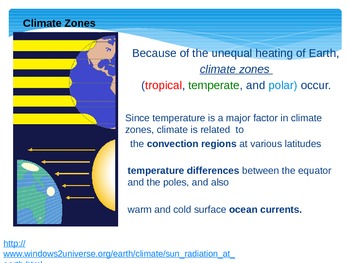
This PowerPoint explains how convection affects weather patterns and climate.Students must know that because warm air near Earth’s surface rises and then cools as it goes up, a convection current is set up in the atmosphere. There are three atmospheric convection areas in the northern hemisphere and three in the southern hemisphere: arctic region, temperate region and tropical region. Students will learn the wind belts located in that region: polar winds, trade winds and westerlies. Colorful graphics and easy to read! ALSO includes simulation from NOAA website to show land and sea breezes during a 24 hour period. Powerpoint also includes information about the ocean currents that affect weather and climate --> California and Gulf Stream Current! Guided notes to be used during lesson are included in store titled "Global and Local Convection Notes Guide".
Total Pages
33 pages
Answer Key
N/A
Teaching Duration
N/A
Report this resource to TPT
Reported resources will be reviewed by our team. Report this resource to let us know if this resource violates TPT’s content guidelines.


