


- PDF
Also included in
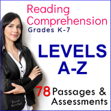 Running Record Passages, "Levels A B C D E F G H I J K L M N O P Q R S T U V W X Y Z". A simple approach with 78 running record passages. Each story includes quick assessments, with a mix of fiction and non-fiction passages. Flesch-Kincaid Reading Levels: K-7.Plus many, many random freebies.ThisPrice $5.99Original Price $7.97Save $1.98
 6th Grade Bundle (5th, 6th, 7th Grade).A deeply-discounted 6th Grade Bundle for most subjects to support your school career. Around 1,600 worksheets and printables.Follow links for full previews.You get 33 main products, plus many random freebies. More from the store...Weekly Magazine packagesGradesPrice $19.95Original Price $89.61Save $69.66
 Math Bundle and More, (4th, 5th, 6th Grade).More fun than rainy day schedule on Halloween! What started out as a simple math bundle turned into a deeply-discounted upper elementary feast of worksheets and random freebies.Follow links for detailed previews. Bonus File: US State Map OutlinesPrice $6.99Original Price $186.67Save $179.68
 Bundle: Writing, Reading, Math, and More (Kindergarten, 1st, 2nd, 3rd Grade).Hundreds of early learner worksheets for reading, writing, math, and other topics at a deeply-discounted price. Be the hero of the staff lunch room.Follow listing links for previews.More from the store...Weekly Magazine pacPrice $7.99Original Price $110.44Save $102.45
 Reading Assessment Passages, (Levels A B C D E F G H I J K L M N O P Q R S T U V W X Y Z).78 reading level passages. Each story includes a simple assessment, with a mix of fiction and non-fiction passages. Flesch-Kincaid Reading Levels: K-7.Preview is typical of Download, or follow links for full prPrice $6.99Original Price $60.43Save $53.44
 US History Bundle (4th, 5th, 6th Grade).A US History bundle with 200 worksheets and 400 images for upper elementary, with many random freebies.Preview is typical of Download, or follow links for full previews. *Tip: This bundle is based on the first product listed (American History Worksheets). ThePrice $6.99Original Price $218.42Save $211.43
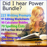 Writing Skills Bundle - Writing Skills Practice - Editing Practice - Grammar Practice - Fraction Worksheets - Geography Questions (Gr. 3-7). If you like writing worksheets - and quite frankly who doesn't - then have I got a writing skills bundle for you. Click links for full previews. 22Price $5.99Original Price $18.38Save $12.39
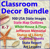 Feeling sad? Walls got you down? Tired of Soviet beige? Then you, my friend, need some classroom decor options.Feel great, look sharp, and put dazzle back into your teaching with a classroom decor bundle. From student work to student art and posters, these downloads will last your career.Click linksPrice $14.30Original Price $22.00Save $7.70
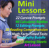 Lesson Bundles - Centers - Mini Lessons. Lesson Bundles support your work in a variety of forms. It's a bundle that fills gaps and adds strength - like dentures. Follow title links for full Previews. Return to The Harstad Collection.Price $13.50Original Price $20.70Save $7.20
 Bundle (4th, 5th, 6th, 7th Grade). More exciting than Rolling Stones Farewell Tour VII, it's the bundle that moves like Jagger. Click links for full Previews. 724 USA Clip Art Images - work nicely for reports, lessons, PowerPoints. 1700's - Colonies & Revolution1800's - Events & MonumPrice $6.99Original Price $18.69Save $11.70
 A Wrinkle in Time Worksheets (Chapters 1-12) + 135 Map Labeling Tasks + 91 Grammar Worksheets. This variety bundle consists of three main listings, plus many freebees. Click links for full previews.153 Wrinkle in Time Questions135 Map Labeling Tasks91 Grammar Worksheets+ 60 FreebeesPrice $7.65Original Price $11.75Save $4.10
 Geography & American History.This bundle is comprised of two main listings with many random freebees.American History (200 worksheets)Geography BundleBonus File90 Calculator Riddles (10 worksheets)Price $7.50Original Price $11.00Save $3.50
 Editing and Proofreading Worksheets Bundle. 131 editing and proofreading worksheets, plus many freebies.Preview is typical of Download.The main bundle files include the following:Language Skills: 44 WorksheetsEditing Skills - 35 WorksheetsEditing - 12 Printable PromptsEditing Prompts with Keys - 40Price $7.99Original Price $9.50Save $1.51
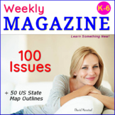 Leveled Reading Comprehension Passages: "Weekly Magazine".100 issues of K-6 leveled reading passages.Four skills worksheets with each issue.Flesch-Kincaid Reading Levels: Grades K-6.Includes full color and printer-friendly versions.No subscription, reusable (pdf, png).Follow links for full previews.Price $15.99Original Price $18.48Save $2.49
 Reading Comprehension & Grammar Bundle (4th, 5th, 6th Grade).Reading comprehension passages and grammar bundle activities. This download consists of the following two main files:50 Weekly Magazine Issues 91 Grammar WorksheetsThe bonus file:50 US State Internet Activities... and many, many randomPrice $9.10Original Price $13.99Save $4.89
Description
FREE - Geography Map | New York
A free New York state outline map.
• Map sized 8.5x11" in PDF. (Outline in Sharpie for any blur issues.)
• Outline format allows for teaching geography your way.
This listing is part of Geography Bundle: Maps, Questions, Labeling, which includes the following:
A) 28 USA Maps
• USA – 13 Colonies
• USA – Civil War 1860
• USA – Electoral Map
• USA – Federal Land
• USA – Goat Population
• United States of America (abbreviations)
• USA – Major Cities & Interstates
• USA – Major Cities
• USA – Major Cities
• USA – Manifest Destiny (1607-1853)
• United States America (colored, labeled)
• United States of America (borders only)
• USA – Midwest
• USA – Northeast
• United States of America (no states)
• USA – Physical Map (colored)
• USA – Physical Map
• USA – Population Density (2012)
• USA – 1898 Population Distribution
• USA – Railroads (1870)
• USA – Rivers
• USA – South
• USA – Yellowstone National Park
• USA – State Silhouettes
• USA – Time Zones
• USA – Lewis & Clark (1804-06)
• USA – West
• USA – Western Expansion (1840)
World Maps (30)
• World Map
• Africa - Labeled
• Africa (no borders)
• Africa
• Antarctica
• Arctic
• Asia (no borders)
• Asia
• Australia
• Canada
• Caribbean Sea
• Central & South America
• Central America
• China & East Asia
• Egypt
• Europe - shape
• Europe (no borders)
• Europe
• Fictional Island (untitled)
• Greece
• Mediterranean Region (no borders)
• Mediterranean Region
• Middle East (no borders)
• Middle East
• North America
• Oceania
• South America (no borders)
• South America
• Southeast Asia
• World - Night Map
Science (5)
• Earth’s Plates
• Plate Tectonics
• Plate Tectonics (Pangea)
• Apollo 11 Moon Map – where they went.
• Apollo 11 - Diagram of Command Module Control Panel.
Bonus Images:
• Aldrin salutes the flag.
• Aldrin on the moon.
• Aldrin after moon walk.
• Armstrong’s first step.
• Apollo 11 – Neil Armstrong, Michael Collins, Buzz Aldrin.
• Alabama
• Alaska
• Arizona
• Arkansas
• California
• Colorado
• Connecticut
• Delaware
• Florida
• Georgia
• Hawaii
• Idaho
• Illinois
• Indiana
• Iowa
• Kansas
• Kentucky
• Louisiana
• Maine
• Maryland
• Massachusetts
• Michigan
• Minnesota
• Mississippi
• Missouri
• Montana
• Nebraska
• Nevada
• New Hampshire
• New Jersey
• New Mexico
• New York
• North Carolina
• North Dakota
• Ohio
• Oklahoma
• Oregon
• Pennsylvania
• Rhode Island
• South Carolina
• South Dakota
• Tennessee
• Texas
• Utah
• Vermont
• Virginia
• Washington
• West Virginia
• Wisconsin
• Wyoming
D) 100 USA Geography Questions
1. What are the capitals of West Virginia and Maryland?
2. Which state is larger: Kansas or Kentucky?
3. Name two states directly south of Montana.
4. Which river borders both Oregon and Washington?
5. Name three large cities in Florida.
6. Which states would you cross walking directly from Pierre, SD to Sacramento, CA?
7. Name four large cities adjacent to the Pacific Ocean.
8. What states border Indiana?
9. Name four states in the Rocky Mountains.
10. What states border the Gulf of Mexico?
11. What is the next closest capital to St. Paul, MN?
12. Which is farther west: St. Louis, MO or New Orleans, LA?
13. What states border Georgia?
14. Name three large cities in Illinois.
15. What states border Canada?
16. Name the four states that meet at one point.
17. List the Great Lakes. (Hint: HOMES)
18. What are the capitals of Nevada and Arizona?
19. Which is closer to Detroit, MI: South Dakota or Arkansas?
20. Name a city in Ohio that starts with “A”.
21. Name four states that start with “N”.
22. How far is it from Memphis, TN to Baltimore, MD?
23. List three states in the Appalachian Mountains.
24. What states border Massachusetts?
25. How far is it from San Francisco, CA to Los Angeles, CA?
26. Name three large cities in Washington.
27. Which Great Lake is the largest?
28. Is Salt Lake City, UT farther east than Las Vegas, NV?
29. What are the capitals of New Hampshire and Ohio?
30. What states border New York?
31. A panhandle is a piece of land that extends out from the main body. Idaho is a “panhandle” state. Name two other states that have a panhandle.
32. What is the distance from Las Vegas, NV to Denver, CO?
33. List three major rivers in the United States.
34. What states border Texas?
35. Which state is smaller: Connecticut or Delaware?
36. Is Omaha, Nebraska farther south than Louisville, KY?
37. What are the state capitals of New Mexico and Kansas?
38. Is the capital of Hawaii on its largest island?
39. What is interesting about Alaska’s capital? Why do you think it is in this location?
40. How far is it from Albany, NY to Philadelphia, PA?
41. Name a large city in western Missouri.
42. What are the capitals of North Carolina and Wyoming?
43. Name two large cities in Wisconsin.
44. What states border South Carolina?
45. Which state is larger: Colorado or Pennsylvania?
46. What river borders Oklahoma and Texas?
47. If you traveled directly from Pierre, SD to Miami, FL, what states would you cross?
48. What states border the Great Lakes?
49. Which city is farther north: Tallahassee, FL or Mobile, AL?
50. How far is it from San Diego, CA to Washington, D.C.?
51. Name three large cities bordering the Atlantic Ocean.
52. The Mississippi River starts in Minnesota and empties into the Gulf of Mexico. List the states that border the river.
53. List three states that begin with “C”.
54. What states border West Virginia?
55. Name all the states that start with “New”.
56. List three states in the Great Plains.
57. Name three states larger than Alabama.
58. Rank the following states in size from smallest to greatest: Wyoming, Oregon, Louisiana, Ohio.
59. How far is it from Orlando, FL to Oklahoma City, OK?
60. State borders were usually created two ways: mathematical lines or natural borders, like rivers and mountains. Name three states with both lines and natural borders.
61. Name a capital that starts with “S”.
62. Find a state capital whose name has more letters than Idaho’s capital.
63. What states border New Hampshire?
64. Is Illinois east or west of Kansas?
65. Name three large cities in North Carolina.
66. What states lie between Texas and North Dakota?
67. What states border Mississippi and Vermont?
68. Name three large cities within 100 miles of New Jersey.
69. Which state is closer to Iowa: Delaware or New Mexico?
70. What states border Massachusetts?
71. What are the capitals of Louisiana and Michigan?
72. If a plane flew directly from Santa Fe, NM to Concord, NH, which states would it cross?
73. How many states border Kentucky?
74. Name three states directly south of Lake Michigan.
75. Which is closer to Maryland: Texas or North Dakota?
76. Name three states north of Arkansas.
77. Is Connecticut closer to Montana or Colorado?
78. What states are directly between Rhode Island and Delaware?
79. List all states directly west of Minnesota.
80. Name the states bordering Chesapeake Bay.
81. What states border the Colorado River?
82. How far is it from Denver, CO to New York, NY?
83. Name three large cities in Texas.
84. What states are crossed flying directly from Lansing, MI to Baltimore, MD?
85. Name three states west of the Missouri River.
86. List these cities from north to south: Atlanta, GA; Charlotte, SC; Nashville, TN.
87. Name three port cities on the Gulf of Mexico.
88. Is Lincoln, NE closer to the Atlantic or Pacific Ocean?
89. How far is it from Fairbanks, AK to Juneau, AK?
90. Order these states from west to east: Tennessee, Virginia, Wyoming, Oklahoma, Alabama, Rhode Island.
91. How far is it from Portland, OR to Birmingham, AL?
92. Name three large cities in Indiana.
93. What are the capitals of Oregon and Connecticut?
94. Name two deserts in the American Southwest.
95. What states border both Kansas and Arkansas?
96. Name the mountain range in both Oregon and Washington.
97. How far is it across Washington state?
98. Name three large cities in southern California.
99. List three Hawaiian islands.
100. Label 50 states (worksheet)
E) 100 World Geography Questions
1. What are the capitals of Brazil and Libya?
2. Which country is larger: Kenya or Syria?
3. Name two countries directly south of Uzbekistan.
4. Which direction does India’s Ganges River flow?
5. Name three large cities in Russia.
6. Which countries would you cross walking directly from Rome, Italy to Poland?
7. Name four countries surrounded by the Pacific Ocean.
8. What countries border Chad?
9. Name four countries in the Caribbean Sea.
10. What countries border the Paraguay?
11. What is the next closest capital to Lusaka, Zambia?
12. Which is closer to the Equator: Mongolia or Greece?
13. What countries border France?
14. Name three large cities in Germany.
15. Name three countries in the Sahara Desert?
16. Order these countries north to south: India, Chile, Finland, Gabon.
17. List four seas north of the Equator.
18. What are the capitals of Canada and Vietnam?
19. Where does the Nile River end?
20. Name three countries that start with “R”.
21. Name three countries between USA and Colombia.
22. How far is it from Washington, D.C. to London, UK?
23. List three countries in Europe’s Alps mountains.
24. What countries border Nepal?
25. How far is it from Oslo, Norway to Cairo, Egypt?
26. Name three large cities in Australia.
27. Name three seas bordering Asia.
28. Order from south to north: Thailand, Ireland, Peru?
29. What are the capitals of Bolivia and South Korea?
30. What countries border Iraq?
31. Describe the location of the Andes mountains. (3 sentences)
32. What is the distance from Madrid, Spain to Moscow, Russia?
33. List three major rivers in Europe.
34. What countries border Guatemala?
35. Which country is smaller: Mauritania or North Korea?
36. Is Helsinki, Finland farther south than Montreal, Canada?
37. What are the capitals of Liberia and Indonesia?
38. Is the capital of Japan on its largest island?
39. Name three countries inside the Arctic Circle.
40. How far is it from Warsaw, Poland, to Tokyo, Japan?
41. Name three large cities in France besides Paris.
42. What are the capitals of Australia and Turkey?
43. Name two large cities in United Kingdom besides London.
44. What countries border Suriname?
45. Name three countries on the Tropic of Cancer?
46. What mountains border France and Spain?
47. If you traveled directly from Calcutta, India to Athens, Greece, what countries would you cross?
48. Name two countries surrounded by Italy?
49. Which city is farther north: Mecca, Saudi Arabia or San Juan, Puerto Rico?
50. How far is it from Quito, Ecuador to Chicago, IL?
51. Name three Asian cities bordering the Pacific Ocean.
52. The Mediterranean Sea has long been important in trading goods between Africa, Asia, and Europe. Name six countries bordering the sea.
53. List three countries that begin with “B”.
54. What countries border Laos?
55. Name three Asian countries larger than Armenia.
56. List three countries in South America north of the Tropic of Capricorn.
57. Which country is closer to the International Date Line: Belize or Panama.
58. Rank the following countries in size from smallest to greatest: Netherlands, Andorra, Slovenia, Hungary
59. How far is it from Berlin, Germany to London, United Kingdom?
60. After Canada and Mexico, what are the third and fourth nearest countries to the United States?
61. Describe the location of the Atlas Mountains (2 sentences).
62. Find a country capital whose name has more letters than Lithuania’s capital.
63. What countries border Botswana?
64. Is Lake Victoria, Africa larger or smaller than Lake Michigan, USA?
65. Name three large cities in Argentina.
66. Name four countries between Egypt and Somalia?
67. What countries border Slovakia?
68. Name three large cities closest to Brussels, Belgium.
69. Which country is closer to Iceland: Canada or Finland?
70. How far is it from Lisbon, Portugal to Jerusalem, Israel?
71. What are the capitals of Jamaica and Chile?
72. If a plane flew directly between the capitals of Ecuador and Paraguay, which countries would it cross?
73. Name three countries that start with “N”.
74. How far is it from Los Angeles, CA to Tokyo, Japan.
75. Which is closer to Madagascar: Sweden or Kazakhstan?
76. Name three large cities in Spain.
77. How far is it across Australia?
78. What two small island countries lie east of Madagascar?
79. List three countries on the Adriatic Sea.
80. What mountain range divides Russia into Asia and Europe.
81. What countries are between Senegal and Liberia?
82. How far is it from Sao Paulo, Brazil to Cape Town, South Africa?
83. Name three large cities in Japan besides Tokyo.
84. What countries are crossed flying directly from Montreal, Canada to Managua, Nicaragua?
85. Name three countries bordering the Indian Ocean.
86. List these countries from north to south: The Bahamas, Grenada, USA, Haiti.
87. Name three countries that start with “K”.
88. List three gulfs (an inlet of a sea) in the world?
89. How far is it from Stockholm, Sweden to Reykjavik, Iceland?
90. Order these countries from west to east: Mongolia, Lebanon, New Zealand, South Korea.
91. How far is it from Moldova’s capital to Austria’s capital?
92. Name three seas in the northern hemisphere.
93. What are the capitals of Venezuela and New Zealand?
94. Name three world deserts.
95. What country is smaller: Liechtenstein or Monaco?
96. Name two island countries surrounded by the Mediterranean Sea.
97. What is the longest distance across Iceland?
98. What direction does the Amazon River flow?
99. List two African capitals whose names are longer than Tunisia’s capital.
100. Label 13 country silhouettes (worksheet)
F) Geography - 135 Map Labeling Tasks
USA - POLITICAL MAP & FLAG:
1. All 50 states.
2. All state capitals.
3. 15 major U.S. cities.
4. Washington, D.C.
5. Outline each state a different color, so that no two same colors are touching.
6. State boundaries were usually decided by a mathematical line or natural boundaries, like mountain ranges or rivers. List three states that contain both line and natural borders.
7. State capitals are not always the largest city. Many states chose smaller cities for their capital to reduce the influence big cities would have over state decisions. List three small-city capitals.
8. What is the second most northern state after Alaska? (Hint: It is not Maine.)
9. The flag should never be used as a drape, towel, tablecloth, sheet, or clothing. Instead, use bunting as a patriotic decoration. What are three different occasions bunting would be an appropriate decoration?
10. A United States flag is provided, at no cost, to families of deceased veterans for memorial services. The purpose is to honor the memory of a veteran’s military service to his or her country. The request form and flags are available at your local post office. How does a memorial flag from the United States show respect to the veteran?
USA - PHYSICAL MAP:
1. Label six rivers
2. Rocky Mountains, Sierra Nevada, Cascade Mountains, Appalachian Mountains
3. Black Hills (Home of Mt. Rushmore)
4. Great Salt Lake, Great Lakes (Hint: HOMES)
5. Canada, Mexico, The Bahamas
6. Add Hawaii and Alaska
7. Pacific Ocean, Atlantic Ocean, Gulf of Mexico
8. Great Plains, Piedmont, Mojave Desert
9. Washington, D.C. and your school.
10. How long is the Mississippi River?
USA - WEST:
1. Label all states
2. Label all capitals
3. Label one large city in each state
4. Columbia River, Colorado River
5. Pacific Ocean
6. Rocky Mountains, Sierra Nevada, Cascade Mountains
7. Great Salt Lake
8. Mojave Desert
9. Great Basin (“water having no connection to the ocean”)
10. Canada, Mexico
USA - MIDWEST:
1. Label all states
2. Label all capitals
3. Label one large city in each state
4. Mississippi River
5. Missouri River
6. Ohio River
7. Lake Michigan and Lake Superior
8. Canada
9. Great Plains
USA - SOUTH:
1. Label all states
2. Label all capitals
3. Label one large city in each state
4. Mississippi River, Ohio River, Rio Grande River, Red River
5. Atlantic Ocean, Gulf of Mexico
6. Appalachian Mountains, Ozark Mountains
7. Florida marshes
8. Louisiana marshes
9. Washington, D.C.
10. Mexico
USA - NORTHEAST:
1. Label all states
2. Label all capitals
3. Label one large city in each state
4. Delaware River
5. Atlantic Ocean
6. Appalachian Mountains
7. Lake Eerie, Lake Ontario
8. Niagara Falls, NY
9. Use the Forest symbol to show Maine is a heavily forested state (83%).
AFRICA:
1. Label 30 countries and outline all countries in different colors
2. Label 15 large cities
3. Lake Victoria, Nile River
4. Red Sea, Suez Canal
5. Sahara Desert, Kalahari Desert, Atlas Mountains
6. Equator, Tropic of Cancer, Tropic of Capricorn
7. Cape of Good Hope
ANTARCTICA:
1. South Pole, magnetic South Pole
2. McMurdo Station, Palmer Station
3. Ross Ice Shelf
4. Queen Maud Land
5. Weddell Sea, Ross Sea, Amundsen Sea
6. Antarctic Circle
7. Indian Ocean
8. Antarctic Peninsula
9. Transantarctic Mountains
10. Label two more features
ASIA:
1. Label 25 countries and outline all countries in different colors
2. Label 20 capitals
3. Pacific Ocean, Indian Ocean, Arctic Ocean
4. Gobi Desert, Ural Mountains, Himalayas
5. Mt. Everest, Caspian Sea, Arabian Desert
6. Yellow River, Ob River, Ganges River
7. Arctic Circle, Tropic of Cancer, Equator
8. Lake Baikal
9. Hong Kong
10. Label two more features
AUSTRALIA:
1. Label six states and two territories; outline each in alternating colors
2. Label 10 large cities
3. Ayers Rock, Great Dividing Range, Great Sandy Desert
4. Darling River, Murray River, two lakes
5. Indian Ocean, Pacific Ocean, Tasman Sea, Gulf of Carpentaria
6. Three nearby countries
7. Tropic of Capricorn
8. Canberra
9. Two additional features
EUROPE:
1. Label 30 countries and outline all countries in different colors
2. Label 15 large cities
3. Mediterranean Sea, Baltic Sea, Black Sea, Atlantic Ocean (color blue lightly, avoiding your labels)
4. Alps Mountains, Pyrenees Mountains, Ural Mountains
5. Atlantic Ocean, Strait of Gibraltar
MIDDLE EAST:
1. Label 20 countries and outline all countries in alternating colors.
2. Label 20 country capitals
3. Nile River, Tigris River, Euphrates River
4. Mediterranean Sea, Black Sea, Caspian Sea
5. Zagros Mountains, Syrian Desert, Suez Canal
6. Persian Gulf, Red Sea, Arabian Sea
7. Lightly color the water blue, avoiding your labels
NORTH AMERICA:
1. Label 15 countries and outline in different colors
2. Label 15 large cities
3. Label your school and Washington, D.C.
4. Mississippi River, Yukon River, Rio Grande River
5. Atlantic Ocean, Pacific Ocean, Arctic Ocean
6. Hudson Bay, Caribbean Sea, Gulf of Mexico
7. Rocky Mountains, Mojave Desert
8. Tropic of Cancer, magnetic North Pole
9. Great Bear Lake, Great Lakes (Hint: HOMES)
10. Panama Canal
OCEANIA:
1. Label 12 countries; outline all countries in alternating colors
2. Label 10 towns
3. Pacific Ocean, Indian Ocean, Tasman Sea, Coral Sea
4. Equator
5. Great Barrier Reef
6. International Date Line (mathematical line where each new day begins)
7. Tropic of Capricorn
8. Great Australian Bight
9. Two additional features
SOUTH AMERICA:
1. Label all countries and outline in different colors
2. Label all capitals
3. Label one large city in each country
4. Amazon River, Atacama Desert, Andes Mountains
5. Atlantic Ocean, Pacific Ocean, Caribbean Sea
6. Cape Horn, Strait of Magellan, Lake Titicaca
7. Amazon Basin
8. Tropic of Capricorn, Equator
9. Pampas (grassland)
10. Patagonia (region)
Also Available:
• Clip Art & Posters | USA Bundle | 724 Images
• Writing Bundle: 223 Year-Long Prompts
Return toThe Harstad Collection
